- Deep Springs, California
-
Deep Springs — Unincorporated community — Location in California
 Deep Springs
Coordinates: 37°22′18″N 117°59′06″W / 37.37167°N 117.985°WCoordinates: 37°22′18″N 117°59′06″W / 37.37167°N 117.985°W Country United States State California County Inyo County Elevation[1] 5,194 ft (1,583 m) Deep Springs (formerly, Deep Spring) is an unincorporated community in Inyo County, California.[1] It is located in the northeastern section of Deep Springs Valley, 22 miles (35 km) east of Bishop,[2] 2.6 km (1.6 mi) north of Soldier Pass and 6.4 km (4 mi) southwest of Chocolate Mountain (formerly Piper Mountain),[3] at an elevation of 5194 feet (1583 m).[1] Deep Springs College is located in Deep Springs Valley, although not at the site of the springs.
The Deep Spring post office operated from 1881 to 1883[2], and from 1920 to 1953.[2] The springs after which the town was named are now called Buckhorn Springs.[2]
References
- ^ a b c U.S. Geological Survey Geographic Names Information System: Deep Springs, California
- ^ a b c d Durham, David L. (1998). California's Geographic Names: A Gazetteer of Historic and Modern Names of the State. Quill Driver Books. p. 1159. ISBN 9781884995149.
- ^ http://geonames.usgs.gov/pls/gnispublic/f?p=gnispq:3:::NO::P3_FID:253759
Municipalities and communities of Inyo County, California City 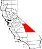
CDPs Big Pine | Cartago | Darwin | Dixon Lane-Meadow Creek | Furnace Creek | Homewood Canyon | Independence | Keeler | Lone Pine | Mesa | Olancha | Pearsonville | Round Valley | Shoshone | Tecopa | Trona | Valley Wells | West Bishop | Wilkerson
Unincorporated
communitiesAberdeen | Alabama Hills | Alico | Alta Vista | Ashford Junction | Aspendell | Badwater | Ballarat | Bartlett | Beatty Junction | Beveridge | Blackrock | Brockmans Corner | Calvada Springs | Coso | Coso Junction | Crater | Death Valley Junction | Deep Springs | Dolomite | Dunmovin | Evelyn | Fish Springs | Grant | Haiwee | Harrisburg | Homewood Canyon-Valley Wells | Indian Village | Junction Ranch | Kearsarge | Keough Hot Springs | Laws | Linnie | Little Lake | Millspaugh | Mock | Monola | Oteys Sierra Village | Owenyo | Panamint Springs | Park Village | Peterson Mill | Poleta | Reward | Rocking K | Rovana | Ryan | Scheelite | Scranton | Seven Pines | Stovepipe Wells | Sykes | Talus | Teakettle Junction | Whitney Portal | Zurich
Indian
reservationsBig Pine Reservation | Lone Pine Reservation
Ghost towns Ashford Mill | Avena | Bend City | Bradford Siding | Burnt Wagons | Carthage | Cerro Gordo Landing | Chloride City | Chrysopolis | Clark | Copperfield | Coso | Echo | Elna | Furnace | Furnace Creek Inn | Greenwater | Grestley | Horton | Intake | Jay | Kasson | Kearsarge | Lane Mill | Leadfield | Lee | Lila C | Lone Pine Station | Lookout City | Manzanar | Narka | Newburyport | Nine Mile Station | Noonday Camp | Owensville | Panamint | Reilly | San Carlos | Schwaub | Skidoo | Skyes | Sodan | Stewarts | Sunland | Swansea | Tule Station | White Mountain City
Categories:- Populated places in Inyo County, California
- Unincorporated communities in California
- Inyo County, California geography stubs


Wikimedia Foundation. 2010.