- List of districts of Assam
-
Assam, a state of India, has twenty seven administrative districts.
 The Districts of Assam
A district of an Indian state is an administrative geographical unit, headed by the Deputy Commissioner (DC), which combines the offices of the District Magistrate ultimately responsible for maintaining law and order and District Collector responsible for collection the revenue. Generally, an officer belonging to the Indian Administrative Service becomes the DC but occasionally officers belonging to the Assam Civil Service too get appointed. The DC is assisted by a number of officials belonging to different wings of the administrative services of the state.
A superintendent of Police, an officer belonging to Indian Police Service is entrusted with the responsibility of maintaining law and order and related issues.
The twenty seven districts of Assam state are:
Code District Headquarters Population (2011)86[1] Area (km²) Density (/km²) Map BA Barpeta Barpeta 1,693,190 3,245 506 
BO Bongaigaon Bongaigaon 732,639 2,510 361 
CA Cachar Silchar 1,736,319 3,786 381 
DA Darrang Mangaldai 908,090 3,481 432 
DM Dhemaji Dhemaji 688,077 3,237 176 
DB Dhubri Dhubri 1,948,632 2,838 576 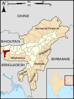
DI Dibrugarh Dibrugarh 1,327,748 3,381 347 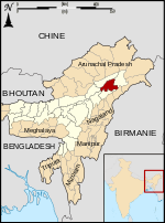
GP Goalpara Goalpara 1,008,959 1,824 451 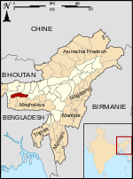
GG Golaghat Golaghat 1,058,674 3,502 270 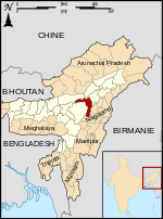
HA Hailakandi Hailakandi 659,260 1,327 409 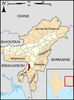
JO Jorhat Jorhat 1,091,295 2,851 354 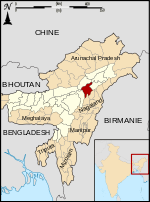
KA Karbi Anglong Diphu 965,280 10,434 78 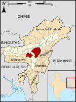
KR Karimganj Karimganj 1,217,002 1,809 555 
KK Kokrajhar Kokrajhar 930,404 3,129 297 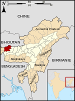
LA Lakhimpur Lakhimpur 1,040,644 2,277 391 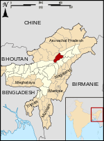
MA Marigaon Marigaon 957,853 1,704 455 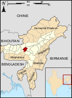
NG Nagaon Nagaon 2,826,006 3,831 604 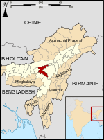
NL Nalbari Nalbari 769,919 2,257 504 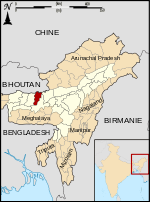
NC Dima Hasao Haflong 213,529 4,888 38 
SI Sibsagar Sibsagar 1,150,253 2,668 395 
SO Sonitpur Tezpur 1,925,975 5,324 315 
TI Tinsukia Tinsukia 1,316,948 3,790 303 
Kamrup 1,517,202 
Kamrup Metropolitan 1,260,419 
Baksa 953,773 Udalguri 832,769 Chirang 481,818 References
- ^ "District Census 2011". Census2011.co.in. http://www.census2011.co.in/district.php.
Districts of States of India States Andhra Pradesh · Arunachal Pradesh · Assam · Bihar · Chhattisgarh · Goa · Gujarat · Haryana · Himachal Pradesh · Jammu and Kashmir · Jharkhand · Karnataka · Kerala · Madhya Pradesh · Maharashtra · Manipur · Meghalaya · Mizoram · Nagaland · Orissa · Punjab · Rajasthan · Sikkim · Tamil Nadu · Tripura · Uttar Pradesh · Uttarakhand · West Bengal
Union Territories Andaman and Nicobar Islands · Chandigarh · Dadra and Nagar Haveli · National Capital Territory of Delhi · Daman and Diu · Lakshadweep · PuducherryRelated topics List of states and territories of India · District collector · Sub-Divisional Magistrate · Community Development Block · Block Development Officer · Gram panchayatCategories:- Assam geography stubs
- Districts of Assam
- Assam-related lists


Wikimedia Foundation. 2010.