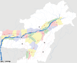
- Dhemaji
-
This article is about the municipality in India. For its namesake district, see Dhemaji district.
Dhemaji — town — Coordinates 27°29′N 94°35′E / 27.48°N 94.58°ECoordinates: 27°29′N 94°35′E / 27.48°N 94.58°E Country India State Assam District(s) Dhemaji Population 11,851 (2001[update]) Sex ratio 1000:915 ♂/♀ Time zone IST (UTC+05:30) Area
• 91 metres (299 ft)
Website dhemaji.nic.in Dhemaji (Assamese: ধেমাজি) is the headquarters of Dhemaji district, Assam, India. It is one of the remotest districts of Assam. From the State Capital (Guwahati), it takes about 10 hours by road to reach Dhemaji. Dhemaji is a very flood-prone district. For a few days it remains cut off from the rest of the country every year. It is situated in the foothills of Eastern Himalayas and also very high-risk zone as regards seismicity. Dhemaji was once famous for fish of various varieties. It was also a good source of milk. Still many varieties of fish are found in the rivers and rivulets in the region.
Contents
Geography
Dhemaji is located at 27°29′N 94°35′E / 27.48°N 94.58°E.[1] It has an average elevation of 91 metres (298 feet).
Demographics
As of 2001[update] India census,[2] Dhemaji had a population of 11,851. Males constitute 54% of the population and females 46%. Dhemaji has an average literacy rate of 76%, higher than the national average of 59.5%: male literacy is 80% and, female literacy is 70%. In Dhemaji, 13% of the population is under 6 years of age.
Transport
The National Highway No. 52 passes through Dhemaji District. The main towns in Dhemaji District are Dhemaji, Bordoloni, Gogamukh, Silapathar and Jonai. Murkong Selek railway station is located in Dhemaji District near Jonai, a train from Murkong Selek travels along the metre gauge line via Dhemaji station and on to Rangiya Junction, Rangiya Junction also has broad gauge trains going to Guwahati, as well as Siliguri, Kolkata, Mumbai and Delhi. Jiadhal and Gainadi are the most ravaging rivers in this district in terms of floods. Every year floods destroy a bulk of the agricultural proceeds and people take refuge in Camps. The nearest airport to Dhemaji is Lilabari, near North Lakhimpur, some 66 km away.
Economy
During the last 10 years Dhemaji has been witnessing rapid growth in terms of business and education. A good number of students are coming out from the roots of Dhemaji to join different institutes and organizations of international and national repute.
The economy of Dhemaji is based on agriculture. The prominent employment avenue apart from agriculture is the service sector (govt. jobs, school teachers).Central govt. schemes for rural development is changing the scene of the district. People now have different options to enrich themselves. The DRDA, Zilla Parishad, Gram Panchayat are flourishing income opportunities to the people as well as the office-bearers of these organizations.
Education
Dhemaji has a dozen of schools and colleges. The oldest recorded among them is a primary school established in 1885 named Nalanipam L.P. School. The school is to be declared "Model School" by the SSA Mission, Assam. Teachers Late Gobinda Chandra Buragohain, Late Nagendra Nath Saikia and Mrs. Sashimai Saikia (Dutta) have been awarded by the Dept. of Education, Govt. of Assam for their outstanding services.Dhemaji Higher Secondary School and Dhemaji Girls Higher Secondary School are pioneer educational school at Dhemaji which produces a good number of talent in the world. St Francis De Sales school (a Christian missionary managed school) is a pioneer school providing education in English medium in the district. This school produces a good number of rank holders in High School Leaving Certificate Examination. Dhemaji College, Dhemaji Commerce College, Moridhal College are major colleges. Gogamukh College at Gogamukh, Silapathar College at Silapathar,bordoloni michamari college are other prominent colleges.
Education in remote villages have been mostly contributed by lots of Non-provincialized Venture Schools using volunteer teachers.
Politics
Dhemaji is part of Lakhimpur (Lok Sabha constituency).[3] There are two Assembly constituencies in Dhemaji District- Dhemaji and Jonai.
References
- ^ Falling Rain Genomics, Inc - Dhemaji
- ^ "Census of India 2001: Data from the 2001 Census, including cities, villages and towns (Provisional)". Census Commission of India. Archived from the original on 2004-06-16. http://web.archive.org/web/20040616075334/http://www.censusindia.net/results/town.php?stad=A&state5=999. Retrieved 2008-11-01.
- ^ "List of Parliamentary & Assembly Constituencies". Assam. Election Commission of India. http://archive.eci.gov.in/se2001/background/S03/AS_ACPC.pdf. Retrieved 2008-10-06.
External links
Categories:- Cities and towns in Dhemaji district
- Dhemaji
Wikimedia Foundation. 2010.


