- Toronto streetcar loops
-
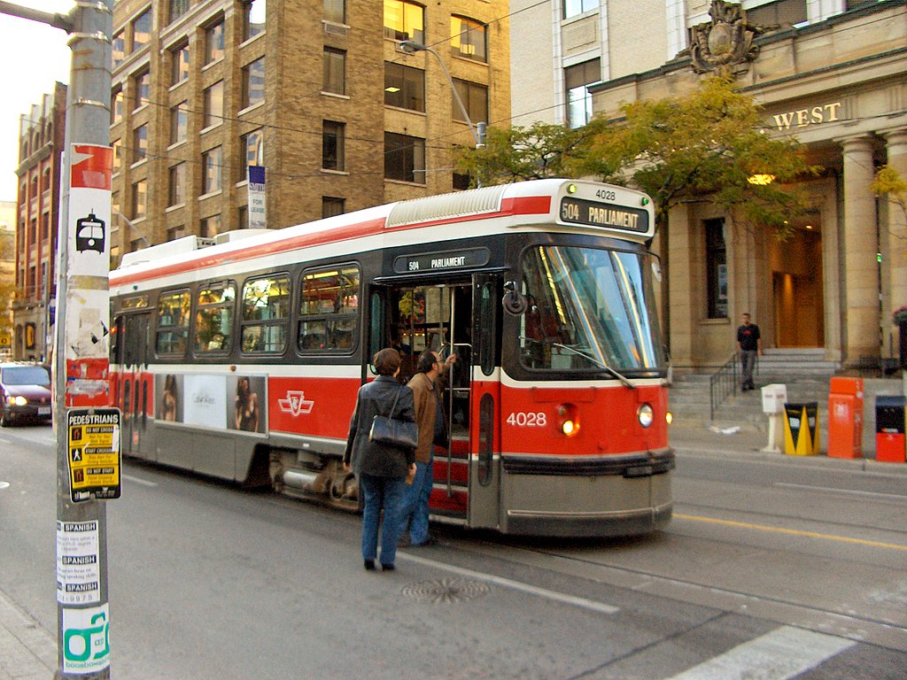
Toronto streetcar loops are the termini for streetcar routes on the Toronto streetcar system in Toronto, Ontario, Canada. Unidirectional streetcars require track loops in order to change direction. Besides short off-street track loops these can also be larger interchange points, having shelters and driver facilities, or be part of a subway station structure. Streetcars also often take a longer loop around city streets; notable at Church Street, Parliament Street and Shaw Avenue.
Current loops
Bathurst Station Loop
Main article: Bathurst (TTC)Bingham Loop
- Location: Kingston Road and Victoria Park[1]
- Coordinates: 43°40′53.5″N 79°17′05.3″W / 43.681528°N 79.284806°W
- Functions: Eastern terminus for 502 Downtowner and 503 Kingston Road
- Facilities: Shelters
- Passenger use: Yes
- Connections: TTC bus routes 12 Kingston Rd and 22 Coxwell
Broadview Station Loop
Main article: Broadview (TTC)Charlotte Loop
 Waiting on on Charlotte Street
- Location: Street loop on Charlotte Street between Adelaide St and King St[2]
- Coordinates: 43°38′47″N 79°23′38″W / 43.64639°N 79.39389°W
- Functions: Return loop for southbound 510 King
- Facilities: None
- Passenger use: Yes
- Connections: None
College Loop
- Location: Street loop on College, Dundas and Lansdowne
- Coordinates:
- Functions:
- Facilities: None
- Passenger use:
- Connections: None
Dundas West Station Loop
Main article: Dundas West (TTC)Dufferin Loop
- Location: Dufferin Street at the Dufferin Gates
- Coordinates: 43°38′03.5″N 79°25′34.5″W / 43.634306°N 79.42625°W
- Functions: During the EX, it becomes a fare-paid area. Formerly the terminus for the 522 Exhibition-West route from Dundas West Station, via the tracks on Roncesvalles, King and Dufferin.[3] Although the tracks remain, it is not regularly used by streetcars, but it may be used on a non-scheduled basis to adjust service.[4]
- Facilities: Ticket booths, turnstiles, control tower (all seasonal use)
- Passenger use: Yes
- Connections: TTC bus route 29 Dufferin
 Earlscourt Loop
Earlscourt Loop
- Location: Southwest corner of St Clair and Lansdowne
- Coordinates: 43°40′32.5″N 79°27′03.4″W / 43.675694°N 79.450944°W
- Functions: Terminus for 512 Lansdowne
- Facilities: Driver's cabin
- Passenger use:
- Connections: TTC bus route 47 Lansdowne
Exhibition Loop
Main article: Exhibition Loop (TTC)Fleet Loop
- Location: Fleet Street and Lake Shore Blvd West[5]
- Coordinates:
- Functions:
- Facilities: None
- Passenger use: No
- Connections: None
 Gunns Loop
Gunns Loop
- Location: St. Clair Avenue at Gunn's Road (formerly Maybank) west of Keele Street.
- Coordinates: 43°40′19.2″N 79°28′17.6″W / 43.672°N 79.471556°W
- Functions: Western terminus for 512 St. Clair
- Facilities: Shelter
- Passenger use: Yes
- Connections: TTC bus route 71 Runnymede
High Park Loop
 CLRV #4100 departs High Park Loop
- Location: High Park on the west side of Parkside Drive at Howard Park Avenue
- Coordinates: 43°38′53.0″N 79°27′28.6″W / 43.64806°N 79.457944°W
- Functions: Western terminus for 506 Carlton
- Facilities: Public washrooms and shelter
- Passenger use: Yes
- Connections: None
Humber Loop
- Location: South of The Queensway, west of the Humber River.[6]
- Coordinates: 43°37′51.7″N 79°28′43.8″W / 43.631028°N 79.478833°W
- Functions: Short turn for 501 Queen, terminus of 501 Humber, also originally the zone limit.
- Facilities: Enclosed waiting room and staff facilities.
- Passenger use: Yes
- Connections: TTC bus route 66A
 Peter Witt car at Kipling
Kipling Loop
- Location: West side of Kipling Avenue, north of Lakeshore Boulevard West
- Coordinates: 43°35′55.8″N 79°31′03.3″W / 43.598833°N 79.517583°W
- Functions: Short turn loop for 501 Queen, former New Toronto Loop
- Facilities: None
- Passenger use: Yes
- Connections: None
 Long Branch Loop
Long Branch Loop
- Location: North side of Lake Shore Boulevard West, just west of Brown's Line
- Functions: Western terminus for 501 Queen and 508 Lake Shore and 301 Queen Blue Night streetcar
- Facilities: Shelter
- Passenger use: Yes
- Connections: TTC bus routes 110A/B Islington South, 123 Shorncliffe and MiWay (Mississauga Transit) bus routes 5/5B and 23
-
-
-
- Adjacent to Long Branch GO Station[7], which is a stop for GO Transit trains running between downtown Toronto and points further west.
-
-
-
Main Street Station Loop
Main article: Main Street (TTC)McCaul Loop
- Location: East side of McCaul Street, a block north of Queen Street West. Enclosed loop at Village by the Grange mixed use development.[8]
- Coordinates: 43°39′05.8″N 79°23′24.6″W / 43.651611°N 79.390167°W
- Functions: Western terminus for 502 Downtowner
- Facilities: None
- Passenger use: No
- Connections: None
- McCaul Loop Gallery
-

A Peter Witt car, decked out in holiday fare, pauses at the McCaul Loop in 1975
-

Entrance to the loop, which has now been integrated into the Village by the Grange complex
-

Detail of the tracks looping around inside the building
 Neville Park Loop
Neville Park Loop
- Location: Queen Street at Nursewood Road,[9] just west of Victoria Park Avenue
- Coordinates: 43°40′25.5″N 79°16′53.0″W / 43.67375°N 79.28139°W
- Functions: Eastern terminus for 501 Queen
- Facilities: None
- Passenger use: No
- Connections: None
 Oakwood Loop
Oakwood Loop
- Location: North of St Clair Avenue West between Oakwood Avenue and Robina Avenue
- Coordinates: 43°40′50.2″N 79°26′07.8″W / 43.680611°N 79.4355°W
- Functions: Short turn loop for 512 St. Clair streetcar and terminus loop for TTC rush hour bus route 63A
- Facilities: None
- Passenger use: No
- Connections: None. Stops are located on St. Clair and on Oakwood
Queen-Coxwell Loop
- Location: Northwest corner of Queen Street East and Coxwell Avenue
- Coordinates: 43°40′00.4″N 79°18′59.1″W / 43.666778°N 79.316417°W
- Functions: Short turn loop for 506 Carlton
- Facilities:
- Passenger use: No
- Connections: None
Queens Quay and Spadina Loop
- Location: Northeast corner of Queens Quay and Spadina Avenue
- Coordinates: 43°38′18.5″N 79°23′28.5″W / 43.638472°N 79.39125°W
- Functions: Return loop for southbound 510 Queens Quay and Spadina
- Facilities:
- Passenger use: Yes
- Connections: None
Roncesvalles Loop
- Location: Through the carhouse trackage at Roncesvalles and The Queensway
- Coordinates: 43°38′21.5″N 79°26′48.0″W / 43.639306°N 79.44667°W
- Functions: Turn around for westbound 504 Roncesvalles cars.
- Facilities: None
- Passenger use: No
- Connections: None
Spadina Station Loop
Main article: Spadina (TTC)St. Clair Station Loop
Main article: St. Clair (TTC)St. Clair West Station Loop
Main article: St. Clair West (TTC)Sunnyside Loop
- Location: North side of The Queensway at Sunnyside Avenue, just west of the Roncesvalles carhouse
- Coordinates: 43°38′20.0″N 79°26′53.5″W / 43.63889°N 79.448194°W
- Functions: Short turn for westbound 501 Queen cars along The Queensway
- Facilities: None
- Passenger use: No
- Connections: None
 Townsley Loop
Townsley Loop
- Location: The loop is at northwest corner of Old Weston Road and Townsley Street, north of St. Clair Avenue West.[10] The streetcar tracks were removed and the loop was repaved during the upgrade of the 512 St. Clair right-of-way in 2010.
- Coordinates: 43°40′27″N 79°27′48″W / 43.67417°N 79.46333°W
- Functions: Terminus for TTC bus route 127
- Facilities: Staff Facilities
- Passenger use: Yes
- Connections: None
Union Station Loop
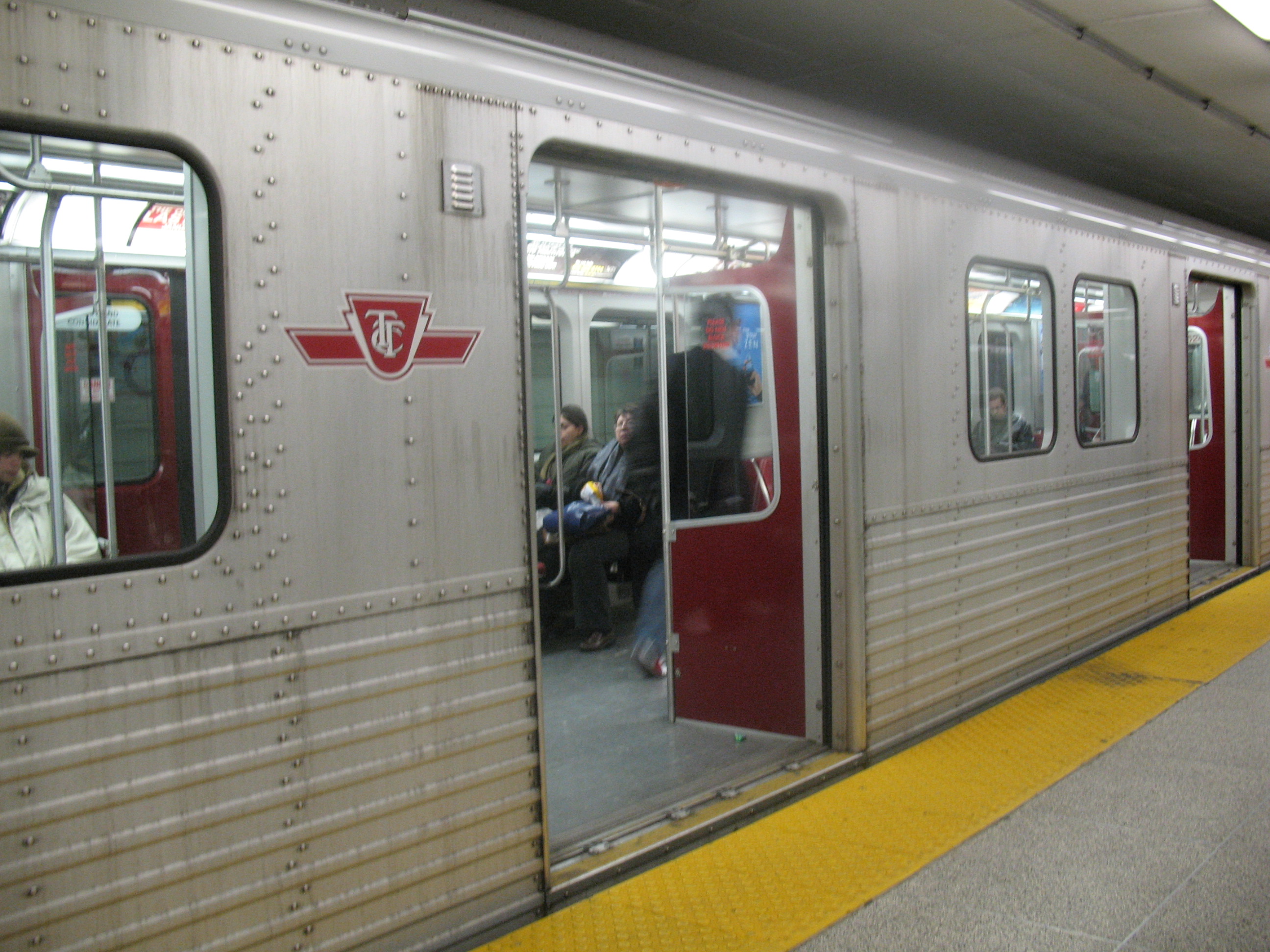
 Streetcar underground on the Union Station LoopMain article: Union (TTC)
Wolseley Loop
- Location: Bathurst Street north of Queen Street West
- Coordinates: 43°38′53.8″N 79°24′14.6″W / 43.648278°N 79.404056°W
- Functions: Loops from northbound to southbound only
- Facilities: Driver cabin
- Passenger use: No
- Connections: None
Woodbine Loop
- Location: Northeast corner of Queen Street East and Kingston Road
- Coordinates: 43°40′04.8″N 79°18′41.5″W / 43.668°N 79.311528°W
- Functions: Short turn for eastbound 501 Queen
- Facilities: None
- Passenger use: No
- Connections: None
Former loops
 Mutual Loop in 1929
Name Location Status Asquith Loop Church St. north of Bloor St. E. later bus loop, now redeveloped Avon Loop Weston Rd. & Rogers Rd.[11] later trolley bus loop, now bus loop Bedford Loop Bloor St. W. & Bedford Rd. partially redeveloped, partially parking lot Bicknell Loop Rogers Rd. & Bicknell Ave. belongs to the City of Toronto[11] Birchmount Loop Birchmount Rd. & Kingston Rd. [12] redeveloped Caledonia Loop St. Clair Ave. W. & Station St. Christie Loop Dupont St. & Christie St. redeveloped Danforth-Coxwell Loop Danforth Ave. & Coxwell Ave. was part of Danforth Carhouse property; now redeveloped Erindale Loop Broadview Ave. & Erindale Ave.
north side of street, opposite parketteredeveloped Ferry Loop Queen's. Quay W. west of Bay St. also known as Ferry Docks Loop Gilbert Loop Eglinton Ave. W. & Gilbert St. Glen Echo Loop Yonge St. & Glen Echo Ave. redeveloped Hillingdon Loop Danforth Ave. & Hillingdon Ave. was part of Danforth Carhouse property Hillside Wye Hillside Ave. & Lake Shore Blvd. W. paved over in 2002 Jane Loop Bloor St. W. & Jane St. now redeveloped Keele Loop Keele St. north of St. Clair Ave. W. redeveloped Keele Stn. Loop Indian Grove & Bloor St. W. redeveloped Lawton Loop north of Yonge St./Lawton Blvd. intersection parkette Lipton Loop Lipton Ave. & Pape Ave. now buses only, part of Pape Station Luttrell Loop Danforth Ave. west of Victoria Park Ave. redeveloped Main Loop Main Street north of Danforth Ave. rebuilt into Main Street Station Loop Mt Pleasant Loop Eglinton Ave. E. & Mount Pleasant Rd. later trolley bus loop, now used only by buses Mutual Loop Mutual St. & Queen St. E. redeveloped Moore Park Loop Mount Pleasant Rd. & St. Clair Ave. E. Loring-Wyle Parkette Park Loop Bloor St. W. & High Park Ave. park of High Park Parliament Loop King St. later bus loop only; now redeveloped as part of a car dealership Prescott Loop Royce Loop Lansdowne Ave. & Dupont St. redeveloped Runnymede Loop Dundas St. W. & Runnymede Rd. later trolley bus loop, now bus loop Simcoe Loop Front St. W. & Simcoe St. redeveloped St. Clair Carhouse Loop also known as Wychwood Carhouse St. Clarens Loop St. Clarens Ave. & Davenport Rd. Terauley Bay bus loop only City Hall Louisa, James & Albert Streets Vaughan Loop north of Bathurst St./Vaughan Rd. intersection redeveloped Viaduct Loop Bloor St. E. & Parliament St. parkette Vincent Loop across from Dundas West Station Woodbine Stn. Loop Cedarvale Ave. & Strathmore Blvd. part of parking lot beside Woodbine Station References
- ^ Venerable Bingham Loop
- ^ Introducing Charlotte Loop
- ^ Streetcars to the Exhibition (Routes 521, 522 and more)
- ^ "Status Update for February 2009". Transit City Light Rail Plan. Toronto Transit Commission. February 2, 2009. http://www.ttc.ca/postings/gso-comrpt/documents/report/f3854/Commission_Report_-_Transit_City_Light_Rail_Plan_Status_Update_-_February_20091.pdf. Retrieved 17 December 2009.
- ^ Exhibition Loop and Fleet Loopl
- ^ The Humber Loop Interchange
- ^ Westerly Long Branch Loop
- ^ A Brief History of McCaul Loop
- ^ The Great Neville Loop
- ^ Trusty Townsley Loop
- ^ a b A History of the Rogers/Weston Streetcar Loops (Northlands, Avon and Bicknell)
- ^ Remembering Birchmount Loop
External links
- TTC Toronto Track Diagram 1966
- Toronto Transit Commission Track Diagram 1973
- TTC Streetcar Track Map (1995)
Toronto Transit Commission Buses Blue Night Network • Fleet • Routes • Wheel-Trans • York University Busway
Subway/RT Bloor–Danforth • Scarborough RT (Eglinton–Scarborough Crosstown) • Sheppard • Yonge–University–Spadina • Rolling stock • Stations • SignalsStreetcar system 501 Queen • 502 Downtowner • 503 Kingston Rd • 504 King • 505 Dundas • 506 Carlton • 508 Lake Shore • 509 Harbourfront • 510 Spadina • 511 Bathurst • 512 St. Clair • Rolling stock • LoopsFacilities Arrow Road Bus Garage • Birchmount Bus Garage • Davisville Subway Yard • Eglinton Bus Garage • Greenwood Subway Yard • Hillcrest Complex • Lakeshore Bus Garage • Malvern Bus Garage • McCowan RT Yard • Mount Dennis Bus Garage • Queensway Bus Garage • Roncesvalles Carhouse • Russell Carhouse • Toronto Coach Terminal • Vincent Subway Yard • Wilson Bus Garage and Subway Yard • William McBrien BuildingHistory Williams Omnibus Bus Line • Toronto Street Railway • Toronto Suburban Railway Company • Toronto Railway Company • Toronto Civic Railways • Toronto Transportation Commission • Defunct facilities • Toronto Island Ferry • Gray Coach • Queen line • Lower Queen • Municipal Service Car • Network 2011 • Downtown Relief Line • 1995 Russell Hill subway accident • Eglinton West line • 2006 wildcat strike • 2008 strike • Transit City • Special Constable ServicesMiscellaneous Accessibility • Communications and Information System • Fares • Metrolinx • Obay • Personnel • Toronto Subway FontItalics indicate a proposed route or project under constructionCategories:


Wikimedia Foundation. 2010.