- Eakin Mill Covered Bridge
-
Eakin Mill Covered Bridge
 Northern side of the bridge
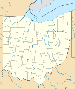
Location: Mound Hill Rd., Arbaugh, Ohio Coordinates: 39°10′16″N 82°20′13″W / 39.17111°N 82.33694°WCoordinates: 39°10′16″N 82°20′13″W / 39.17111°N 82.33694°W Area: less than one acre Built: 1870 Architect: Gilman & Ward Co. Architectural style: King post truss Governing body: Local NRHP Reference#: 76001539[1] Added to NRHP: March 16, 1976 The Eakin Mill Covered Bridge (also known as the "McLaughlin Bridge" or the "Geer's Mill Bridge") is a historic covered bridge in Vinton County, Ohio, United States. Located southeast of the county seat of McArthur, this bridge carries Mound Hill Road near the community of Arbaugh.[1]
Built in 1870,[1] the Eakin Mill Bridge was constructed across the Big Raccoon Creek by the McArthur contracting firm of Gilman and Ward. Like many other covered bridges built in Ohio during the late nineteenth century, the Eakin Mill Bridge features the king post truss design; unlike most others, this bridge was built with multiple king posts, enabling it to be significantly stronger than the average bridge that was built with a single king post. This sturdiness was necessitated by the Eakin Mill, a busy gristmill along the Big Raccoon; many other covered bridges spanned the stream, but the frequent mill traffic forced the builders to use an extraordinarily strong design.[2] Gilman and Ward built their bridge on stone piers and roofed it with metal;[3] like many other covered bridges,[2] its walls are weatherboarded.[3]
With the developments of modern truck transportation, the Eakin Mill Covered Bridge became less well suited to daily operation. Many trucks crossed the bridge while carrying loads heavier than they were permitted to carry, and the bridge sustained significant structural damage; accordingly, it was closed and replaced. Nevertheless, the bridge remains in its original location, and it has been designated a historic site.[2] In 1976, the Eakin Mill Covered Bridge was listed on the National Register of Historic Places,[1] qualifying both because of its historically significant engineering and because of its place in Ohio's history.[3]
References
- ^ a b c d "National Register Information System". National Register of Historic Places. National Park Service. 2009-03-13. http://nrhp.focus.nps.gov/natreg/docs/All_Data.html.
- ^ a b c Owen, Lorrie K., ed. Dictionary of Ohio Historic Places. Vol. 2. St. Clair Shores: Somerset, 1999, 1367.
- ^ a b c Eakin Mill Covered Bridge, Ohio Historical Society, 2007. Accessed 2010-08-08.
U.S. National Register of Historic Places Topics Lists by states Alabama • Alaska • Arizona • Arkansas • California • Colorado • Connecticut • Delaware • Florida • Georgia • Hawaii • Idaho • Illinois • Indiana • Iowa • Kansas • Kentucky • Louisiana • Maine • Maryland • Massachusetts • Michigan • Minnesota • Mississippi • Missouri • Montana • Nebraska • Nevada • New Hampshire • New Jersey • New Mexico • New York • North Carolina • North Dakota • Ohio • Oklahoma • Oregon • Pennsylvania • Rhode Island • South Carolina • South Dakota • Tennessee • Texas • Utah • Vermont • Virginia • Washington • West Virginia • Wisconsin • WyomingLists by territories Lists by associated states Other National Register of Historic Places in Vinton County, Ohio Properties Eakin Mill Covered Bridge | Hope Furnace | Markham Mound | Masonic Lodge No. 472 | Mt. Olive Road Covered Bridge | Ponn Humpback Covered Bridge | Ranger Station Mound | Ratcliffe Mound | Trinity Episcopal Church | Zaleski Methodist Church Mound
 Categories:
- Covered bridges in Ohio
- Bridges on the National Register of Historic Places in Ohio
- Buildings and structures in Vinton County, Ohio
- Bridges completed in 1870
- Transportation in Vinton County, Ohio
- Visitor attractions in Vinton County, Ohio
- Road bridges in Ohio
Wikimedia Foundation. 2010.

