- McMullin, Virginia
-
McMullin — CDP — Location within the Commonwealth of Virginia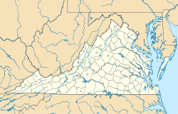
 McMullin
Coordinates: 36°49′3″N 81°34′31″W / 36.8175°N 81.57528°WCoordinates: 36°49′3″N 81°34′31″W / 36.8175°N 81.57528°W Country United States State Virginia County Smyth Time zone Eastern (EST) (UTC-5) – Summer (DST) EDT (UTC-4) ZIP codes 24354 FIPS code 51-48445 GNIS feature ID 2629841 McMullin is a census-designated place in Smyth County, Virginia. The population as of the 2010 Census was 464.[1]
References
- ^ Virginia Trend Report 2: State and Complete Places (Sub-state 2010 Census Data). Missouri Census Data Center. Accessed 2011-06-08.
Municipalities and communities of Smyth County, Virginia Towns 
CDPs Adwolf | Atkins | McMullin | Seven Mile Ford | Sugar Grove
Unincorporated
communitiesAllison Gap
Footnotes ‡This populated place also has portions in an adjacent county or counties
Categories:- Populated places in Smyth County, Virginia
- Census-designated places in Virginia
- Southwest Virginia geography stubs


Wikimedia Foundation. 2010.