- Molucca Sea Plate
-
 Map of the Molucca Sea Plate (as "Mer des Moluques") and its neighbouring plates (in French)
Contents
Earlier theory
The Molucca Sea Plate (also Molucca Sea Microplate) was theorised to be a small tectonic plate carrying northern Sulawesi, the Molucca Sea and a portion of the Banda Sea in a region littered with numerous small plates. The theory suggested a subduction zone lies along its northern border with the Sunda Plate. A small divergent boundary exists along the Sulawesi part of the border with the Banda Sea Plate and transitions into a convergent boundary as it bisects the Banda Sea; the rest of the borders being transform boundaries.
Current theory
More recent scientific studies suggest the Molucca Sea Plate has been totally subsumed by the Halmahera Plate and the Sangihe Plate, so that no portion of the Molucca Sea Plate remains exposed to the Earth's surface. The tectonic setting of this region is unique in that it is the only global example of an active arc-arc collision consuming an oceanic basin via subduction in two directions, between microplates Halmahera Plate and Sangihe Plate.[1] To the Southeast is the Sorong Fault, a major lateral east-west fault in the region which separates Bird's Head Plate and Halmahera Plate. This theory is more fully discussed in the article Molucca Sea Collision Zone.
Large earthquakes frequently strike this area sometimes triggering tsunamis.
Recent large quakes (>6.0) in region
- June 13, 2011 - 6.2 Molucca Sea
- Feb 11, 2009 - 7.2 Kepulauan Talaud
- Sep 10, 2008 - 6.6 180 km south of Manado on Sulawesi.
- July 26, 2007 - 6.9 Molucca Sea
- Mar 17, 2007 - 6.5 Molucca Sea
- Jan 21, 2007 - 7.5 Molucca Sea, 5 deaths
- May 19, 2006 - 6.3 Molucca Sea
- Dec 21, 2005 - 6.3 190 km south of Manado.
References
- Bird, P. (2003). "An updated digital model of plate boundaries". Geochemistry, Geophysics, Geosystems 4 (3): 1027. doi:10.1029/2001GC000252. http://peterbird.name/publications/2003_PB2002/2003_PB2002.htm.
Tectonic plates Major 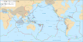
Minor Other Aegean Sea · Altiplano · Amurian · Anatolian · Apulian · Australian · Balmoral Reef · Banda Sea · Bird's Head · Burma · Capricorn · Caroline · Conway Reef · Easter · Explorer · Falklands · Futuna · Galapagos · Gonâve · Gorda · Greenland · Halmahera · Iberian · Indian · Iranian · Juan Fernández · Kerguelen · Kermadec · Kula · Madagascar · Manus · Maoke · Mariana · Molucca Sea · New Hebrides · Niuafo'ou · North Andes · North Bismarck · North Galapagos · Nubian · Okhotsk · Okinawa · Panama · Pelso · Philippine Mobile Belt · Rivera · Sangihe · Seychelles · Shetland · Solomon Sea · Somali · South Bismarck · South Sandwich · Sri Lanka · Sunda · Timor · Tisza · Tonga · Woodlark · YangtzeAll Large Small West: Burma Plate · Philippines: Philippine Mobile Belt · Indonesia: Banda Sea Plate · Molucca Sea Collision Zone · Bird's Head Plate · Halmahera Plate · Sangihe Plate · Timor Plate · New Guinea: Maoke Plate · Woodlark Plate · North Bismarck Plate · South Bismarck Plate · Manus Plate · Solomon Sea PlateFaults Philippine Fault System · Sorong Fault · Ramu-Markham Fault · Great Sumatran fault · New Britain Subduction ZoneTrenches and troughs Java Trench (Sunda) with Mentawai Trough · Sunda Trough · Timor Trough · Philippines: North Luzon Trough · Manila Trench · Philippine Trench · Cotabato Trench · East Luzon Trench · Sulu Trench · Negros Trench · Palawan Trench · Moluccas: Banda Trench · Ceram Trough · Ternate Trough · Talaud Trough · Sangihe Trough · Salajar Trough · Ayu Trough · West Caroline Trough · Timor: Aur Trough · Tanimbar Trough · New Guinea: New Guinea Trench · Manokwari Trough · West Melanesian Trench · Lyra Trough · Mussau Trench · New Britain Trench (Bougainville) · Pocklington TroughSubsea plateaus and basins Benham Plateau · Weber Basin · North Australian Basin
This tectonics article is a stub. You can help Wikipedia by expanding it.

