- Ryan's Creek Aerodrome
-
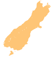
Ryan's Creek Aerodrome IATA: IVC – ICAO: NZNV Location of airport off south end of South Island Summary Airport type Public Operator South East Air Location Stewart Island, New Zealand Elevation AMSL 288 ft / 88 m Coordinates 46°53′59″S 168°06′06″E / 46.89972°S 168.10167°E Runways Direction Length Surface m ft 04/22 800 2,625 Source: New Zealand AIP[1] Ryan's Creek Aerodrome (IATA: SZS, ICAO: NZRC) is a small airstrip on Stewart Island in southern New Zealand.
Contents
History
The aerodrome was built in the late 1970s to accommodate Stewart Island Air Services (flying Aztec DUB AZTEC TJE|TJE, 402 DSB, Nomad SAL, Islander IAS and Islander FFL). The strip was made of the native red rock from the area. In the mid-1980s Stewart Island Air Services changed its name to Southern Air Limited with Keith Smith, Joe Cave, Bill Haslett and Sam Nicol as shareholders. Ryan's Creek was asphalted and ready for service with its new owner. All aircraft from Stewart Island Air Services were sold (apart from an Islander IAS which crashed on the strip and an FFL which remained with Southern Air).[2] Stewart Island Travel used Ford Transits to take passengers to and from the strip and offered bus tours of the island's roads. Southern Air Limited purchased an Islander FGR shortly afterwards which proved to be a suitable aircraft for the job. Around 1986, an Islander FLU was bought. In 1990 a hill at one end of the strip was leveled; this left more room for aircraft to land, and allowed easier access to the strip. Southern Air then purchased FXE and FWZ in 1990 to replace FGR and FFL because of difficulty obtaining parts (FFL's main parts—such as its fuselage—are in Invercargill, as are parts of FGR). Smith brought the post office/depot in 1995; Stewart Island Travel was no longer needed for van service, since Southern Air had Bedford CFs and Hiaces for this now. In 1997 Southern Air was brought by Allan Aitcheson, and the name was changed to Southern Air 1997 Limited. The company continued to use Ryan's Creek and remained accident-free, purchasing 172 DNP, 177RG DXS and the 402 VAC. VAC crashed off Bluff Hill in Aug 1998, when Robin Andrews was captain. Another accident involved JEM, which crashed on landing. In 2000 Southern Air 1997 Ltd was bought by Stewart Island Flights, which uses FXE, FWZ 185, JEM PA32, RTS and DIV aircraft in its service.
Facilities
The airport is at an elevation of 288 feet (88 m) above mean sea level.[3] It has one runway, designated "04/22", which measures 800 by 66 metres (2,625 × 217 ft).[1]
Airlines and destinations
Airlines Destinations Stewart Island Flights Invercargill References
- ^ a b "NZRC - Ryan's Creek aerodrome chart". Civil Aviation Authority of New Zealand. Effective 10 Feb 2010. http://www.aip.net.nz/pdf/NZRC.pdf.
- ^ Ryan's Creek accident report Retrieved 2011-08-01.
- ^ Great Circle Mapper Retrieved 2011-08-01.
Categories:- Airports in New Zealand
- Stewart Island / Rakiura
- Southland Region
Wikimedia Foundation. 2010.

