- Kaitaia Airport
-
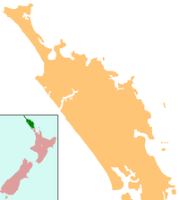
Kaitaia Airport IATA: KAT – ICAO: NZKT Location of airport in Northland Summary Airport type Public Operator Far North Holdings Ltd. Location Kaitaia Elevation AMSL 270 ft / 82 m Coordinates 35°04′12″S 173°17′07″E / 35.07°S 173.28528°E Runways Direction Length Surface ft m 12/30 4,600 1,402 Asphalt 18/36 4,190 1,277 Gravel Kaitaia Airport (IATA: KAT, ICAO: NZKT) is located at Kaitaia in the Northland Region, of New Zealand. It's about 4 hours drive from Auckland and a 45 minute flight from Auckland International Airport.
On 13 June 2005, Kaitaia Airport received an injection of $333,850 to upgrade its runway facilities so that it can accommodate larger aircraft. The Far North District Council approved loan funding for Kaitaia Airport's project that will allow it to accommodate aircraft up to 15,000 kilograms (33,000 lb) in weight. This upgrade will allow Air New Zealand to fly into Kaitaia with its new fleet of Dash 8 aircraft. Over the next 10 years, $1.4 million will be invested into the airport.
Contents
Aircraft transit
Kaitaia Airport is the most northern airfield in New Zealand that has fuel available. Kaitaia airport has a long and smooth runway, it also has the longest runway in Northland and is used by light aircraft, as well as private (such as the Gulfstream V) and a regular Air New Zealand service from Auckland Airport.
852 km (460 nautical miles) to the North West of Kaitaia is Norfolk Island Airport from which it is 754 km (407 nautical miles) to Noumea in New Caledonia, or 900 km (486 nautical miles) to Lord Howe Island which can be used as a stepping stone to the Australian mainland.
These distances are within the range of many light aircraft when fitted with long range tanks, while the direct distances are usually used with the larger private aircraft which are able to land at Kaitaia Airport. From New Caledonia other Pacific Islands such as Vanuatu and Fiji are within range and can be used as further 'stepping stones' to the other South Pacific and North Pacific destinations.
Information for Aviators
Kaitaia Airport code: KAT (NZKT)
Kaitaia Airport has a 1,402m sealed runway and a gravel cross runway of 1,277m. Navigation aids include a PAL landing system. Private aircraft are permitted to use the airport.
The runway has a Pavement Classification Number (PCN) of 15 which allows aircraft of up to 22,500 kg. MCTOW access to the airport
Kaitaia Airport has:
- Runway Lighting
- PAPI (Precision Approach Path Indicator)
- Navigation Rotating Beacon
- Non Directional Beacon (NDB)
- lighted Wind Socks at either end of both of the runways
- Fuel - Mobil Avgas
Air New Zealand services
Airlines Destinations Air New Zealand operated by Eagle Airways Auckland Kaitaia Airport receives Beechcraft 1900D's twice daily Mon-Fri and daily Sat-Sun.
External links
- Far North Holdings Ltd.
- About Far North Holdings Ltd.
- Airport information for NZKT at World Aero Data. Data current as of October 2006.
Categories:- Airports in New Zealand
- Far North District
- Buildings and structures in the Northland Region
Wikimedia Foundation. 2010.

