- Nahal Tavor
-
Coordinates: 32°39′8.58″N 35°27′47.45″E / 32.6523833°N 35.4631806°E
 Tavor stream (Nahal Tavor)
Nahal Tavor (Hebrew: נחל תבור; Arabic: وادي البيره, Wadi al-Bireh), lit. Tabor Stream, is an intermittent stream in the lower Galilee, Israel.
Geography
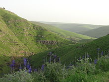 Nahal Tavor looking south-east, Lupins in the foreground
The stream starts in the hills of Nazareth, east of the city, and runs east and south of Mount Tabor, where it turns east and then empties into the Jordan River between Gesher and Belvoir Fortress.
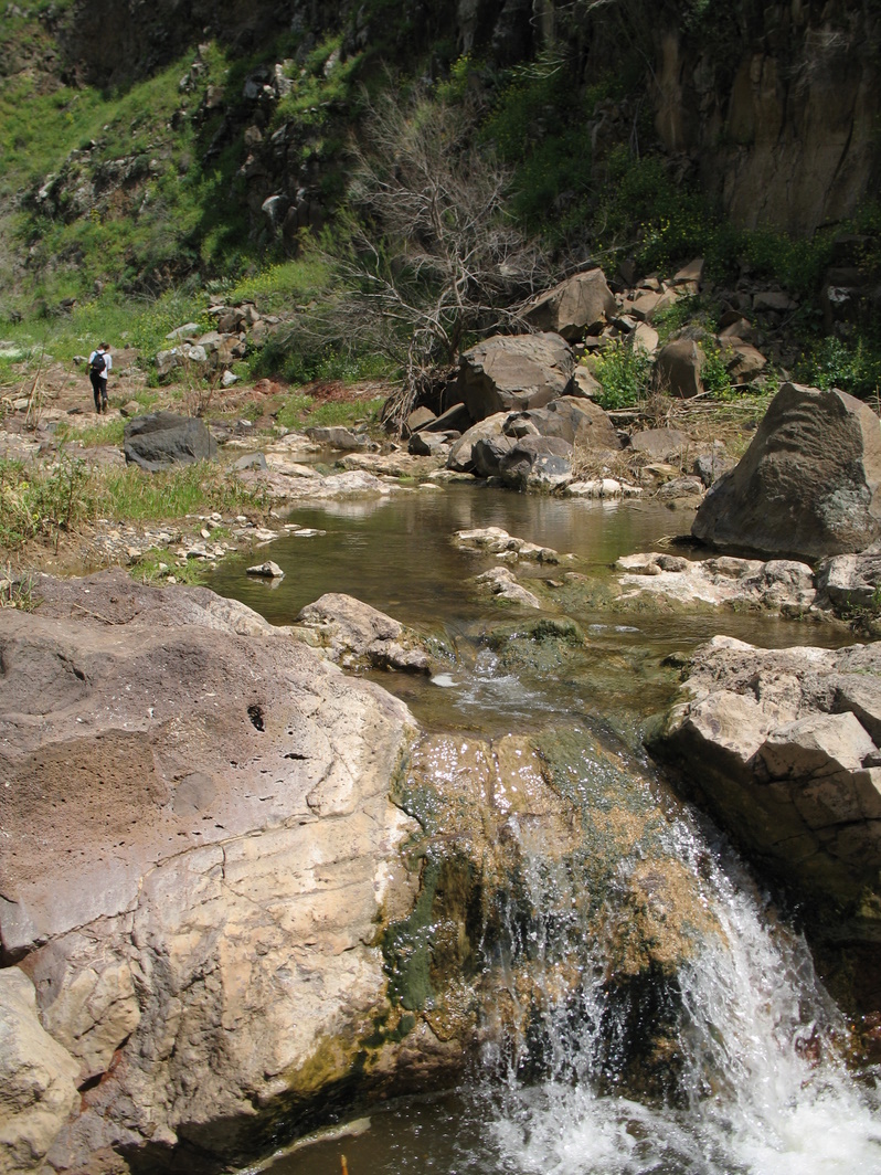
Three springs feed the stream within the boundaries of the Nahal Tavor Nature Reserve; Ein Rechesh, Ein Ze'ev, and Ein Shachal. Ein Rechesh is near Tel Rechesh, an archeological tel thought to be Anaharath, a town mentioned in the description of one of Thutmose III's campaigns, and also in Joshua 19:19, describing the allotment of the Tribe of Issachar.[1][2]
Near kibbutz Gazit, the stream runs through a Basalt canyon.
Nature reserve
The Tabor Stream received nature reserve status in 1974.[3]
The Nature reserve encompasses the stream from the area near Kfar Kish up to Highway 90[1].
Flora includes Tamarix, Willow, Ziziphus spina-christi, Pistacia atlantica, Faidherbia albida, and Prunus korshinskyi trees. Many wildflowers grow during the winter months, such as Lupins (Lupinus pilosus), Cyclamen persicum, Anemones, Chives, and Asafoetida.
Fauna in the reserve includes Gazelles (Gazella gazella gazella), Spanish Sparrows and Alectoris partridges.
References
- ^ a b "נחל תבור ויובליו [Nahal Tavor and its tribuaries]" (in Hebrew). Israel Nature and Parks Authority website. http://www.parks.org.il/BuildaGate5/general2/data_card.php?Cat=~20~~743419345~Card1~&ru=&SiteName=parks&Clt=&Bur=40639899,%D7%A9%D7%9E%D7%95%D7%A8%D7%AA.
- ^ "Rekhesh Project". Rekhesh.com. http://rekhesh.com/html/about%20the%20site.html. Retrieved 2010-09-15.
- ^ "Nahal Tavor Nature Reserve". protectedplanet.net. http://www.protectedplanet.net/sites/Nahal_Tavor_Nature_Reserve.
 Nature reserves of Israel
Northern District Ein Afek · Akhziv Islands · Alonei Yitzhak · Alonei Abba · Amud Stream · Nahal Ayun · Balfouria · Bitan Aharon · Nahal Betzet · Nahal Dishon · Dor Beach and Ma'agan Michael Islands · Ein Avazim · Ein Elah · Ein Nymphit · Ein Te'oh · Ein Yehuda · Nahal Gamal · Gamla nature reserve† · Snir Stream · Hermon nature reserve† · Nahal Hermon† · Hula Valley · Hurshat Tal · Hurshat Zakum · Kerem Ben Zimra · Nahal Kziv · Mount Arbel · Mount Carmel · Mount Gilboa · Mount Meron · Mount Tabor · Pa'ar Cave · Rosh HaNikra · Shamir-Nahal Rachum · Shimron · Nahal Taninim · Tel Anafa · Nahal Tavor · Tel Dan · Tel Shikmona · Nahal YehiamCentral District Adullam · Ashdod Nitzanim Sand Dune Park · Bnei Zion · Avshalom Cave · Ein Hemed · HaMasrek Reserve · Neot Kedumim · Nahal Poleg · Nahal Sorek · Tel Yitzhak · Te'omim Cave · UdimSouthern District Eilat Region Coral Beach Nature Reserve · Timna valley · Yotvata Hai-Bar† Located in the Israeli-occupied territories Categories:- Rivers of Israel
- Nature reserves in Israel

Wikimedia Foundation. 2010.