- National Register of Historic Places listings in Hancock County, Illinois
-
See also: List of Registered Historic Places in Illinois
Contents: List of Registered Historic Places in Hancock County, Illinois, USA:
-
- This National Park Service list is complete through NPS recent listings posted November 10, 2011.[1]
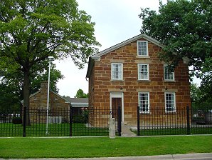
Landmark name Image Date listed Location City or Town Summary 1 Cambre House and Farm November 13, 1984 SW of Niota
40°35′38″N 91°20′35″W / 40.59389°N 91.34306°WNiota 2 Carthage Courthouse Square Historic District August 13, 1986 Roughly bounded by Main, Adams, Wabash, and Madison Sts.
40°24′47″N 91°8′7″W / 40.41306°N 91.13528°WCarthage 3 Carthage Jail 
March 20, 1973 Walnut and N. Fayette Sts.
40°24′56″N 91°7′55″W / 40.41556°N 91.13194°WCarthage 4 Cyrus Felt House March 18, 1980 3 mi. N of Hamilton
40°26′1″N 91°22′13″W / 40.43361°N 91.37028°WHamilton 5 La Harpe City Hall November 14, 1991 207 E. Main St.
40°35′0″N 90°58′2″W / 40.583333°N 90.96722°WLa Harpe 6 La Harpe Historic District April 30, 1987 100-124 W. Main St., 100-122 and 101-129 E. Main Sts., 101-121 S. Center St., and City Pk.
40°34′59″N 90°58′10″W / 40.58306°N 90.96944°WLa Harpe 7 Nauvoo Historic District 
October 15, 1966 Nauvoo and its environs
40°33′5″N 91°22′18″W / 40.55139°N 91.37167°WNauvoo 8 William J. Reimbold House December 2, 1987 950 White St.
40°32′51″N 91°23′18″W / 40.5475°N 91.38833°WNauvoo 9 Warsaw Historic District December 16, 1977 Roughly bounded by the Mississippi River, Marion and 11th Sts.
40°21′48″N 91°25′58″W / 40.36333°N 91.43278°WWarsaw References
- ^ "National Register of Historic Places: Weekly List Actions". National Park Service, United States Department of the Interior. Retrieved on November 10, 2011.
See also
- List of National Historic Landmarks in Illinois
- National Register of Historic Places listings in Illinois
U.S. National Register of Historic Places Topics Lists by states Alabama • Alaska • Arizona • Arkansas • California • Colorado • Connecticut • Delaware • Florida • Georgia • Hawaii • Idaho • Illinois • Indiana • Iowa • Kansas • Kentucky • Louisiana • Maine • Maryland • Massachusetts • Michigan • Minnesota • Mississippi • Missouri • Montana • Nebraska • Nevada • New Hampshire • New Jersey • New Mexico • New York • North Carolina • North Dakota • Ohio • Oklahoma • Oregon • Pennsylvania • Rhode Island • South Carolina • South Dakota • Tennessee • Texas • Utah • Vermont • Virginia • Washington • West Virginia • Wisconsin • WyomingLists by territories Lists by associated states Other  Category:National Register of Historic Places •
  Portal:National Register of Historic PlacesCategories:
- Hancock County, Illinois
- National Register of Historic Places in Illinois by county
-

Wikimedia Foundation. 2010.