- Oaks Estate, Australian Capital Territory
-
Oaks Estate
Canberra, Australian Capital Territory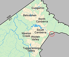
Population: 310 (2001 census) Established: 1984 Postcode: 2620 District: Jerrabomberra Suburbs around Oaks Estate: Oaks Estate Queanbeyan Queanbeyan Queanbeyan Oaks Estate is an urban village situated immediately on the northern side of the NSW-ACT border abutting the township of Queanbeyan in south-eastern New South Wales, Australia. The estate covers an area of approximately 40 hectares and is bound by the Molonglo River to the north, 'The Oaks' to the east and the Queanbeyan-Cooma railway to the south. The village is located 12 kilometres from the centre of Canberra. The village is also noteworthy as the nucleus of Queanbeyan's industrial development during the second half of the 19th century. Oaks Estate takes its name from 'The Oaks', which was part of Duntroon, Robert Campbell's farming estate.[1] This makes Oaks Estate one of only a few place names in the ACT with significant connections to early colonial times.
Contents
History
Colonial
 Front door of the 'Oaks' Residence
Timothy Beard, a pardoned convict and former innkeeper from Campbelltown in New South Wales was the first European to occupy the area. In the mid 1820s he drove cattle from Liverpool to graze near the junction of the Molonglo and Queanbeyan Rivers. His station huts which he named ‘Queenbeeann’were located two kilometres downstream from the Molonglo/Queanbeyan River junction in what is today the abattoir paddock. The township of Queanbeyan was established in 1838 about 2 kilometres (1.2 mi) south east of Oaks Estate.
In 1877 John Bull, a farmer and grazier from Tarago NSW purchased from Charles Campbell, the son of Robert, 100 acres of land including the building known as ‘The Oaks’. He operated the inn as the ‘Elmsall Inn’. In the same year John Bull established Hazelbrook Works, a wool washing works and fellmonger near the junction of the Queanbeyan and Molonglo rivers.[2][3]
In 1885 George Tompsitt bought Hazelbrook Works and renamed it the Hazelbrook Wool Scouring Works, Tannery and Wholesale Produce Warehouses. With a major business expansion Oaks Estate became the nucleus of Queanbeyan industry.[3] The Queanbeyan Railway Station opened in September 1887 and the auction of the sale of the first residential allotments in Oaks Estate took place a few months later. In the early 1890s a local businessman established the Queanbeyan Roller Flour Mill in the Oaks Estate[1]
After federation
Two years after the passing of the Seat of Government Acceptance Act 1909,the Federal Capital Territory was brought into existence on 1 January 1911.[1] The Goulburn-Cooma railway line was prescribed as the eastern territorial boundary, Oaks Estate was excised from Queanbeyan by the federal Act of Parliament and a 20 metre long railway bridge.[4] The Queanbeyan station is located on the southern side of the tracks adjacent to Oaks Estate and a road bridge links Oaks Estate to Queanbeyan.
The Oaks burial ground was Queanbeyan's first cemetery established in 1838 until the Riverside cemetery was opened in 1846. The existence of Queanbeyan's earliest burial site was lost to time until 1991 when old human remains were unearthed. The earthly remains of more than 40 Queanbeyan settlers are buried there.[1]
Place names
The street names in Oaks Estate village mark the name of some significant historic figures in its development over the past 150 years.
Street name Probable origin Florence Street Florence Bull was John Bull’s daughter[3] Railway Street Proximity of street to the railway easement George Street George Tompsitt purchased a portion of John Bull’s land which included the ‘The Oaks’ and the wool washing works and fellmongery[3] Hazel Street Hazelbrook Works was a wool washing and fellmongering industry established in 1877 by John Bull and purchased by George Tompsitt in 1885.[3] Hill Street Road name in use for many years McEwen Avenue Former Prime Minister and Minister for the Interior, John McEwen was instrumental in extending Canberra's water supply to Oakes Estate. The water tank is located at the end of this road[3] River Street The road leads to the Molonglo River[3] William Street In 1885 William Price, a Sydney merchant, purchased the remaining portion of John Bull’s land[3] Amenities
Oaks Estate has a population of about 330. The village supports a mixture of industrial and commercial uses in storage, warehousing, light metal fabrication, liquor storage and retailing as well as some ACT Government public housing.
Located there is:
- allotment garden
- the water pollution control centre,
- council city nursery,
- saleyards,
- electricity substation,
- a sportsground,
- several horse holding paddocks,
- an abattoir,
- a tannery,
- a Local Liquor store,
- an antiques restoration workshop.
Geology
Under Oaks Estate are rocks from the Pittman formation. These are from the Ordovician period and consist of chert, phyllite and quartz rich micaceous sandstone. This area of the ACT is structurally on the Cullarin Horst, an uplifted area. A small patch of black Acton Shale is in the south east end of the settlement.
References
- ^ a b c Monaro Consultants & Burnham Planning (2001), Oaks Estate Planning Study, ACT Government
- ^ A fellmonger is someone who removes hair from animal hides in preparation for tanning
- ^ a b c d e f g h Savery N (20006), Public Place Names (Oaks Estate) Determination 2006 (No 1), ACT Parliamentary Counsel
- ^ Williams, K (1997) ‘Oaks Estate: No Man’s Land’. Published by Karen Williams, Canberra
Categories:- Suburbs of Canberra
- Towns in the Australian Capital Territory


Wikimedia Foundation. 2010.