Dinas Cross

Dinas Cross
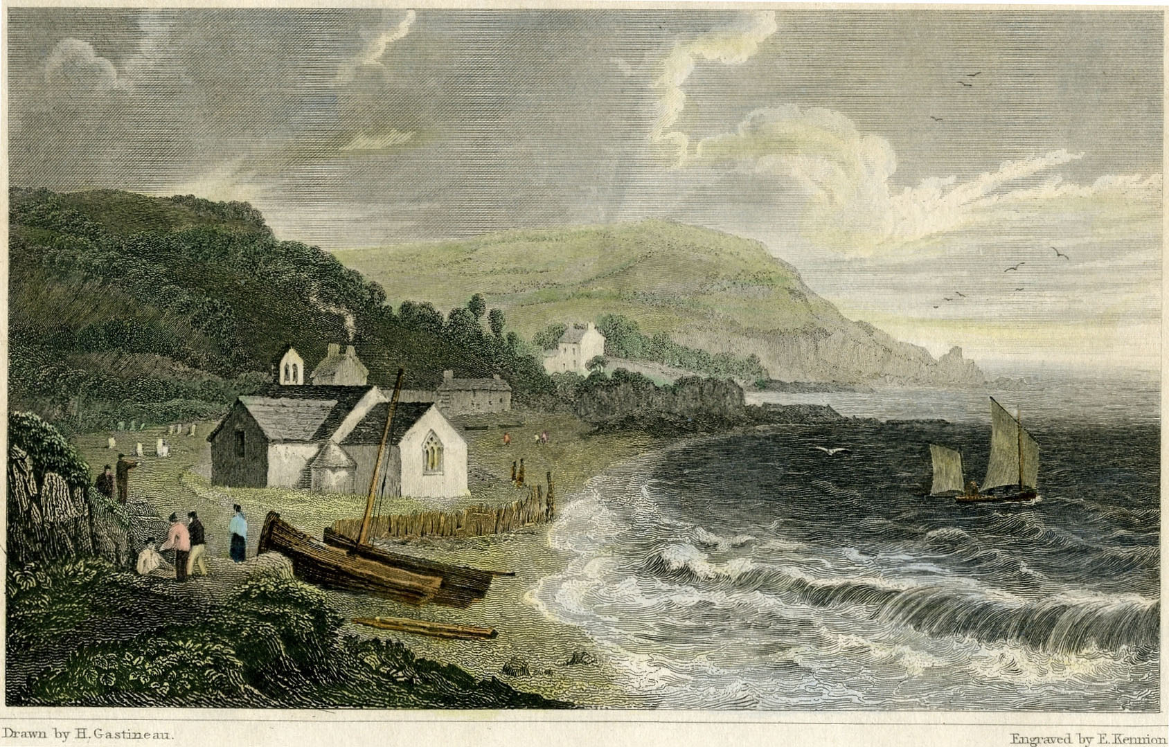
Dinas Old Church, prior to 1830

Dinas Cross (Welsh: Dinas) is a village in Pembrokeshire, Wales. It is situated between Fishguard and Newport in the Pembrokeshire Coast National Park and is a popular holiday destination on the A487. The village has its own elected community council and gives its name to an electoral ward of Pembrokeshire County Council. The electoral ward of Dinas Cross covers the communities of Dinas Cross, Cwm Gwaun and Puncheston.

Dinas has a total of four pubs: The Country Club, The Ship Aground, The Freemasons Arms and The Old Sailors. At one time there was also a cafe, a school, a garden centre, a fulltime post office and two shops. Now it has a Community hall Yr Hen Ysgol, a part time post office, a coffee shop, two shops, garage and a chip shop.

Dinas also houses two chapels which are in use; Tabor (a Baptist Chapel) and Gideon (an Independent Chapel), a servicing church (St Brynach's), and Ramah; an old, disused and neglected Methodist Chapel on the way to Pwllgwaelod beach.

Places of interest

  • Cwm-yr-Eglwys - St Brynach's church, the original parish church of Dinas, is situated on the picturesque beach of Cwm-yr-eglwys. The chancel of the church was washed away in the 1850, and the roof and north wall were destroyed during the Royal Charter Storm in 1859. A replacement church was subsequently built 1860-61 higher up in the village.
  • Dinas Head - A small peninsula sometimes referred to as Dinas Island, jutting off the coast, a very popular walk and an old farm. The Pembrokeshire Coast Path passes by St. Brynach's church and around Dinas Head.

External links

Coordinates: 52°00′29″N 4°54′25″W / 52.008°N 4.907°W / 52.008; -4.907


Wikimedia Foundation. 2010.

Игры ⚽ Нужен реферат?

Look at other dictionaries:

  • Dinas — may refer to one of several places: Wales Dinas, Carmarthenshire Dinas, Gwynedd Dinas railway station, Gwynedd Dinas Cross, Pembrokeshire Dinas Powys, Vale of Glamorgan Dinas Powys railway station Dinas Rhondda, Rhondda Cynon Taf Dinas Rhondda… …   Wikipedia

  • Cross Inn railway station — Cross Inn Location Place Llantrisant Area Rhondda Cynon Taf Coordinates …   Wikipedia

  • Dinas Mawddwy — is a village in Gwynedd, north Wales, just to the side of the A470 so that most visitors pass the village by. Its population is roughly 600. The village marks the junction of the unclassified road to Llanuwchllyn which climbs up through the… …   Wikipedia

  • Dinas Powys — Coordinates: 51°26′N 3°13′W / 51.43°N 3.22°W / 51.43; 3.22 …   Wikipedia

  • Castell Dinas Bran — Castell Dinas Brân is a medieval castle standing high on a hill above the town of Llangollen in Denbighshire, Wales. It is also the site of an Iron Age hill fort. Castell Dinas Brân (left) viewed from the north west Conte …   Wikipedia

  • Pen Dinas — and the Wellington Monument Pen Dinas is the name of a hill south of Aberystwyth on the coast of Ceredigion, Wales, upon which an extensive Iron Age hill fort is situated. The name is more correctly Dinas Maelor , this could be translated into… …   Wikipedia

  • Culverhouse Cross — Coordinates: 51°27′56″N 3°16′13″W / 51.46566°N 3.27036°W / 51.46566; 3.27036 …   Wikipedia

  • Pembrokeshire — Pembrokeshire …   Wikipedia

  • List of communities in Wales — This is a list of communities in Wales sorted by principal area. The community is the lowest tier of local government in Wales and is usually represented by a community council. Contents 1 Blaenau Gwent 2 Bridgend 3 Caerphilly …   Wikipedia

  • Cwm Gwaun — Coordinates: 51°58′08″N 4°52′00″W / 51.968814°N 4.866606°W / 51.968814; 4.866606 …   Wikipedia

Share the article and excerpts

Direct link
Do a right-click on the link above
and select “Copy Link”