- Clarendon Park, Leicester
-
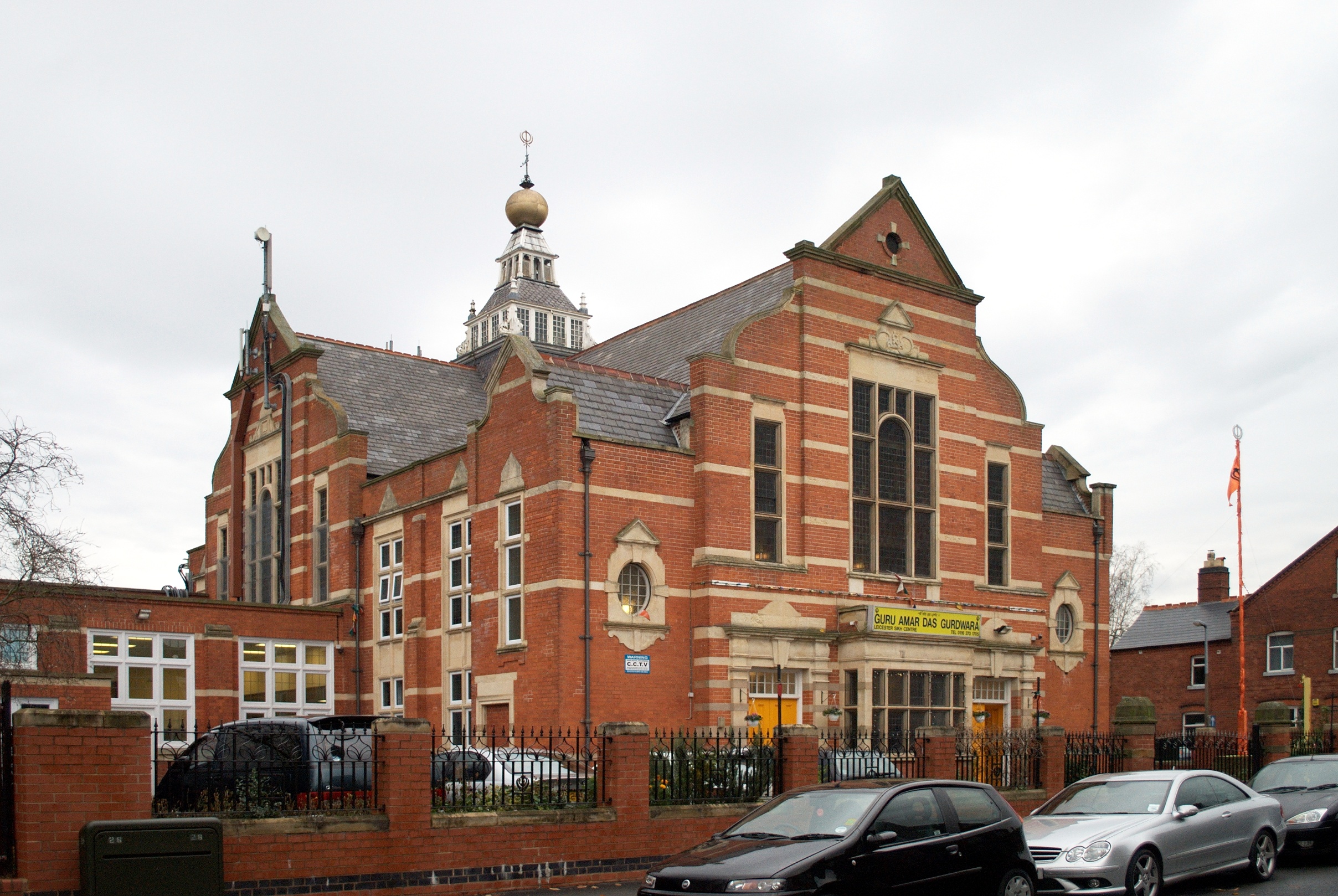
 The Guru Amar Das Gurdwara on Clarendon Park Road: one of the most prominent buildings in the area
Clarendon Park is an area in the south of the city of Leicester. It is bordered by Welford Road to the west, London Road to the east, Victoria Park to the north and Knighton Road to the south. It is part of Castle Ward and the constituency of Leicester South. There is one major shopping street Queens Road which runs north-south which is intersected near the middle of the area by Clarendon Park Road which links to Welford Road and London Road.
An important influence on the area is its proximity to the University of Leicester
Historically, the name derives from the fact that until the nineteenth century the area was a park owned by the Society of Friends, whose meeting house is situated in the area. Their opposition to the consumption of alcohol at one time led to there being very few pubs in the area, although several bars have opened in recent years along Queens Road.
Joe Orton lived in the area in his very early years.
Suburbs of Leicester Wards Abbey • Aylestone • Beaumont Leys • Belgrave • Braunstone Park & Rowley Fields • Castle • Charnwood • Coleman • Evington • Eyres Monsell • Fosse • Freemen • Humberstone & Hamilton • Knighton • Latimer • New Parks • Rushey Mead • Spinney Hills • Stoneygate • Thurncourt • Westcotes • Western Park
Areas Abbey Rise • Ashton Green • Aylestone • Beaumont Leys • Bede Island • Belgrave • Blackfriars • Braunstone Frith • Charnwood • City Centre • Clarendon Park • Crown Hills • Dane Hills • Evington • Evington Valley • Eyres Monsell • Frog Island • Gilmorton • Goodwood • Hamilton • Highfields • Horston Hill • Humberstone • Humberstone Garden • Kirby Frith • Knighton • Montrose • Mowmacre Hill • Netherhall • Newfoundpool • New Parks • North Evington • Northfields • Rowlatts Hill • Rowley Fields • Rushey Mead • Saffron • Southfields • South Knighton • Spinney Hills • Stocking Farm • Stoneygate • St. Matthew's • St. Mark's • St. Peters • Thurnby Lodge • West End • West Knighton • Western Park • Woodgate
Coordinates: 52°36′58″N 1°06′58″W / 52.616°N 1.116°W
Categories:- Areas of Leicester
- Leicester
- Leicestershire geography stubs
Wikimedia Foundation. 2010.