- Plymouth, Wisconsin
:"For other places named Plymouth, in Wisconsin or elsewhere, see
Plymouth (disambiguation) ."Infobox Settlement
official_name = Plymouth, Wisconsin
settlement_type =City
nickname =
motto =
imagesize =
image_caption =
image_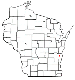
mapsize = 250px
map_caption = Location of Plymouth, Wisconsin
mapsize1 =
map_caption1 =subdivision_type = Country
subdivision_name =United States
subdivision_type1 = State
subdivision_name1 =Wisconsin
subdivision_type2 = County
subdivision_name2 = Sheboygangovernment_footnotes =
government_type =
leader_title =
leader_name =
leader_title1 =
leader_name1 =
established_title =
established_date =unit_pref = Imperial
area_footnotes =area_magnitude =
area_total_km2 = 10.8
area_land_km2 = 10.6
area_water_km2 = 0.2
area_total_sq_mi = 4.2
area_land_sq_mi = 4.1
area_water_sq_mi = 0.1population_as_of = 2000
population_footnotes =
population_total = 7781
population_density_km2 = 731.9
population_density_sq_mi = 1895.5timezone = Central (CST)
utc_offset = -6
timezone_DST = CDT
utc_offset_DST = -5
elevation_footnotes = GR|3
elevation_m = 257
elevation_ft = 843
latd = 43 |latm = 44 |lats = 57 |latNS = N
longd = 87 |longm = 58 |longs = 36 |longEW = Wpostal_code_type =
postal_code =
area_code =
blank_name = FIPS code
blank_info = 55-63700GR|2
blank1_name = GNIS feature ID
blank1_info = 1571709GR|3
website =
footnotes =Plymouth is a city in Sheboygan County,
Wisconsin , along theMullet River . The population was 7,781 at the 2000 census. It is included in theSheboygan, Wisconsin Metropolitan Statistical Area . The city is located within the Town of Plymouth, but is politically independent.Geography
Plymouth is located at coor dms|43|44|57|N|87|58|36|W|city (43.749277, -87.976799)GR|1.
According to theUnited States Census Bureau , the city has a total area of 4.2square mile s (10.8km² ), of which, 4.1 square miles (10.6 km²) of it is land and 0.1 square miles (0.2 km²) of it (1.44%) is water.Demographics
As of the
census GR|2 of 2000, there were 7,781 people, 3,262 households, and 2,071 families residing in the city. Thepopulation density was 1,895.5 people per square mile (732.7/km²). There were 3,395 housing units at an average density of 827.0/sq mi (319.7/km²). The racial makeup of the city was 98.44% White, 0.23% Black or African American, 0.22% Native American, 0.44% Asian, 0.19% from other races, and 0.48% from two or more races. 1.11% of the population wereHispanic orLatino of any race.There were 3,262 households out of which 31.7% had children under the age of 18 living with them, 51.7% were married couples living together, 8.7% had a female householder with no husband present, and 36.5% were non-families. 30.8% of all households were made up of individuals and 14.5% had someone living alone who was 65 years of age or older. The average household size was 2.35 and the average family size was 2.98.
In the city the population was spread out with 25.9% under the age of 18, 7.9% from 18 to 24, 29.8% from 25 to 44, 20.3% from 45 to 64, and 16.1% who were 65 years of age or older. The median age was 37 years. For every 100 females there were 92.9 males. For every 100 females age 18 and over, there were 91.9 males.
The median income for a household in the city was $42,103, and the median income for a family was $52,488. Males had a median income of $33,948 versus $25,457 for females. The
per capita income for the city was $22,260. About 2.6% of families and 3.6% of the population were below thepoverty line , including 2.6% of those under age 18 and 3.8% of those age 65 or over.Education
Public education for the city and the surrounding area, including the communities of Cascade and Parnell is provided by thePlymouth Joint School District , which consists of the following schools;
*Plymouth Comprehensive High School
*Riverview Middle School
*Parkview Elementary School
*Fairview Elementary School
*Horizon Elementary School
*Cascade Elementary SchoolReligious education is provided by;*St. John's The Baptist
*St. John's The LutheranLandmarks
A large Holstein cow named Antoinette is often cited as a local landmark. Erected in 1977 during the city's centennial celebration, it stands 20 feet high and weighs over 1,000 pounds. [ [http://www.plymouthwisconsin.com/ PlymouthWisconsin.com] ] The monument observes the robust dairy industry in the area.
Plymouth is also known as "Hub City" because of its location between Milwaukee, Sheboygan, Fond du Lac, and Green Bay.
References
External links
* [http://www.plymouthgov.com/ Plymouth, Wisconsin]
* [http://www.sheboyganhistory.com Sheboygan County History]
Wikimedia Foundation. 2010.