- Nußloch
-
Nußloch Town hall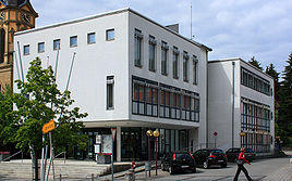

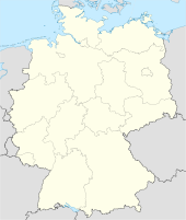
 NußlochLocation of Nußloch within Rhein-Neckar-Kreis district
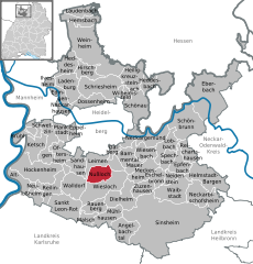

Coordinates 49°19′25″N 8°41′38″E / 49.32361°N 8.69389°ECoordinates: 49°19′25″N 8°41′38″E / 49.32361°N 8.69389°E Administration Country Germany State Baden-Württemberg Admin. region Karlsruhe District Rhein-Neckar-Kreis Mayor Karl Rühl (CDU) Basic statistics Area 13.59 km2 (5.25 sq mi) Elevation 146 m (479 ft) Population 10,700 (31 December 2010)[1] - Density 787 /km2 (2,039 /sq mi) Other information Time zone CET/CEST (UTC+1/+2) Licence plate HD Postal code 69226 Area code 06224 Website www.nussloch.de  Nußloch from across the Saugrund
 The title of this article contains the character ß. Where it is unavailable or not desired, the name may be represented as Nussloch.
Nußloch is a municipality in the Rhein-Neckar-Kreis (Baden-Württemberg), about 10 km south of Heidelberg. It's located on the tourist routes Bergstraße ("Mountain Road") and Bertha Benz Memorial Route. The hamlet Maisbach also belongs to Nußloch.
Contents
History
Nußloch was first mentioned on December 31, 766 in a deed of gift to the Lorsch Abbey. A married couple of strong faith donated a vineyard to the monastery from their property in Nußloch. It has been uder the control of the Palatinate at the latest since 1269. The hamlet Maisbach was annexed April 1, 1937. Literally translated, the German name Nußloch means "Nut Hole".
Government
Nußloch has a municipal council with 18 members according to the municipal code of Baden-Württemberg. The mayor also has a seat and a vote in the municipal council as a regular member.
Municipal Council
Municipal Council 2004 Party Votes Seats CDU 35.0 % 7 Independent (Freie Wähler) 18.5 % 3 FDP/BfN 16.6 % 3 SPD 15.7 % 3 Greens 14.2 % 2 Voter Participation: % Sister cities
The community of Nußloch has sister city relationships to the following communities:
Economy
The clothing company Betty Barclay employs more than 500 people in Nußloch. The factory outlet is supposed to be expanded to include 8000 square meters of salesfloor.
 Aerial tramway for goods transport in Nußloch
At Nußloch, there is also a large cement factory. It uses a material aerial tramway as mean of transport.
References
- ^ "Bevölkerung und Erwerbstätigkeit" (in German). Statistisches Landesamt Baden-Württemberg. 31 December 2009. http://www.statistik-bw.de/Veroeffentl/Statistische_Berichte/3126_10001.pdf.
External links
- Official Homepage of Nußloch
- Homepage of the Nußloch library
- Homepage der Red Cross youth organization in Nußloch
- Homepage of the Motorsport Club Nußloch e.V. in ADAC
- Homepage the Nußloch Automobile Slalom driver Stefan Körner
Towns and municipalities in Rhein-Neckar (district) Altlußheim | Angelbachtal | Bammental | Brühl | Dielheim | Dossenheim | Eberbach | Edingen-Neckarhausen | Epfenbach | Eppelheim | Eschelbronn | Gaiberg | Heddesbach | Heddesheim | Heiligkreuzsteinach | Helmstadt-Bargen | Hemsbach | Hirschberg | Hockenheim | Ilvesheim | Ketsch | Ladenburg | Laudenbach | Leimen | Lobbach | Malsch | Mauer | Meckesheim | Mühlhausen | Neckarbischofsheim | Neckargemünd | Neidenstein | Neulußheim | Nußloch | Oftersheim | Plankstadt | Rauenberg | Reichartshausen | Reilingen | Sandhausen | Sankt Leon-Rot | Schönau | Schönbrunn | Schriesheim | Schwetzingen | Sinsheim | Spechbach | Waibstadt | Walldorf | Weinheim | Wiesenbach | Wiesloch | Wilhelmsfeld | Zuzenhausen Categories:
- Municipalities in Baden-Württemberg
- Rhein-Neckar-Kreis


Wikimedia Foundation. 2010.