- Cliffe Woods
-
Coordinates: 51°26′06″N 0°29′44″E / 51.435°N 0.4956°E
Cliffe Woods 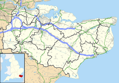
 Cliffe Woods
Cliffe Woods shown within KentDistrict Medway Shire county Kent Region South East Country England Sovereign state United Kingdom Police Kent Fire Kent Ambulance South East Coast EU Parliament South East England List of places: UK • England • Kent Cliffe Woods is a small suburb on the Hoo Peninsula in Kent, England. It forms part of the parish of Cliffe and Cliffe Woods in the borough of Medway.
It was once just a hamlet and is situated next to Higham. The old woods rise to meet Chattenden and the Ratcliffe highway, just before Hoo, and still retains much of its rural character, but has of late been built upon. The modern estate now situated just back from the B2000 was built on a clay subsoil, and many of the houses had to be underpinned after having been sold, because they were noticed to have moved slightly, built on a hillside.
A petrol filling station was one of the few village shops here as early as 1925, and was rebuilt in the 1960s. Even then some of the properties in the woods did not have their own water supply, and had to visit the garage to collect their water. In the mid-1990s, the petrol station closed, and was not reopened; however the estate saw a community center, doctors' surgery and pharmacy open.
The railway station was never busy and very quaint. Trains came from Waterloo at least hourly and were mainly of the old slam door type with drop down windows located with a leather strap. There was a pub just on the corner from the railway, and it was usually quiet in the early 60s.
In the 1950s and 1960s View Road was a bumpy unmade track and was lined with trees. There was a small one room hovel/house/shed half way up on the right, with someone living in it. There were several very large plots nearer the top just at the base of the hill to the woods. At least one was purchased before or during the war and used unofficially for living in until it was compulsorily purchased in the late 1960s. The owner believed that there was council interest and could never get planning permission for a proper house. The original plots were demolished about 1968/9.
At least some of the plots had electricity (from the early 1950s at least), mains water and a septic tank. Most people had a paraffin stove used for cooking and also lighting when the electric failed. The petrol station was still the only shop in the early 1960s.
In the early 1960s, at the top of View Road there were woods stretching almost to the river, with wild cobnuts, and chestnuts too. There were wild damsons in the area, and apple trees were planted and mature by the 1950s.
External links
 Media related to Cliffe Woods at Wikimedia Commons
Towns and villages in the Unitary authority of Medway in Kent, England Allhallows · Borstal · Brompton · Chatham · Chattenden · Cliffe · Cliffe Woods · Cooling · Cuxton · Frindsbury · Frindsbury Extra · Gillingham · Halling · Hempstead · High Halstow · Hoo St Werburgh · Isle of Grain · Lordswood · Rochester · Rainham · Rainham Mark · St Mary Hoo · St Mary's Island · Stoke · Strood · Twydall · Upnor · Wainscott · Walderslade · WigmoreList of places in Kent Categories:- Medway
- Villages in Kent
- Kent geography stubs

Wikimedia Foundation. 2010.