- Oklahoma State Highway 39
-
State Highway 39

Route information Maintained by ODOT Length: 68.4 mi (110.1 km) Existed: 1936/7[1] – present Major junctions West end: 

 US-62/US-277/SH-9 east of Chickasha
East end: 

 US-377/SH-3E/SH-99 east of Konawa
mainline becomes SH-56Highway system Oklahoma State Highways
Oklahoma turnpike system←  SH-38
SH-38I-40  →
→State Highway 39, abbreviated as SH-39 or OK-39, is a state highway in the U.S. state of Oklahoma. It is 68.4 miles[2] (110 km) in length. Built in 1923[3], it runs east–west through the central part of the state. It currently has no lettered spurs.
Contents
Route description
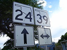 SH-39 shield on SH-24 near their intersection.
The highway begins at the concurrency of US-62/US-277/State Highway 9 near the unincorporated community of Tabler, east of Chickasha. The road begins traveling east from there, intersecting SH-76 ten miles (16 km) later west of Dibble. From Dibble, it continues east, meeting the eastern terminus of SH-59 and intersecting SH-24 in the unincorporated town of Woody Chapel. It then continues east to Purcell.
In Purcell, SH-39 crosses under Interstate 35, but does not have a junction with it. The highway soon encounters US-77/SH-74 just east of the interstate. Here, it turns northward and begins an overlap with the two highways through Purcell. SH-74 splits off after a few blocks while SH-39 and US-77 turn eastward and cross over the Canadian River on the James C. Nance Memorial Bridge. After crossing the river, the highways arrive in the town of Lexington and US-77 splits off to the northeast.
SH-39 continues eastward, serving the Lexington prison and overlapping for less than a mile with SH-102. At the town of Asher, the highway intersects SH-3W and SH-59 again. 11 miles (18 km) later, the highway meets SH-9A in Konawa.
Four miles (6 km) later, the highway ends at US-377/SH-3E/SH-99. The mainline of the highway becomes SH-56.
History
The road that would become SH-39 was built in 1923[3], but it was not assigned a state route number until at least late 1936, first appearing on the 1937 state map.[1] Originally, the route's eastern terminus was at US-77 in Purcell.[1] By April 1939, it had been extended eastward to end at Asher.[4] The route first reached its current termini in 1941 (although at the time, SH-99 passed through Konawa).[5] A short gap existed west of Asher in the SH-39 designation between 1946 and 1947;[6] by 1948 this gap had been filled. The final change to SH-39 occurred in 1968 or 1969, when SH-99 was rerouted to bypass Konawa, and SH-39 was extended east of town to end at the present junction.[7] No changes have been made since.
Spurs
SH-39 once had one spur route, SH-39B. It ran along what is now May Avenue from SH-39's junction with SH-59 to SH-74B east of Cole, Oklahoma.[8]
Junction list
County Location Mile[2] Destinations Notes Grady Tabler 0.0 US-62/277/SH-9Western terminus McClain Dibble 9.7  SH-76
SH-7615.1  SH-59
SH-59Western terminus of SH-59 Woody Chapel 19.0  SH-24
SH-24Purcell 26.4 
 US-77/SH-74
27.5 SH-74Cleveland Lexington 28.8 US-77Pottawatomie 47.0  SH-102
47.2 SH-102Asher 53.1 
 US-177/SH-3W/59
Seminole Konawa 63.4  SH-9A
SH-9ASouthern terminus of SH-9A 68.4 US-377/SH-3E/99Eastern terminus; mainline continues as  SH-56
SH-561.000 mi = 1.609 km; 1.000 km = 0.621 mi References
- ^ a b c Oklahoma Department of Highways. Map Showing Condition of the State Highway System and Landing Fields (Map) (April 1937 ed.). http://www.odot.org/hqdiv/p-r-div/maps/state-maps/pdfs/1937.pdf.
- ^ a b Stuve, Eric. "OK-39". OKHighways. http://www.okhighways.com/ok39.html. Retrieved 2005-03-27.
- ^ a b Burns, Hoyt. Early History of the Town of Washington, Oklahoma. Del City, Oklahoma, Del City Publishing Co., Inc.
- ^ Oklahoma Department of Highways. Map Showing Condition of the State Highway System (Map) (April 1939 ed.). http://www.odot.org/hqdiv/p-r-div/maps/state-maps/pdfs/1939.pdf.
- ^ Oklahoma Department of Highways. Map Showing Condition of the State Highway System (Map) (January 1942 ed.). http://www.odot.org/hqdiv/p-r-div/maps/state-maps/pdfs/1942.pdf.
- ^ Oklahoma Department of Highways. (Untitled 1947 state map) (Map). http://www.odot.org/hqdiv/p-r-div/maps/state-maps/pdfs/1947.pdf.
- ^ Oklahoma Department of Highways. Oklahoma (Map) (1969 ed.). http://www.odot.org/hqdiv/p-r-div/maps/state-maps/pdfs/1969.pdf.
- ^ Map of McClain County. Date unknown. Washington High School library. Referenced 17:42, 13 February 2006 (UTC).
External links
Categories:- State highways in Oklahoma


Wikimedia Foundation. 2010.