Max Starcke Dam

Max Starcke Dam
Max Starcke Dam
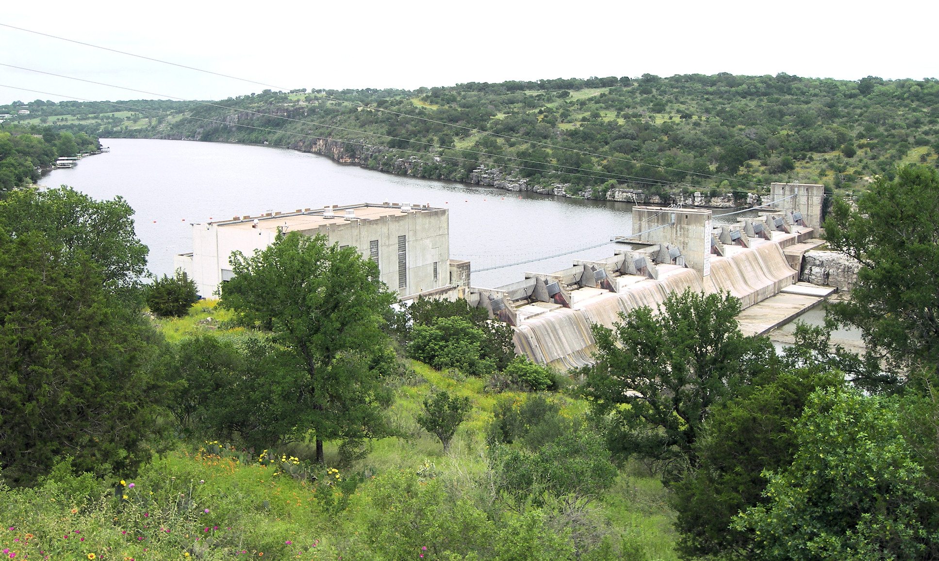
Official name Max Starcke Dam
Location Burnet County, Texas, USA
Coordinates 30°33′24″N 98°15′24″W / 30.55667°N 98.25667°W / 30.55667; -98.25667Coordinates: 30°33′24″N 98°15′24″W / 30.55667°N 98.25667°W / 30.55667; -98.25667
Construction began 1949
Opening date 1951
Dam and spillways
Height 98.8 feet (30.1 m)
Length 859.5 feet (262.0 m)
Base width 56.8 feet (17.3 m)
Impounds Colorado River
Reservoir
Creates Lake Marble Falls
Surface area 611 acres (2.47 km2) [1]
Power station
Turbines 2 [1]
Installed capacity 32 MW [1]

Max Starcke Dam is a dam in the U.S. state of Texas. Named for Max Starcke, the second General Manager of the Lower Colorado River Authority, Starcke Dam forms Lake Marble Falls, one of the Texas Highland Lakes. The dam was constructed in 1949-1951 in order to provide hydroelectric power and is located near Marble Falls, Texas.

References

External links


Wikimedia Foundation. 2010.

Игры ⚽ Нужна курсовая?

Look at other dictionaries:

  • Wirtz Dam — Infobox Dam dam name= Wirtz Dam caption= official name= Wirtz Dam crosses= Colorado River reservoir= Lake LBJ locale=Texas, USA maint= Lower Colorado River Authority length= convert|5491|ft|m|0 height= convert|118.3|ft|m|1 width=… …   Wikipedia

  • Lake Marble Falls — and Starcke Dam, 2007 Location Burnet County, near the town of Marble Falls, Texas Coordinates …   Wikipedia

  • Marble Falls, Texas — Marble Falls redirects here. For the location in the Ozarks, see Marble Falls, Arkansas. Marble Falls, Texas   City   …   Wikipedia

  • List of reservoirs and dams in the United States — There are an estimated 75,000 dams in the United States, blocking 600,000 miles (960,000 km) of river or about 17% of rivers in the nation . [cite web|url=http://www.pcffa.org/dams.htm |title=Dams and salmon |accessdate=2008 02 11] The following… …   Wikipedia

  • List of dams and reservoirs in the United States — This list is incomplete; you can help by expanding it. The following is a partial list of dams and reservoirs in the United States. There are an estimated 75,000 dams in the United States, impounding 600,000 mi (970,000 km) of river or about 17%… …   Wikipedia

  • Greater Austin — Austin–Round Rock–San Marcos Common name: Greater Austin Largest city Austin Other cities …   Wikipedia

  • Texas Highland Lakes — The Texas Highland Lakes is a chain of 6 man made lakes in Central Texas formed by several dams on the Colorado River as it winds southeast from its headwaters near the border of Texas and New Mexico to Matagorda Bay and the Gulf of Mexico. The… …   Wikipedia

  • Lower Colorado River Authority — The Lower Colorado River Authority or LCRA is a nonprofit public utility that was formed in 1934 by the Texas Legislature. LCRA s mission is to protect people, property and the environment by providing public services for more than one million… …   Wikipedia

  • Lake Travis — Infobox lake lake name = Lake Travis image lake = pacebend.jpg type = Hydroelectric reservoir caption lake = Thurmann Cove location = northwest of Austin, Texas basin countries = United States coords = coord|30|26.4|N|98|1.2|W|region:US TX… …   Wikipedia

  • List of Texas-related topics — The following is a list of topics about the U.S. State of Texas. NOTOC compactTOC4 0–9*7 Eleven *28th State to join the United States of AmericaA [ 254 counties of the State of Texas] *Abilene, Texas *Adams Onís Treaty of 1819 *Adjacent states:… …   Wikipedia

Share the article and excerpts

Direct link
Do a right-click on the link above
and select “Copy Link”