- New England Interstate Route 32
-
New England Route 32
Route information Length: 129.64 mi (208.64 km)
Connecticut: 54.88[1] mi (87.36 km)
Massachusetts: 60.66[2] mi (97.66 km)
New Hampshire: 14.11 mi[3] (196.74 km)Existed: 1922 – present Major junctions South end: 
 I-95/US 1 in New London, CT
 I-395 in Norwich, CT
 US 6 in Willimantic, CT
 I-84 in Willington, CT
 I-90 in Palmer, MA

 US 202/Route 2 in Athol, MA
North end:  NH 12 in Keene, NH
Highway system New England road marking system
←  Route 30A
Route 32A  →
→Route 32 is a multi-state north–south state highway in the New England region of the United States, running from New London, Connecticut through Massachusetts to Keene, New Hampshire. Its number dates from 1922, when it was a New England Interstate Route, also known as the Lake Sunapee Route. (The original route used to end near Lake Sunapee). The New Hampshire segment of the old New England route was completely deleted and the number was reassigned to a much shorter, completely unrelated route.
Contents
Route description
Connecticut
Main article: Connecticut Route 32Connecticut Route 32 begins in New London and runs north to Norwich along the west bank of the Thames River. North of Norwich, it heads northwest going through Willimantic and Stafford before entering Massachusetts.
Massachusetts
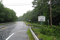

Northbound entering Athol Massachusetts Route 32 begins at the Connecticut state line in Monson. It crosses the Fays Bridge over the Quaboag River into Palmer, where it has junctions with both U.S. Route 20 and the Massachusetts Turnpike. From Palmer, it continues north through Ware, before crossing for short lengths through West Brookfield and back into a small segment of Ware, then through a very short segment of New Braintree before continuing through Hardwick in the village of Gilbertville, Barre, and Petersham before crossing U.S. Route 202 and Route 2 in Athol. In Athol it passes the former northern terminus of Route 21 during a concurrency with Route 2A. After splitting from route 2A, the route then goes through the western part of Royalston and continues into New Hampshire.
County Location Milepost Roads intersected Notes Hampden Monson 0.0  CT Route 32
Southern terminus of Massachusetts Route 32. Palmer 8.8  U.S. Route 20 East
Begin concurrency with Route 20. 9.8 U.S. Route 20 WestEnd concurrency with Route 20. 10.5 I-90/Mass PikeRamp access to I-90 Exit 8. Hampshire Ware 18.9  Route 9 West
Begin concurrency with Route 9. Worcester West Brookfield 20.5 Route 9 EastEnd concurrency with Route 9 at the West Brookfield town line. Hardwick 23.9  Route 32A
Southern terminus of Route 32A. Barre 31.5  Route 67
Northern terminus of Route 67. 34.0  Route 122 South
Begin concurrency with Route 122 35.2  Route 62
Western terminus of Route 62. Petersham 42.5 Route 122 NorthEnd concurrency with Route 122 42.7 Route 32ANorthern terminus of Route 32A 44.0  Route 101
Southern end of Route 101 Athol 48.9 Route 2 / US 202Access to Route 2 Exit 17. 49.8  Route 2A East
Begin concurrency with Route 2A 50.5  Route 21
Former northern terminus of Route 21. 51.2 Route 2A WestEnd concurrency with Route 2A Royalston 58.7  Route 68
Northern terminus of Route 68. 60.66  NH Route 32
Northern end of Massachusetts Route 32.
Southern end of NH Route 32.New Hampshire
New Hampshire Route 32 (NH-32) runs from Richmond on the Massachusetts border to Keene. The northern terminus of NH-32 is at New Hampshire Route 12, near its junction with NH-101 in the village of Joslin, just south of central Keene. NH-32 is locally named Old Homestead Highway. In Keene, NH-32 provides access to the local Dillant-Hopkins Airport.
County Town Milepost Junction Notes Cheshire Richmond 0.0  MA Route 32
Northern terminus of MA Route 32.
Southern terminus of NH Route 32.2.4  NH 119
Keene 14.1 NH 12Northern terminus of New Hampshire Route 32. History
New England Route 32 has had many major realignments particularly in Massachusetts and New Hampshire. In New Hampshire, the current route has actually no relation to the original New England route.
In 1932, Route 32 swapped places with Route 12 south of Norwich, Connecticut. The original route began in Groton instead of its current southern terminus in New London. In northern Connecticut, the alignment was also shifted west by several miles, entering Massachusetts at Monson instead of at Wales. The old alignment is now Route 19.
From Connecticut, the original New England route entered Wales, Massachusetts on what is now Route 19. It followed Route 19 into Brimfield, then west along current U.S. Route 20 until Palmer. The portion between Palmer and Athol more or less still follows the original route with only minor alignment changes. North of Athol, the old route went along current US 202 up to the New Hampshire state line.
In New Hampshire, the old New England Route was completely deleted sometime in the 1930s. The current alignment in New Hampshire was established later as a continuation of modern Route 32 from the Massachusetts line and is unrelated to the original route. The original route continued from the state line to Henniker along US 202, then along NH 114 to Bradford, and finally along NH 103 to its original Newport terminus west of Lake Sunapee at New England Route 10.
Massachusetts Route 32A
Route 32A
Location: Hardwick-Petersham Length: 12.79 mi[citation needed] (20.58 km) Route 32A is a short north–south state highway in central Massachusetts.
Route 32A is an alternate route to Route 32 from the village of Gilbertville in Hardwick to Petersham center. The road passes close to the eastern shore of the Quabbin Reservoir, with several entrances (gates 39-42) accessing the reservation lands along the route.[4] It runs parallel several miles east of the former northern half of Route 21, which ran through the current Quabbin Reservoir lands prior to the reservoir's filling.
Major intersections
County Location Mile Roads intersected Notes Worcester Hardwick 0.00 Route 32Southern terminus of Route 32A. Petersham 12.3 Route 12212.79 Route 32Northern terminus of Route 32A.
To Route 101, via Route 32 North.New England Interstate Route 32A
New England Route 32A
Location: Henniker-Bradford, New Hampshire Length: 27 mi (43 km) New England Interstate Route 32A was an alternate route of the 1920s New England Route 32 in New Hampshire, between the towns of Henniker and Bradford. The main route went directly between the two towns along the Henniker-Bradford Road. Route 32A used a more circuitous route, first heading east from Henniker to Hopkinton then north through Warner, then west to meet up with the main route again in Bradford. Route 32A was about 27 miles (43 km) long. The current designations of old Route 32A are:
- US 202 from Henniker to Hopkinton
- NH 103 from Hopkinton to Bradford.
New Hampshire decommissioned its New England Route 32 (and 32A) in the early 1930s.
References
- ^ Connecticut State Numbered Routes and Roads as of December 31, 2004 (PDF)
- ^ Executive Office of Transportation, Office of Transportation Planning - 2005 Road Inventory
- ^ New Hampshire DOT Route Logs
- ^ Tougias, Michael. Quabbin: A History and Explorer's Guide. Yarmouth Port, MA: On Cape Publications, 2002, p. 127.
See also
- Route 32A (Massachusetts) - An alternate route between Hardwick, Massachusetts and Petersham, Massachusetts
- Route 32A (New England) - A defunct, alternate route of the old alignment in New Hampshire through Hopkinton
Browse numbered routes ←  Route 31
CT Route 33  →
→←  Route 31
MA Route 32A →←  NH 31
NH 31NH NH 33  →Categories:
- New England Interstate Routes
- Numbered routes in Massachusetts
- State highways in New Hampshire


Wikimedia Foundation. 2010.