- North Carolina Highway 5
-
"NC 5" redirects here. NC 5 may also refer to North Carolina's 5th congressional district.
NC 5
Route information Maintained by NCDOT Length: 8.30 mi[2] (13.36 km) Existed: 1961[1] – present Major junctions South end: Bethesda Road at Malcolm Blue Farm in Aberdeen, NC 


 US 1 / US 15 / US 501 / NC 211 in Aberdeen
North end: NC 211 in Pinehurst, NCLocation Counties: Moore Highway system ←  NC 4
NC 4NC 6  →
→NC 5 is a six-mile (10 km) North Carolina state highway. It runs entirely within Moore County and connects the Sandhills municipalities of Aberdeen and Pinehurst. It also serves as an alternate route for NC 211. NC 5's route was designated in 1961 and it has not changed since then.
Contents
Route description
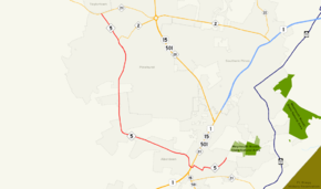
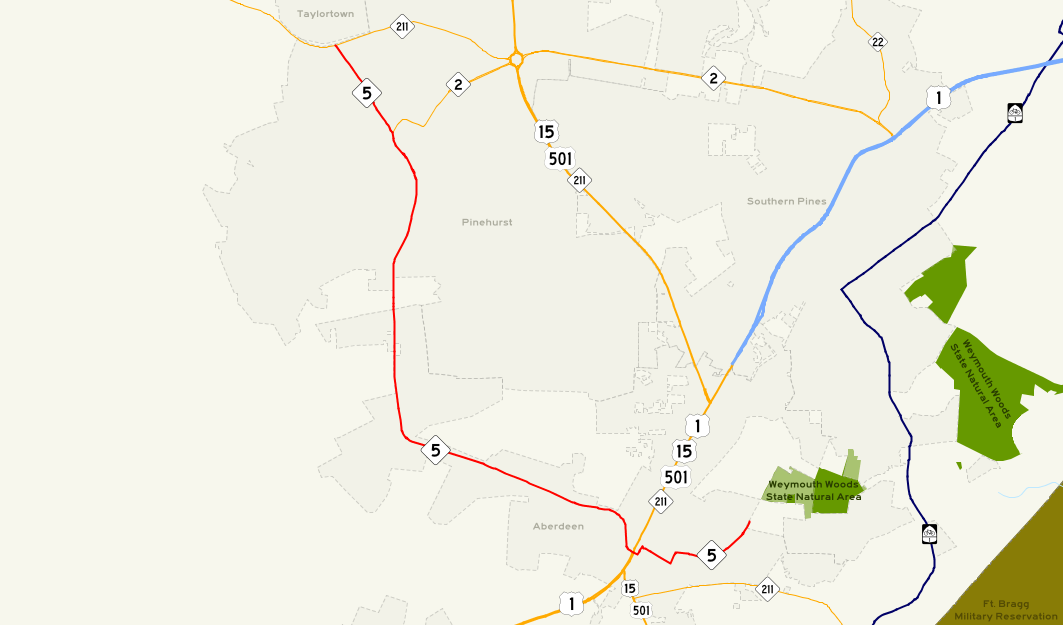
NC 5 starts at a three-way intersection at Malcolm Blue Farm and progresses through downtown Aberdeen, where it crosses U.S. 1/US 15/US 501/NC 211/Sandhills Boulevard and continues northwest towards Pinehurst. It comes to its northern terminus at NC 211 at the Pinehurst/Taylortown city limits border.
All the NC 5 shields east of Sandhills Boulevard have no directional plates; this is because at NC 5's southern terminus, the route is heading in a northerly direction.
NC 5's central segment parallels a railroad owned by Norfolk Southern. Sand Pit Road between Aberdeen and Pinehurst splits from NC 5 and heads due south to the nearby town of Pinebluff.
Nearby points of interest
- Pinehurst Harness Track, a horse racing track in Pinehurst
- The Pit Golf Links, a nationally popular golf course near Aberdeen
- Pinehurst Resort
Major intersections
The entire route is in Moore County.
Location Mile Destinations Notes Aberdeen 0.00 Bethesda Road at Malcom Blue Farm Southern terminus of NC 5 1.51 US 15 / US 501 / NC 211Pinehurst 7.31  NC 2
NC 2Western terminus of NC 2 8.30 NC 211Northern terminus of NC 5 1.000 mi = 1.609 km; 1.000 km = 0.621 mi See also
- North Carolina Highway 2, a similar route in the Sandhills region
References
- ^ NCRoads Annex - NC 5
- ^ Google Maps. Overview Map North Carolina Route 5 (Map). http://maps.google.com/maps?f=d&source=s_d&saddr=Bethesda+Rd&daddr=W+South+St+to:Beulah+Hill+Rd+N+to:35.203748,-79.481925&hl=en&geocode=FcQhGAIdkE5E-w%3BFUQQGAId5P9D-w%3BFWT5GAIdHFpD-w%3B&mra=mi&mrcr=2&mrsp=3&sz=16&sll=35.202147,-79.478724&sspn=0.007767,0.013797&ie=UTF8&z=16. Retrieved 2010-01-27.
External links
Categories:- State highways in North Carolina
- Transportation in Moore County, North Carolina

Wikimedia Foundation. 2010.