- Old Oyo National Park
-
Old Oyo National Park IUCN Category II (National Park)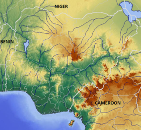

Location Kwara State,  Nigeria
Nearest city Ilorin Coordinates 8°25′0″N 3°50′0″E / 8.416667°N 3.833333°ECoordinates: 8°25′0″N 3°50′0″E / 8.416667°N 3.833333°E Area 2,512 km² Old Oyo National Park is one of the National parks of Nigeria, located across northern Oyo State and southern Kwara State, Nigeria.[1] It is rich in plant and animal resources including buffaloes, bushbuck and wide variety of birds. The park is easily accessible from southwestern and northwestern Nigeria. The nearest cities and towns adjoining Old Oyo National Park include Saki, Iseyin, Igboho, Sepeteri, Tede and Igbeti which have their own commercial and cultural attractions for tourism.
Contents
History
The Park takes its name from Oyo-lle (Old Oyo), the ancient political capital of Oyo Empire of the Yoruba people, and contains the ruins of this city.[2] Oyo Ile was destroyed in the late 18th century by Ilorin and Hausa/Fulani warriors at the culmination of the rebellion of Afonja, commander of Oyo Empire's provincial army for which he allied himself with Hausa/Fulani muslim jihadists.
The National Park originated in two earlier Native Administrative forest Reserves, Upper Ogun established in 1936 and Oyo-lle established in 1941. These were converted to Game Reserves in 1952, then combined and upgraded to the present status of a National Park.[1]
Environment
The park covers 2,512 km2, mostly of lowland plains at a height of 330m and 508m above sea level. The southern part is drained by the Owu, Owe and Ogun Rivers, while the northern sector is drained by the Tessi River. Outcrops of granite are typical of the North Eastern Zone of the Park, including at Oyo-lle, with caves and rock shelters in the extreme north. The central part of the Park has scattered hills, ridges and many rock outcrops that are suitable for mountaineering. The Ikere Gorge Dam on the Ogun river provides water recreation facilities for tourists.[1]
Flora and fauna
Within the entire country there previously existed extensive forestation; however, there is less forested area present in the country mirroring a trend in the region. The Old Oyo National Park was previously habitat for the endangered Painted Hunting Dog, Lycaon pictus. However, this canid is now deemed extirpated locally due to hunting pressure and the expanding human population in this region.[3]
References
- ^ a b c "Old Oyo National Park". Nigeria National Park Service. http://nigeriaparkservice.org/oyo/Default.aspx. Retrieved 2010-11-05.
- ^ John K. Thornton (1999). Warfare in Atlantic Africa 1500-1800. London and New York: Routledge. p. 19. ISBN 1-85728-393-7.
- ^ C. Michael Hogan (2009). "Painted Hunting Dog: Lycaon pictus". GlobalTwitcher.com, ed. N. Stromberg. http://globaltwitcher.auderis.se/artspec_information.asp?thingid=35993. Retrieved 2010-11-05.
Protected areas of Nigeria Forest Reserves Afi River • Akure • Akure Ofosu • Edumanom • Idanre • Ise • Ngel Nyaki • Oba Hills • Okeluse • Okomu • OluwaGame Reserves Borgu • Kashimbila • Ohosu • ZugurmaNational Parks Other Afi Mountain Wildlife Sanctuary • Mbe Mountains Community ForestCategories:- IUCN Category II
- National parks of Nigeria
- Oyo State
- Kwara State

Wikimedia Foundation. 2010.