- Highway shield
-
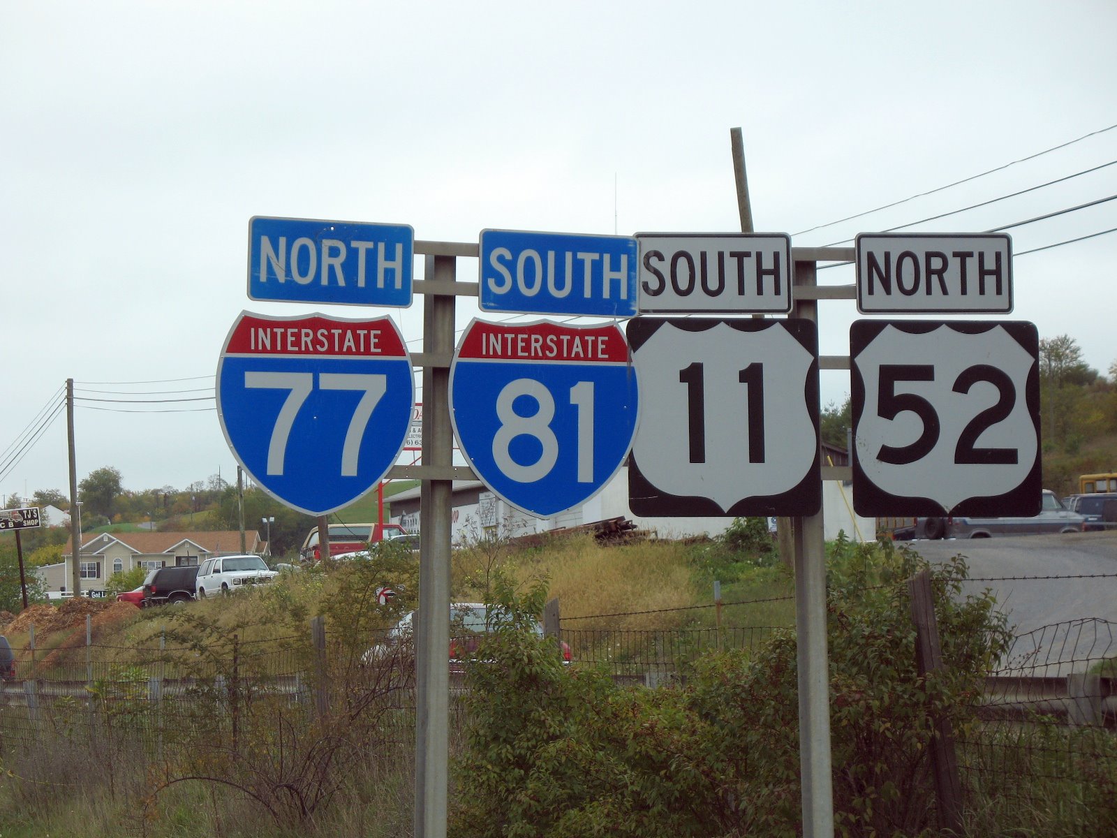
 The shields for Interstate highways (left) and U.S. routes (right) can be seen on this set of markers in Virginia.
A highway shield is a sign denoting the route number of a highway, usually in the form of a symbolic shape with the route number enclosed. As the focus of the sign, the route number is usually the sign's largest element, with other items on the sign rendered in smaller sizes or contrasting colours. Highway shields are used by travellers, commuters, and all levels of government for identifying, navigating, and organising routes within a county, state, province, or country. Simplified highway shields often appear on maps.
Contents
Highway shields by country
-
This transport-related list is incomplete; you can help by expanding it.
Australia
Australia has maintained distinctly different trends pertaining to Highway shields in the past and will continue in this vein somewhat, despite the conversion to alpha-numeric routes and shields. Alpha-numeric route numbering has been in use in Tasmania since the 1970s. However, from 1996 states on the mainland began conversion to the alpha-numeric system. The state of Victoria was the first to implement the policy. Prior to this conversion and concurrently, Federal Highway (gold-on-green squared-off bullet), National Highway (black-on-white squared-off bullet), State Highway (blue bullet) and Tourist Route (white-on-brown rounded isosceles trapezoid) shields existed. In Victoria Freeway shields were used (white-on-green with 'F' prefix) until the late 1980s, while during the 1990s Queensland and New South Wales implemented a hexagonal blue-on-white Metroad system of urban arterial routes. With the opening of the Western Ring Road (now M80); that road used a shield quite similar to the U.S. Interstate shield, albeit with 'Ring Road' written instead of 'Interstate' and with 2 peaks, rather than 3. To further complicate matters, with the introduction of the alpha-numeric system, roads that are Federally funded (or Federal Highways) have a squared-off bullet encompassing the alpha-numeric designation. Freeways and dual-carriageway roads often use an 'M' prefix, particularly in Victoria.
Canada
Each province dictates the type of shields used as their highway system is a provincial responsibility.
Ontario
Ontario highways shields vary in shape and colour.
For major or 400 series highway use a white bullet with a crown on top. These are referred to as King's Highway markers.
Secondary and local or county roads use an isosceles trapezoid as markers. Background colour is usually white, but they can be green. Tertiary road signs are rectangular in shape. Text is black or white and will indicate the county name.
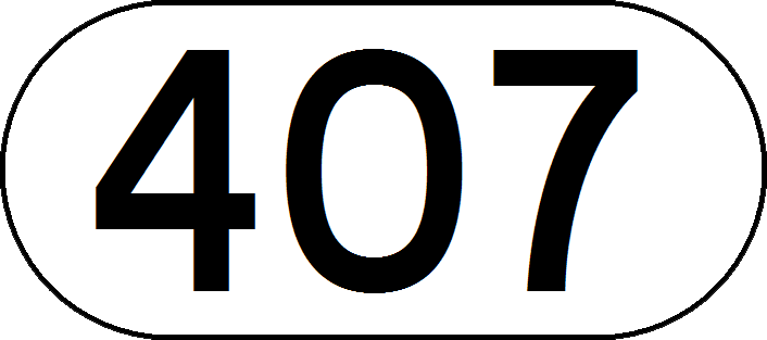
Ontario Highway 407 is the only 400-series highway not to have a standard shield. The rectangular signs has generic 407 and ETR markers.
-

Typical Ontario secondary road signs
-

Typical Ontario teritary road signs
-

Typical Ontario county or local road sign marker
-

An Ontario 400-series marker
-

Hong Kong
 A typical shield for a numbered route in Hong Kong.
The Hong Kong Strategic Route and Exit Number System states that the standard shield should consist of a yellow, bullet-shaped shield with the route number in black color. It is used on all numbered routes in Hong Kong.
Malaysia
Main article: Road signs in Malaysia A typical Malaysian federal road shield.
According to the Manual on Traffic Control Devices Standard Traffic Signs by Malaysian Public Works Department, a standard Malaysian highway shield consists of a yellow hexagon shield with black border line which resembles the Public Works Department's logo itself. The highway shield standard is used for all expressways, federal and state roads in Malaysia, which can be distinguished through the numbering scheme used (please refer to the Road signs in Malaysia article for details).
United States
 The default state route marker in the United States
The United States' Manual on Uniform Traffic Control Devices (MUTCD) gives standard designs for highways in the Interstate Highway System and U.S. route system (see U.S. Route shield). The MUTCD also provides default designs for state highways (the circular highway shield) and county highways (a blue pentagon with yellow text).[1] However, states are free to use any design for their numbered routes; as of 2007[update] only five states (Delaware, Iowa, Kentucky, Mississippi, and New Jersey) use the default shield on their primary systems, with all others using a custom design. Many of these designs are other geometric shapes (like squares and diamonds), outlines of the state boundaries, or a design representing the state (like Pennsylvania's keystone design and Kansas' sunflower). See Numbered highways in the United States#State highways and other similar systems.
The Interstate shield is the only trademarked route shield in use in the United States.
Some U.S. counties also have unique shield designs, though most use the MUTCD default.
Alternatives to shields
Many countries worldwide, such as the United Kingdom and France, do not use shields, instead relying on text representations of highway numbers. Road numbers (the term "highway" is not in general use in the UK) are prefixed by a letter indicating the type of road, for example M1, A1, B123 in the UK; A1, N1, D1 in France. These are sometimes highlighted with a different background color, depending on the class of highway and the context of the sign.
See also
- Reassurance marker
- Numbered highways in Canada
- Numbered highways in the United States
- Road designation or abbreviation
References
External links
Categories:- Traffic signs
-


Wikimedia Foundation. 2010.