- New York State Route 26
-
"NY 26" redirects here. NY 26 may also refer to New York's 26th congressional district.This article is about the current alignment of NY 26. For the former alignment of NY 26 in Central New York, see New York State Route 26 (1924–1930).
NYS Route 26

Map of New York with NY 26 highlighted in redRoute information Maintained by NYSDOT, Madison County and the city of Rome Length: 203.80 mi[2] (327.98 km) Existed: 1930[1] – present Major junctions South end:  PA 267 at Vestal
 NY 17 in Vestal
 I-81 in Whitney Point
 US 20 in Madison


 NY 49 / NY 69 / NY 365 in Rome
 NY 12 in Lowville
 US 11 in Philadelphia
North end: NY 12 in Alexandria BayLocation Counties: Broome, Cortland, Chenango, Madison, Lewis, Oneida, Jefferson Highway system Numbered highways in New York
Interstate • U.S. • N.Y. (former) • Reference • County←  NY 25D
NY 26A  →
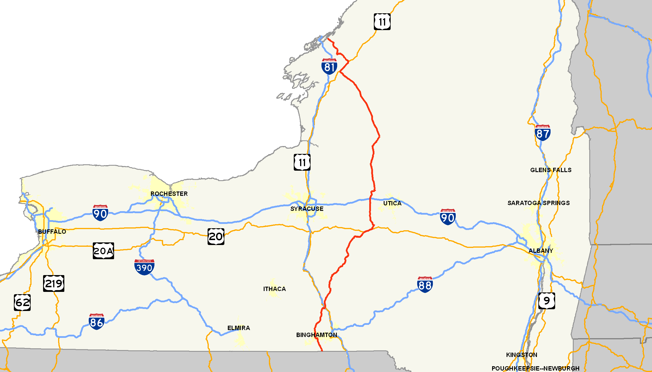
→New York State Route 26 (NY 26) is a north–south state highway that runs for 203.80 miles (327.98 km) through Central New York in the United States. Its southern terminus is located at the Pennsylvania state line south of the town of Vestal in Broome County, where it becomes Pennsylvania Route 267 (PA 267). Its northern terminus is located at a junction with NY 12 in the village of Alexandria Bay in Jefferson County. NY 26 serves three cities along its routing; one directly (Rome) and two via other roadways (Binghamton via NY 17 and Watertown via NY 3).
NY 26, as a single route, was established in the 1930 renumbering of state highways in New York; however, portions of the route had been signed state routes since the 1920s. Since 1930, the route has been realigned several times in the North Country, resulting in a modern routing significantly different from its initial alignment.
Contents
Route description
Most of NY 26 is maintained by the New York State Department of Transportation (NYSDOT); however, two locally-maintained sections exist in Madison County and Oneida County. In Madison County, the route is county-maintained from NY 46 to U.S. Route 20 (US 20), where it overlaps with the unsigned County Route 79 (CR 79). In the Oneida County city of Rome, NY 26 is city-maintained from the north end of its overlap with NY 46 to the northern boundary of the city's inner district.[3][4]
Broome County
Route 26 begins at the Pennsylvania state line in Vestal as a continuation of PA 267, a thoroughfare in northern Pennsylvania. The road heads northward through Vestal, passing points such as Wildcat Hill (just over the state line), and Pierson Hill, in which Route 26 runs along the base of. As Route 26 heads through Vestal Center, it intersects with several Broome County routes, and passes through some hills.[5]
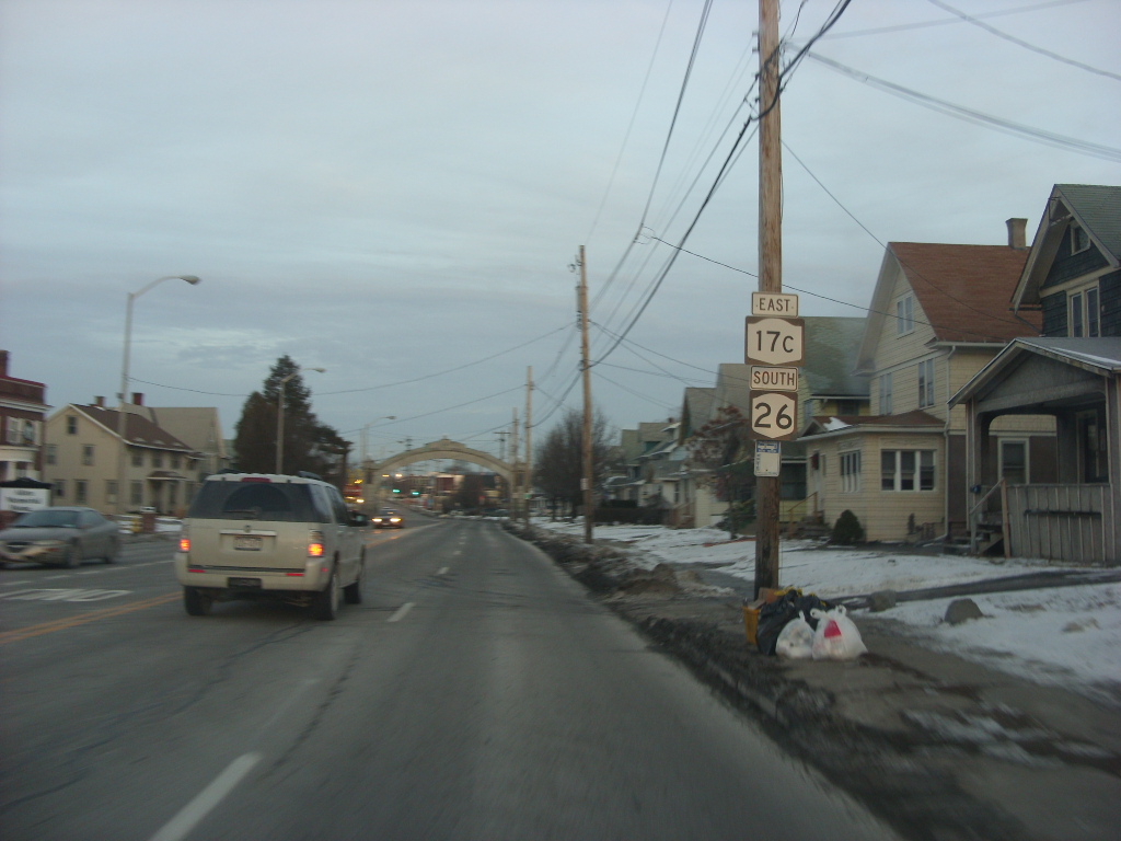
 NY 17C and NY 26 in Endicott
As Route 26 leaves Vestal, it crosses over Pierce Hill and connects to NY 434 and NY 17 by way of two separate interchanges.[5] Route 26 crosses the Susquehanna River and enters Endicott, where it becomes concurrent with NY 17C. Route 26 turns to the north soon after, ending the concurrency.[6] Route 26 passes through more hills and intersects with several county routes. Just to the north, in Union Center, NY 38B terminates. Route 26 passes through the town of Maine, intersecting with several local roads, and heads northward.[7] Route 26 heads north, connecting to Interstate 81 by way of an interchange.[8]
Cortland and Chenango Counties
Route 26 enters Whitney Point and becomes concurrent with US 11.[8] Route 26 enters a mountainous region again after two concurrencies (one with Route 11 and one with NY 79). Route 26 passes to the east of Dorchester Park, which is located on the shores of the Whitney Point Reservoir. Route 26 enters Cortland County and heads along the Otselic River.
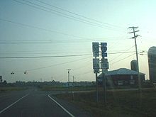
 NY 26 heading northbound from Whitney Point, NY 79 and NY 206
In the hamlet of Willet, Route 26 intersects with NY 41, starting a 3-mile (5 km) long concurrency.[9] Route 26 and Route 41 intersect with NY 221 just to the west of Willet. The two roads head north through mountains until a split at 42 miles (68 km). NY 23 terminates at Route 26, which heads north through Cortland County. Route 26 enters the hamlet of Taylor, New York, where it turns to the east then to the northeast into Chenango County.[10] At 60 miles (97 km), CR 16 becomes concurrent for a short distance. The two roads pass Otselic Center, a small hamlet in Chenango County.[11] The concurrency ends, and Route 26 heads northeastward, where it becomes concurrent again, this time with NY 80. During the concurrency, Routes 26 and 80 enter Madison County.
Madison and Oneida Counties
Routes 26 and 80 split in the hamlet of Georgetown.[12] Route 26 heads to the northeast, passing mountains and hills to the right and left. For much of the distance of Route 26 in Madison County, Route 26 intersects with local Madison County routes. Route 26 enters the hamlet of West Eaton and turns to the west towards Oneida County at 72.3 miles (116.4 km). Just south of Bouckville, NY 46 intersects. US 20 becomes concurrent to the east of Bouckville.[13] The concurrency stretches for five miles (8 km), with NY 12B joining at 80.5 miles (129.6 km). Routes 26, 20 and 12B enter the village of Madison and split in two directions. Route 20 heads east and Routes 26/12B head north. Routes 26 and 12B exits Madison County for Oneida county at 85.3 miles (137.3 km).
Routes 12B and 26 enter the village of Oriskany Falls, where Route 26 splits to the northwest while 12B heads northward.[14] Route 26 goes through farmland for several miles before entering Vernon Center, where NY 31 terminates at a traffic circle.[15] About a mile north of Vernon Center, NY 5 intersects. Route 26 passes through more farmland, crossing over the New York State Thruway.[16] Route 26 enters the city of Rome at 103.5 miles (166.6 km) and becomes concurrent with NY 365.[17] The concurrency is short, as Route 26 heads northward through more farmland after 1.8 miles (2.9 km). In downtown Rome, Routes 49 and 69 intersect with Route 26, with NY 46 coming soon after. Route 26 leaves the City of Rome as it stretches towards Lewis County. Route 26 passes to the west of Delta Lake as it heads through Stokes Center.[18]
Lewis and Jefferson Counties
 NY 26 at an intersection with NY 294 in West Leyden
Route 26 enters Lewis County at 125.5 miles (202.0 km), entering the town of West Leyden.[19] There, NY 294 begins to the east. Route 26 heads through farmlands, coming and passing through the village of Constableville.[20] At 137 miles (220 km), NY 12D intersects and heads north. Route 26 heads to the northwest along the base of the Tug Hill Plateau and passes through several hamlets as well as the village of Turin. At 150.5 miles (242.2 km), NY 12 becomes concurrent. Routes 12 and 26 enter Lowville and intersects with NY 812.[21] Route 12 turns to the west at this intersection, and Route 26 heads north along Route 812. The concurrency is short-lived, and Route 26 heads north towards Watertown. NY 410 terminates at 158.2 miles (254.6 km) in Denmark. Shortly after the intersection with CR 55, Route 26 leaves Lewis County for Jefferson County.[22]
 NY 26, NY 411 and NY 37 in Theresa
Route 26 enters West Carthage and becomes concurrent with NY 126.[23] Route 126 turns to the west at 166.4 miles (267.8 km), and Route 26 leaves West Carthage for more farmland. NY 3 intersects 4 miles (6 km) north of West Carthage in the town of Great Bend. Route 26 passes through the Fort Drum Military Reservation and intersects with CR 37. Route 26 leaves the reservation and becomes concurrent with US 11 in Le Ray. Routes 26 and 11 pass through more farmland and rural areas until reaching the village of Philadelphia, where the two roads split.[24] Route 26 continues through rural land and enters the village of Theresa at 190 miles (306 km). There, Route 26 becomes concurrent with NY 37 for three miles (5 km). Route 26 heads to the northeast, through the final stretch of farmland, coming to an end at Route 12 (Seaway Trail) in Alexandria Bay.[25]
History
Origins
In 1908, the New York State Legislature created a statewide system of unsigned legislative routes. One route created at this time was Route 27, which began in Forestport and followed what is now NY 12, NY 12D, and NY 26 north through Boonville and Lowville to West Carthage. At this point, Route 27 proceeded northeast to Carthage on modern NY 126 and west to Watertown on current NY 3. It continued generally northward from Watertown to a terminus in Alexandria Bay.[26][27] In 1910, the legislature established Route 30-a, a connector between Route 27 in Carthage and Route 30 (now US 11) in Antwerp via current NY 3 and the U.S. Military Highway through Fort Drum.[27] On March 1, 1921, Route 30-a was redesignated as Route 49 while Route 27 was extended northeast to Ogdensburg along what is now NY 26, CR 192, and NY 37.[28]
When the first set of posted routes in New York were assigned in 1924, the segment of legislative Route 27 between Alexandria Bay and Ogdensburg became part of NY 3 while the portion of Route 27 from Foresport to Lowville was included in NY 12.[29][30] By 1926, the Lowville–Carthage section of legislative Route 27 and all of Route 49 was designated as part of NY 48, which continued west from Antwerp to NY 3 in Alexandria on what is now CR 193, CR 194 and NY 26. Also created by 1926 was NY 46, which began in Oriskany Falls and went north to Rome on modern NY 26. Past Rome, NY 46 followed its current alignment to Boonville.[30] The portion of what is now NY 26 south of US 20 was unnumbered prior to 1930.[31]
Designation and realignments
Modern NY 26 was established as part of the 1930 renumbering of state highways in New York.[1] It began at the Pennsylvania state line south of Endicott[32] and went north to Carthage over its modern alignment. From Oriskany Falls to Rome, it replaced NY 46,[1] which was moved onto a new alignment to the west that passed through the city of Oneida.[32] NY 26 continued north to Turin via a previously unnumbered road and overlapped with NY 12 from there to Lowville. Past Lowville, NY 26 progressed northward through Carthage, Antwerp and Theresa to Alexandria Bay, replacing all of NY 48 and part of NY 3, which was realigned to follow its modern alignment east of Watertown as part of the renumbering.[1] Also assigned as part of the renumbering was NY 411, a connector highway between NY 26 near Theresa and US 11 in Philadelphia.[32]
NY 26 was realigned in the mid-1950s to bypass Fort Drum to the west. The route now overlapped NY 3 northwest and west from Carthage to Black River, where it turned northwest to follow a surface road known as the Watertown Bypass to Calcium. NY 26 joined US 11 at a junction north of Calcium and followed it northwest to Antwerp, where it joined its previous alignment.[33][34] The state of New York assumed ownership and maintenance of the bypass in 1960,[35] at which time it was designated as NY 181.[36] The easternmost section of the highway was realigned ca. 1963 to bypass Black River to the west. It separated from NY 3 west of Black River and followed the Black River north to Pearl Street, where it met its old routing. NY 181, which NY 26 overlapped between Calcium and Black River, was renumbered to NY 342 around this time.[36][37]
Truncation and re-extension
NY 26 was truncated in the mid-1970s to end at NY 3 and NY 26A in Carthage. The former routing of NY 26 from Antwerp to Alexandria Bay was then redesignated as NY 283.[38][39] On August 1, 1979, ownership and maintenance of the portions of NY 283 from US 11 in Antwerp to NY 411 in Theresa and from LaFargeville Road in Theresa to NY 37 west of the village were transferred from the state of New York to Jefferson County as part of a highway maintenance swap between the two levels of government. As part of the swap, maintenance of LaFargeville Road from NY 37 to NY 283 and of Broad and Martin Streets, Great Bend and Fort Drum Roads between West Carthage and Evans Mills were transferred from the county to the state.[40]
Following the swap, NY 26 was rerouted to follow the new state highway between West Carthage and Evans Mills. It then overlapped US 11 to Philadelphia, where it continued to Theresa on former NY 411. It exited Theresa on LaFargeville Road, then followed NY 37 north to Wilson Road, where it rejoined its pre-1970s alignment and continued to Alexandria Bay.[41] The former routing of NY 26 between Fort Drum and Theresa via Antwerp (and thus the former alignment of NY 283 between Antwerp and Theresa) became CR 194 while the former part of NY 26 and NY 283 west of Theresa became CR 193.[42][43]
Suffixed routes
- NY 26A was an alternate route of NY 26 between Lowville, Lewis County, and Carthage, Jefferson County. While NY 26 followed a direct routing between the two villages, NY 26A veered to the east to serve Croghan. The route was assigned as part of the 1930 renumbering of state highways in New York[1] and renumbered to NY 126 and NY 812 in the late 1970s.[39][44]
- NY 26B was a spur route in Alexandria that connected NY 26 to NY 37 in the hamlet of Redwood in Jefferson County. The route was assigned ca. 1931[32][45] and renumbered to NY 287 in the mid-1970s when NY 26 was cut back to Carthage.[38][39]
Major intersections
County Location Mile[2] Destinations Notes Broome Vestal 0.00 PA 267Continuation into Pennsylvania 6.75  NY 434
6.96 NY 17Exit 67 (NY 17) Endicott 7.70  NY 17C east
Eastern terminus of NY 17C / NY 26 overlap 8.94 NY 17C westWestern terminus of NY 17C / NY 26 overlap Maine 13.28  NY 38B
Hamlet of Union Center; eastern terminus of NY 38B Barker 27.72 I-81Exit 8 (I-81) Whitney Point 28.03 US 11 southSouthern terminus of US 11 / NY 26 overlap 28.12  US 11 north / NY 79 west
Northern terminus of US 11 / NY 26 overlap; western terminus of NY 26 / NY 79 overlap 28.20  NY 79 east / NY 206
Eastern terminus of NY 26 / NY 79 overlap; western terminus of NY 206 Cortland Willet 38.76  NY 41 south
Southern terminus of NY 26 / NY 41 overlap 39.34  NY 221
Eastern terminus of NY 221 Cincinnatus 42.59 NY 41 northNorthern terminus of NY 26 / NY 41 overlap 43.90  NY 23
NY 23Western terminus of NY 23 Chenango Otselic 61.53  NY 80 east
Southern terminus of NY 26 / NY 80 overlap Madison Georgetown 65.11 NY 80 westNorthern terminus of NY 26 / NY 80 overlap Town of Madison 78.34  NY 46
NY 4678.86 US 20 westWestern terminus of US 20 / NY 26 overlap 80.51  NY 12B south
Western terminus of NY 12B / NY 26 overlap 83.51 US 20 eastEastern terminus of US 20 / NY 26 overlap Oneida Oriskany Falls 86.06 NY 12B northEastern terminus of NY 12B / NY 26 overlap Town of Vernon 95.26  NY 31
NY 31Eastern terminus of NY 31; to I-90 / Thruway 96.65  NY 5
NY 5Rome 104.95 NY 365 westWestern terminus of NY 26 / NY 365 overlap 106.75 NY 365 eastWestern terminus of NY 26 / NY 365 overlap; interchange 107.15 NY 49 east / NY 69 eastSouthern terminus of NY 26 / NY 49 / NY 69 overlap; interchange 108.21 NY 46 south / NY 49 west / NY 69 westNorthern terminus of NY 26 / NY 49 / NY 69 overlap; southern terminus of NY 26 / NY 46 overlap 108.80 NY 46 northNorthern terminus of NY 26 / NY 46 overlap Lewis Lewis 126.35  NY 294
Hamlet of West Leyden; western terminus of NY 294 West Turin 137.24  NY 12D
Village of Lowville 150.77 NY 12 southSouthern terminus of NY 12 / NY 26 overlap 151.35  NY 12 south / NY 812
Northern terminus of NY 12 / NY 26 overlap; southern terminus of NY 26 / NY 812 overlap; southern terminus of NY 812 151.72 NY 812 northNorthern terminus of NY 26 / NY 812 overlap Denmark 158.18  NY 410
Jefferson West Carthage 165.66  NY 126 east
Eastern terminus of NY 26 / NY 126 overlap 166.44 NY 126 westWestern terminus of NY 26 / NY 126 overlap Great Bend 172.51  NY 3
NY 3Town of Philadelphia 177.82 US 11 southSouthern terminus of US 11 / NY 26 overlap Village of Philadelphia 184.87 US 11 northNorthern terminus of US 11 / NY 26 overlap Village of Theresa  CR 46 (Commercial Street)
Former eastern terminus of NY 37D Town of Theresa 192.88 
 NY 37 south / NY 411
Eastern terminus of NY 411; southern terminus of NY 26 / NY 37 overlap 195.48 NY 37 northNorthern terminus of NY 26 / NY 37 overlap Alexandria 200.13  CR 192
Former western terminus of NY 26B Alexandria Bay 203.80 NY 121.000 mi = 1.609 km; 1.000 km = 0.621 mi References
- ^ a b c d e Dickinson, Leon A. (January 12, 1930). "New Signs for State Highways". The New York Times: p. 136.
- ^ a b "2008 Traffic Volume Report for New York State" (PDF). New York State Department of Transportation. June 16, 2009. pp. 78–81. https://www.nysdot.gov/divisions/engineering/technical-services/hds-respository/NYSDOT%20TVR%202008%20by%20Route.pdf. Retrieved January 31, 2010.
- ^ "Madison County Inventory Listing" (CSV). New York State Department of Transportation. March 2, 2010. https://www.nysdot.gov/divisions/engineering/technical-services/hds-repository2/INV_2010-03-02_madison.csv. Retrieved December 17, 2010.
- ^ "Oneida County Inventory Listing" (CSV). New York State Department of Transportation. March 2, 2010. https://www.nysdot.gov/divisions/engineering/technical-services/hds-repository2/INV_2010-03-02_oneida.csv. Retrieved December 17, 2010.
- ^ a b Google, Inc. Google Maps – overview map of Route 26 in Vestal (Map). Cartography by Google, Inc. http://maps.google.com/maps?sourceid=navclient&ie=UTF-8&rlz=1T4ADBF_enUS232US232&q=Route+26,+Vestal,+NY&um=1&sa=N&tab=il. Retrieved December 23, 2007.
- ^ Google, Inc. Google Maps – overview map of Route 26 in Endicott (Map). Cartography by Google, Inc. http://maps.google.com/maps?sourceid=navclient&ie=UTF-8&rlz=1T4ADBF_enUS232US232&q=Route+26,+Endicott,+NY&um=1&sa=N&tab=il. Retrieved December 23, 2007.
- ^ Google, Inc. Google Maps – overview map of Route 26 in Union Center (Map). Cartography by Google, Inc. http://maps.google.com/maps?sourceid=navclient&ie=UTF-8&rlz=1T4ADBF_enUS232US232&q=Route+26,+Union+Center,+NY&um=1&sa=N&tab=il. Retrieved December 23, 2007.
- ^ a b Google, Inc. Google Maps – overview map of Route 26 in Whitney Point (Map). Cartography by Google, Inc. http://maps.google.com/maps?sourceid=navclient&ie=UTF-8&rlz=1T4ADBF_enUS232US232&q=Route+26,+Whitney+Point,+NY&um=1&sa=N&tab=il. Retrieved December 23, 2007.
- ^ Google, Inc. Google Maps – overview map of Route 26 in Willet (Map). Cartography by Google, Inc. http://maps.google.com/maps?sourceid=navclient&ie=UTF-8&rlz=1T4ADBF_enUS232US232&q=Route+26,+Willet,+NY&um=1&sa=N&tab=il. Retrieved December 23, 2007.
- ^ Google, Inc. Google Maps – overview map of Route 26 in Taylor (Map). Cartography by Google, Inc. http://maps.google.com/maps?sourceid=navclient&ie=UTF-8&rlz=1T4ADBF_enUS232US232&q=Route+26,+Taylor,+NY&um=1&sa=N&tab=il. Retrieved December 23, 2007.
- ^ Google, Inc. Google Maps – overview map of Route 26 in Otselic Center (Map). Cartography by Google, Inc. http://maps.google.com/maps?sourceid=navclient&ie=UTF-8&rlz=1T4ADBF_enUS232US232&q=Route+26,+Otselic+Center,+NY&um=1&sa=N&tab=il. Retrieved December 23, 2007.
- ^ Google, Inc. Google Maps – overview map of Route 26 in Georgetown (Map). Cartography by Google, Inc. http://maps.google.com/maps?sourceid=navclient&ie=UTF-8&rlz=1T4ADBF_enUS232US232&q=Route+26,+Georgetown,+NY&um=1&sa=N&tab=il. Retrieved December 23, 2007.
- ^ Google, Inc. Google Maps – overview map of Route 26 in Bouckville (Map). Cartography by Google, Inc. http://maps.google.com/maps?sourceid=navclient&ie=UTF-8&rlz=1T4ADBF_enUS232US232&q=Route+26,+Bouckville,+NY&um=1&sa=N&tab=il. Retrieved December 23, 2007.
- ^ Google, Inc. Google Maps – overview map of Route 26 in Oriskany Falls (Map). Cartography by Google, Inc. http://maps.google.com/maps?sourceid=navclient&ie=UTF-8&rlz=1T4ADBF_enUS232US232&q=Route+26,+Oriskany+Falls,+NY&um=1&sa=N&tab=il. Retrieved December 23, 2007.
- ^ Google, Inc. Google Maps – overview map of Route 26 in Vernon Center (Map). Cartography by Google, Inc. http://maps.google.com/maps?sourceid=navclient&ie=UTF-8&rlz=1T4ADBF_enUS232US232&q=Route+26,+Vernon+Center,+NY&um=1&sa=N&tab=il. Retrieved December 23, 2007.
- ^ Google, Inc. Google Maps – overview map of Route 26 in Lowell (Map). Cartography by Google, Inc. http://maps.google.com/maps?sourceid=navclient&ie=UTF-8&rlz=1T4ADBF_enUS232US232&q=Route+26,+Lowell,+NY&um=1&sa=N&tab=il. Retrieved December 23, 2007.
- ^ Google, Inc. Google Maps – overview map of Route 26 in Rome (Map). Cartography by Google, Inc. http://maps.google.com/maps?sourceid=navclient&ie=UTF-8&rlz=1T4ADBF_enUS232US232&q=Route+26,+Rome,+NY&um=1&sa=N&tab=il. Retrieved December 23, 2007.
- ^ Google, Inc. Google Maps – overview map of Route 26 in Stokes Center (Map). Cartography by Google, Inc. http://maps.google.com/maps?sourceid=navclient&ie=UTF-8&rlz=1T4ADBF_enUS232US232&q=Route+26,+Stokes+Center,+NY&um=1&sa=N&tab=il. Retrieved December 23, 2007.
- ^ Google, Inc. Google Maps – overview map of Route 26 in West Leyden (Map). Cartography by Google, Inc. http://maps.google.com/maps?sourceid=navclient&ie=UTF-8&rlz=1T4ADBF_enUS232US232&q=Route+26,+West+Leyden,+NY&um=1&sa=N&tab=il. Retrieved December 23, 2007.
- ^ Google, Inc. Google Maps – overview map of Route 26 in Constableville (Map). Cartography by Google, Inc. http://maps.google.com/maps?sourceid=navclient&ie=UTF-8&rlz=1T4ADBF_enUS232US232&q=Route+26,+Constableville,+NY&um=1&sa=N&tab=il. Retrieved December 23, 2007.
- ^ Google, Inc. Google Maps – overview map of Route 26 in Lowville (Map). Cartography by Google, Inc. http://maps.google.com/maps?sourceid=navclient&ie=UTF-8&rlz=1T4ADBF_enUS232US232&q=Route+26,+Lowville,+NY&um=1&sa=N&tab=il. Retrieved December 23, 2007.
- ^ Google, Inc. Google Maps – overview map of Route 26 in Denmark (Map). Cartography by Google, Inc. http://maps.google.com/maps?sourceid=navclient&ie=UTF-8&rlz=1T4ADBF_enUS232US232&q=Route+26,+Denmark,+NY&um=1&sa=N&tab=il. Retrieved December 23, 2007.
- ^ Google, Inc. Google Maps – overview map of Route 26 in West Carthage (Map). Cartography by Google, Inc. http://maps.google.com/maps?sourceid=navclient&ie=UTF-8&rlz=1T4ADBF_enUS232US232&q=Route+26,+West+Carthage,+NY&um=1&sa=N&tab=il. Retrieved December 23, 2007.
- ^ Google, Inc. Google Maps – overview map of Route 26 in Philadelphia (Map). Cartography by Google, Inc. http://maps.google.com/maps?sourceid=navclient&ie=UTF-8&rlz=1T4ADBF_enUS232US232&q=Route+26,+Philadelphia,+NY&um=1&sa=N&tab=il. Retrieved December 23, 2007.
- ^ Google, Inc. Google Maps – overview map of Route 26 in Alexandria Bay (Map). Cartography by Google, Inc. http://maps.google.com/maps?sourceid=navclient&ie=UTF-8&rlz=1T4ADBF_enUS232US232&q=Route+26,+Alexandria+Bay,+NY&um=1&sa=N&tab=il. Retrieved December 23, 2007.
- ^ State of New York Department of Highways (1909). The Highway Law. Albany, New York: J. B. Lyon Company. pp. 62–63. http://books.google.com/books?id=jZ0AAAAAMAAJ&pg=PA62. Retrieved June 7, 2010.
- ^ a b New York State Department of Highways (1920). Report of the State Commissioner of Highways. Albany, New York: J. B. Lyon Company. pp. 540, 546. http://books.google.com/books?id=Sj4CAAAAYAAJ&pg=PA540. Retrieved June 7, 2010.
- ^ New York State Legislature (1921). "Tables of Laws and Codes Amended or Repealed". Laws of the State of New York passed at the One Hundred and Forty-Fourth Session of the Legislature. Albany, New York: J. B. Lyon Company. pp. 42, 63–64, 66, 72. http://books.google.com/books?id=6pE4AAAAIAAJ&pg=PA42. Retrieved June 7, 2010.
- ^ "New York's Main Highways Designated by Numbers". The New York Times: p. XX9. December 21, 1924.
- ^ a b State of New York Department of Public Works (1926). Official Map Showing State Highways and other important roads (Map). Cartography by Rand McNally and Company.
- ^ Standard Oil Company of New York (1929). New York in Soconyland (Map). Cartography by General Drafting.
- ^ a b c d Standard Oil Company of New York (1930). Road Map of New York (Map). Cartography by General Drafting.
- ^ Esso (1956). New York with Special Maps of Putnam–Rockland–Westchester Counties and Finger Lakes Region (Map). Cartography by General Drafting (1957 ed.).
- ^ Esso (1958). New York with Special Maps of Putnam–Rockland–Westchester Counties and Finger Lakes Region (Map). Cartography by General Drafting (1958 ed.).
- ^ New York State Department of Transportation (November 2008). "Fort Drum Connector Final Environmental Impact Statement – Chapter II" (PDF). p. 7. https://www.nysdot.gov/regional-offices/region7/projects/fort-drum-connector/fort-drum-repository/07%20-780426_FEIS_Nov%202008_Chapter%20II.pdf. Retrieved December 15, 2009.
- ^ a b Esso (1962). New York with Sight-Seeing Guide (Map). Cartography by General Drafting (1962 ed.).
- ^ Esso (1963). New York Happy Motoring Guide (Map). Cartography by General Drafting (1963 ed.).
- ^ a b Gulf Oil Company (1974). New York and New Jersey Tourgide Map (Map). Cartography by Rand McNally and Company.
- ^ a b c Exxon (1977). New York (Map). Cartography by General Drafting (1977–78 ed.).
- ^ New York State Legislature. "New York State Highway Law § 341". http://public.leginfo.state.ny.us/LAWSSEAF.cgi?QUERYTYPE=LAWS+&QUERYDATA=$$HAY341$$@TXHAY0341+&LIST=LAW+&TARGET=VIEW. Retrieved June 7, 2010.
- ^ State of New York (1981). I Love New York Tourism Map (Map). Cartography by Rand McNally and Company.
- ^ New York State Department of Transportation (1996). Theresa Digital Raster Quadrangle (Map). 1:24,000. http://www.nysgis.state.ny.us/gisdata/quads/drg24/dotpreview/index.cfm?code=g32. Retrieved May 24, 2009.
- ^ New York State Department of Transportation (1996). Antwerp Digital Raster Quadrangle (Map). 1:24,000. http://www.nysgis.state.ny.us/gisdata/quads/drg24/dotpreview/index.cfm?code=g34. Retrieved May 24, 2009.
- ^ Exxon (1979). New York (Map). Cartography by General Drafting.
- ^ Kendall Refining Company (1931). New York (Map). Cartography by H.M. Gousha Company.
External links
Categories:- State highways in New York
- Transportation in Broome County, New York
- Transportation in Cortland County, New York
- Transportation in Chenango County, New York
- Transportation in Madison County, New York
- Transportation in Lewis County, New York
- Transportation in Oneida County, New York
- Transportation in Jefferson County, New York


Wikimedia Foundation. 2010.