- Crum, West Virginia
-
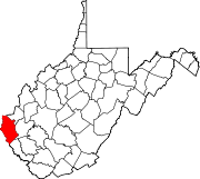
Crum, West Virginia — Census-designated place — Location within the state of West Virginia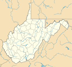
 Crum, West Virginia
Coordinates: 37°54′20.34″N 82°26′45.53″W / 37.90565°N 82.4459806°WCoordinates: 37°54′20.34″N 82°26′45.53″W / 37.90565°N 82.4459806°W Country United States State West Virginia County Wayne Area[1] – Total 0.510 sq mi (1.3 km2) – Land 0.510 sq mi (1.3 km2) – Water 0 sq mi (0 km2) Population (2010)[2] – Total 182 – Density 356.9/sq mi (137.8/km2) Time zone Eastern (EST) (UTC-5) – Summer (DST) CDT (UTC-5) ZIP code 25699 Area code(s) 304 FIPS code GNIS feature ID Crum is an unincorporated census-designated place in southern Wayne County, West Virginia, United States. As of the 2010 census, its population was 182.[2] It is the home to Crum Elementary School and Crum Middle School. It is a part of the Huntington-Ashland, WV-KY-OH, Metropolitan Statistical Area (MSA). As of the 2000 census, the MSA had a population of 288,649.
Contents
Town information
Crum is the home of Silver Creek United Baptist Church (the second oldest church in West Virginia)[citation needed], Crum Separate Baptist Church, Crum Church of Christ, and Crum Missionary Baptist Church. Many other small churches are located in nearby hollows and roads.
U.S. Route 52 runs directly through Crum, as does the Norfolk Southern Railway's Kenova District. The town is bordered on the west by the Tug Fork of the Big Sandy River (also known locally as the Tug River). This river is part of the boundary between West Virginia and Kentucky. A mile section of the future King Coal Highway is built just east of Crum, with access from Silver Creek Rd.
Demographic information
Whites make up 99.2% of the population at 1,537, with blacks and other groups at 0.8% with a population of 12. There were 657 households with an average household size of 2.63. The average house value is listed at $52,100, with an average household income of $15,449. The median age of the general population is 35.10 years, with the male median age at 35.60, and the females at 36.20.
Crum: The Novel
Written by former Crum resident Lee Maynard, it is a fictionalized account of life in Crum in the 1950s. When it was released in 1988, the book stirred up hostility in the town as many Crum residents took offense to Maynard's portrayal of Crum, despite the inclusion of a disclaimer at the beginning of the book explaining that the work is fictional except for the town name of "Crum." Still, a few Crum residents claim that characters and incidents in the book are clearly inspired by real-life people and events. Considered a "cult classic" by some, original copies were selling for large amounts on eBay before the book was re-released in 2001 by West Virginia University Press.
In 2006, actor/producer Ross Ballard and MountainWhispers.com audiobooks produced an audio version of Maynard's classic to a receptive national audience.
Cities / Towns near Crum, West Virginia
- Beauty, Kentucky (5.7 miles)
- Dunlow, West Virginia (9.2 miles)
- Genoa, West Virginia (9.1 miles)
- Inez, Kentucky (5.7 miles)
- Kermit, West Virginia (9.1 miles)
- Kiahsville, West Virginia (12.7 miles)
- River, Kentucky (10.8 miles)
- Tomahawk, Kentucky (10.4 miles)
- Warfield, Kentucky (5.8 miles)
- Wilsondale, West Virginia (4.8 miles)
References
- ^ "US Gazetteer files: 2010, 2000, and 1990". United States Census Bureau. 2011-02-12. http://www.census.gov/geo/www/gazetteer/gazette.html. Retrieved 2011-04-23.
- ^ a b "American FactFinder". United States Census Bureau. http://factfinder2.census.gov. Retrieved 2011-05-14.
Municipalities and communities of Wayne County, West Virginia Cities Ceredo | Huntington‡ | Kenova
Towns CDPs Crum | Lavalette | Prichard
Unincorporated
communitiesArdel | Armilda | Bethesda | Booton | Bowen | Brabant | Buffalo Creek | Centerville | Coleman | Cove Gap | Crockett | Cyrus | Dickson | Doane | Dunlow | East Lynn | Echo | Effie | Elmwood | Ferguson | Fleming | Genoa | Gilkerson | Girard | Glenhayes | Grandview Gardens | Hidden Valley | Hubbardstown | Kiahsville | Mineral Springs | Missouri Branch | Neal | Nestlow | Oakview Heights | Quaker | Radnor | Saltpetre | Shoals | Sidney | Stepptown | Stiltner | Stonecoal | Sweet Run | Tripp | Webb | Westmoreland | Wilsondale | Winslow
Footnotes ‡This populated place also has portions in an adjacent county or counties
Categories:- Populated places in Wayne County, West Virginia
- Census-designated places in West Virginia
- Huntington–Ashland metropolitan area
- Metro Valley geography stubs


Wikimedia Foundation. 2010.