- Filiates
-
Filiates
ΦιλιάτεςLocation 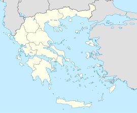
 Filiates
Coordinates 39°36′N 20°19′E / 39.6°N 20.317°ECoordinates: 39°36′N 20°19′E / 39.6°N 20.317°E Location within the region
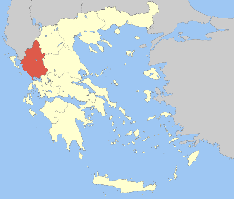
Government Country: Greece Region: Epirus Regional unit: Thesprotia Population statistics (as of 2001) Municipality - Population: 10,448 - Area: 590.6 km2 (228 sq mi) - Density: 18 /km2 (46 /sq mi) Municipal unit - Population: 8,288 - Area: 495.7 km2 (191 sq mi) - Density: 17 /km2 (43 /sq mi) Community - Population: 2,344 Other Time zone: EET/EEST (UTC+2/3) Auto: ΗΝ Filiates (Greek: Φιλιάτες; Albanian: Filat or Filati[1]) is a town and a municipality in Thesprotia, Greece. It is located in the northernmost part of the prefecture, bordering western Ioannina Prefecture and southern Albania.
Contents
Municipality
The present municipality Filiates was formed at the 2011 local government reform by the merger of the following 2 former municipalities, that became municipal units (constituent communities in brackets):[2]
- Filiates (Achladea, Aetos, Agios Nikolaos, Agioi Pantes, Ampelonas, Anavryto, Charavgi, Faneromeni, Filiates, Foiniki, Gardiki, Giromeri, Gola, Kallithea, Kato Xechoro, Kefalochori, Keramitsa, Kerasochori, Kokkinia, Kokkinolithari, Kouremadi, Kryoneri, Kyparisso, Leptokarya, Lia, Lista, Malouni, Milea, Palaiochori, Palaiokklisi, Palampas, Pigadoulia, Plaisio, Platanos, Raveni, Rizo, Sideri, Trikoryfo, Tsamantas, Vavouri, Vrysella, Xechoro)
- Sagiada (Asprokklisi, Kestrini, Ragi, Sagiada, Smertos)
Geography
Filiates is located in a largely mountainous area. The Mourgana mountains lie to the north, on the border with Albania.
The municipal unit Filiates has a land area of 495.727 km² and a population of 8,288 (2001 census). The population of the town Filiates, one of the biggest towns in the area, was 2,246 and the community population was 2,344. The largest other communities in the municipal unit are Keramítsa (pop. 309), Palaiochóri (291), Vrysélla (277), Leptokaryá (276), Trikóryfon (245), Ampeló (222), Kerasochóri (211), and Kokkiniá (205). The municipal unit has a total of 42 communities.
Climate
Because of its high altitude (~850m) location on a west-facing slope, Filiates has one of the wettest climates in Greece.
Location
Filiates is located southwest of Konitsa, west-southest of Kozani and Thessaloniki, west of Ioannina, northwest of Athens, north of Preveza and east of Igoumenitsa.
Filiates is connected with the GR-6 (Larissa - Metsovo - Ioannina - Igoumenitsa) and is now the old road. It has a few interchanges with the Egnatia Odos (Alexandroupoli - Thessaloniki - Igoumenisa) and several had just opened. It is connected with the GR-19 that goes down to Paramythia and Preveza.
History
Ancient History
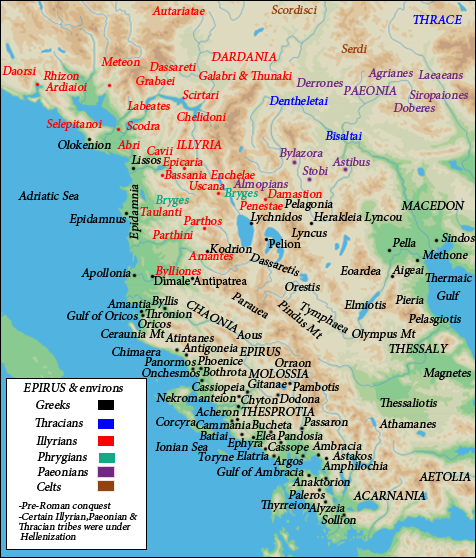
 Epirus in antiquity
In antiquity, the area of Filiates was inhabited by the Epirot Greek tribe of the Chaonians. In antiquity the city was known as Cestrine (or Kestrine), separated from Thesprotia by the River Thyamis.[3] In the past, the city was also known as Cammania, Cestria, Filiates, Ilion, Epirus, Troy, Epirus and Troia, Epirus.[3] According to Pausanias (Description of Greece), Cestrine took its name from Cestrinus, the son of Helenus, having previously borne the appellation of Cammania.
Modern History
 Albanian school of Filiates in 1942-44.[verification needed]
In 15th century Filiates came under Ottoman rule and became part of Sanjak of Ioannina.[4][5] During 17th and 18th century Ottoman rule a significant part of the town's population converted to Islam. In 1911 during the period of the dissolution of the Ottoman empire, Albanians of Filiates formed çetes, armed guerilla groups fighting for autonomy from the Ottoman empire.[6] On the other hand, the local Greek population displayed tolerance towards actions by the Albanians that didn't reveal chauvinist inclinations.[7]
During the Greek-Italian War the town was burned by collaborationist Cham Albanian bands (October 28-November 14, 1940).[8] It was home to a Cham Albanian community, before 1944, when they fled due to accusations of mass collaboration with Nazi forces.[9] In June 1945 a great part of Filiates was burned by Greek bands during the expulsion of Cham Albanians.[10] Almost all Cham Albanian monuments of Filiates were destroyed during WWII.[11]
Population
Year Pop. village Pop. municipal district Pop. municipality 1981 2,439 - - 1991 2,591 - - 2001 2,246 2,344 8,288 Notable people
- Anthimus VII of Constantinople (1835–1913), Ecumenical Patriarch.
- Aziz Çami, officer of the Albanian army and Balli Kombëtar commander.
- Qamil Çami, teacher and poet of era of the Albanian National Awakening.
- Ali Demi, Albanian resistance fighter (World War II).
- Musa Demi, revolutionary and important figure of the Albanian National Awakening.
- Niazi Demi, minister of trade of Albania.
- Rexhep Demi, leading member of the Albanian independence movement and signatory of the Albanian Declaration of Independence.
- Tahir Demi, high-ranking member of the Party of Labour of Albania and representative of Albania at Comecon.
- Stavroula Dimitriou, author and poet.
- Nicholas Gage, Greek American author and investigative journalist.
- Vasiliki Kontaxi, wife of Ali Pasha and member of the patriotic organization Filiki Eteria,[12]
External links
- Official website (English) (Greek)
See also
- List of cities in ancient Epirus
- Axis-Cham Albanian collaboration

Dhivër (Albania) Dropull i Sipërm (Albania) and Delvinaki Lavdani Livadhja and Markat (Albania) 
Molossoi  Filiates

Sagiada and Igoumenitsa Parapotamos Paramythia References
- ^ "The market towns of Filiates and Paramythia were albanian in speech", NGL Hammond, "Epirus: The Geography, the Ancient Remains, the History and Topography of Epirus and Adjacent Areas", page 27
- ^ Kallikratis law Greece Ministry of Interior (Greek)
- ^ a b Bell, Robert (1989). Place names in classical mythology. ABC-CLIO. p. 78. ISBN 0874365074, 9780874365078. http://books.google.com/books?id=CErYAAAAMAAJ&q=cestrine%2Bfiliates&dq=cestrine%2Bfiliates&hl=en&ei=nETPTKC2L4HUtQPF8vGlAw&sa=X&oi=book_result&ct=result&resnum=1&ved=0CCcQ6AEwAA. Retrieved November 2010.
- ^ H. Karpat, Kemal (1985). Ottoman population, 1830-1914: demographic and social characteristics. p. 146. http://books.google.com/books?ei=HuJ6Tp_wBoe20QXL87SjAw&ct=result&sqi=2&id=yhgEAQAAIAAJ&dq=janina+kaza&q=%22Yanya+Central+Kaza%22#search_anchor. Retrieved 22 September 2011.
- ^ Motika, Raoul (1995). Türkische Wirtschafts- und Sozialgeschichte (1071-1920). p. 297. http://books.google.com/books?id=5BQ0AQAAIAAJ&q=pogon+permedi+Koni%C3%A7e&dq=pogon+permedi+Koni%C3%A7e&hl=en&ei=kuV6TsKOMKbk4QS8ptXnDw&sa=X&oi=book_result&ct=result&resnum=1&sqi=2&ved=0CCwQ6AEwAA. Retrieved 22 September 2011. "Sancaks Yanya (Kazas: Yanya, Aydonat (Paramythia), Filat (Philiates), Meçova (Metsovo), Leskovik (war kurzzeitig Sancak) und Koniçe (Konitsa)"
- ^ Gawrych, George (2006). The crescent and the eagle: Ottoman rule, Islam and the Albanians, 1874-1913. I.B.Tauris. pp. 188. ISBN 1845112873. http://books.google.com/books?id=wPOtzk-unJgC.
- ^ M. V. Sakellariou.Epirus, 4000 years of Greek history and civilization. Ekdotike Athenon, 1997. ISBN 9602133716. p 361: "The Greek population displayed toleration whenever the action taken did not reveal chauvinist inclinations, as in the case of establishment of Albanian "clubs" (in Konitsa, Philiates...".
- ^ Georgia Kretsi. Gedächtnis in Albanien: eine Analyse postsozialistischer Erinnerungsstrategien. Harrassowitz, 2007. ISBN 9783447055444, p.283.
- ^ Kretsi, Georgia (2002). "The Secret Past of the Greek-Albanian Borderlands. Cham Muslim Albanians: Perspectives on a Conflict over Historical Accountability and Current Rights". Ethnologia Balkanica (06/2002): 171–195. http://www.ceeol.com/aspx/issuedetails.aspx?issueid=0a13424e-93c0-4bd9-bca0-0315150024fa&articleId=26cecc06-5ff1-44ed-956d-2a52d572b54a.
- ^ The Cham Issue –Albanian National and Property Rights Claims in Greece, by Miranda Vickers, Conflict Studies Research Centre, April 2002 page 21
- ^ Kiel, Machiel (1990). Ottoman architecture in Albania, 1385-1912. Research Centre for Islamic History, Art and Culture. p. 3. ISBN 9789290633303. http://books.google.com/books?ei=AwbPTJ7NL8LBswbE0eSWCA&ct=result&id=2xYzAAAAIAAJ&dq=Aydonat+Albanian&q=Aydonat+#search_anchor. Retrieved 1 November 2010.
- ^ Μουσείο Ελληνικής Ιστορίας Παύλου Βρέλλη. vrellis.gr
Municipal unit of Sagiada Administrative division of the Epirus Region Area: 9,203km² • Population: 353,820 (2001) • Capital: Ioannina Regional unit of Arta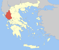 Regional unit of IoanninaRegional unit of PrevezaRegional unit of ThesprotiaFiliates • Igoumenitsa • Souli
Regional governor: Alexandros Kachrimanis • Website: www.php.gov.gr Categories:- Populated places in Thesprotia
- Municipalities of Epirus
- Geography of ancient Epirus
- Geography of Greece
- Ancient Greek cities


Wikimedia Foundation. 2010.