- Offshore Reefs Archeological District
-
Offshore Reefs Archeological District
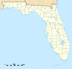

Location: Miami-Dade County, Florida Nearest city: Homestead Coordinates: 25°25′53″N 80°09′54″W / 25.43139°N 80.165°WCoordinates: 25°25′53″N 80°09′54″W / 25.43139°N 80.165°W Area: 226,400 acres (916 km2) Governing body: Federal government NRHP Reference#: 84000838 Added to NRHP: August 24, 1984 The Offshore Reefs Archeological District is a U.S. historic district (designated as such on August 24, 1984) east of Homestead, Florida. It is located across a 30 mile stretch along the eastern edge of the Biscayne National Park.
External links
- Dade County listings at National Register of Historic Places
- Dade County listings at Florida's Office of Cultural and Historical Programs
National Register of Historic Places in Biscayne National Park Historic districts Boca Chita Key Historic District | Offshore Reefs Archeological District
Other properties U.S. National Register of Historic Places in Florida Lists by county Alachua • Baker • Bay • Bradford • Brevard • Broward • Calhoun • Charlotte • Citrus • Clay • Collier • Columbia • DeSoto • Dixie • Duval • Escambia • Flagler • Franklin • Gadsden • Gilchrist • Glades • Gulf • Hamilton • Hardee • Hendry • Hernando • Highlands • Hillsborough • Holmes • Indian River • Jackson • Jefferson • Lafayette • Lake • Lee • Leon • Levy • Liberty • Madison • Manatee • Marion • Martin • Miami-Dade • Monroe • Nassau • Okaloosa • Okeechobee • Orange • Osceola • Palm Beach • Pasco • Pinellas • Polk • Putnam • Santa Rosa • Sarasota • Seminole • St. Johns • St. Lucie • Sumter • Suwannee • Taylor • Union • Volusia • Wakulla • Walton • Washington
Lists by city Other lists Categories:- Historic districts in Florida
- Archaeological sites in Florida
- Geography of Miami-Dade County, Florida
- National Register of Historic Places in Miami-Dade County, Florida
- Biscayne National Park
- Florida Registered Historic Places district stubs


Wikimedia Foundation. 2010.