- Cova Figueira
-
For other uses, see Cova (disambiguation).For other uses, see Figueira (disambiguation).
Cova Figueira
Kóba FigeraLocation in Cape Verde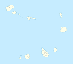
 Cova Figueira
Coordinates: 14°53′30″N 24°17′30″W / 14.89167°N 24.29167°WCoordinates: 14°53′30″N 24°17′30″W / 14.89167°N 24.29167°W Country  Cape Verde
Municipality Santa Catarina do Fogo (seat) Government - Type Democracia - Camara Santa Catarina do Fogo Aquileu GoncalvesPopulation - Total 15,350 Area code(s) 282 Website Cova Figueira.CV Cova Figueira (in Cape Verdean Creole: Kóba Figera), is a city and a cove located approximately 20 km east of the island main city of São Filipe in the island of Fogo, Cape Verde. Since 2005, it serves as the seat of Santa Catarina do Fogo Municipality. The town is situated in a cove area that are surrounded by rocks and is also in the slopey setting.
Nearest Places
- Figueira Pavão, southwest
- Estância Roque, northwest
- Tinteira, northeast
- Cova Matinho, northeast
Geography
The area around Cova Figueira contains farmlands within the city and the shoreline, the rest of the area are slopey and features grasslands and rocks, the mountain that includes Chã das Caldeiras is situated to the northwest. The living standards are in the low range as well as its income, one time, there were no money until the late-20th century. The village is nearly over the island's middle class. Most of the population are farmers and are based in agriculture where banana plantations, pineapple and other crops are common. However, a part of the needy materials comes from the island capital, nearby Cova Figueira and the diaspora. But for other needs, electricity, communications and appliances are partially available in the area as well as phone lines since the mid to late-20th century. A part of the necessities comes from the island capital.The 10th largest city in Cape Verde.
The Island of Fogo Towns, villages and settlements Achada Furna | Achada Grande | Atalaia | Bangaeira | Cabeça Fundão | Campanas | Chã das Caldeiras | Cova Figueira | Coxo | Curral Grande | Estancía Roque | Fajãzinha | Figueira Pavão | Fonsaco | Fonte Aleixo | Furna | Galinheiros | Lomba | Miguel Gonçalves | Monte Grande | Mosteiros | Patim | Ponta Verde | Relva | Ribeira Ilhéu | Salto | Santo António | São Filipe | São Jorge | São Lourenço | Vicente DiasMountains: Chã das Caldeiras | Mount FogoMunicipalities: Mosteiros | Santa Catarina | São FilipeParishes: Nossa Senhora da Ajuda | Nossa Senhora da Conceição | Santa Catarina | São LourençoCape Verde | Barlavento | Fogo Categories:- Towns in Cape Verde
- Fogo, Cape Verde
- Cape Verde geography stubs

Wikimedia Foundation. 2010.