Castle Semple railway station
- Castle Semple railway station
Infobox UK disused station
name = Castle Semple
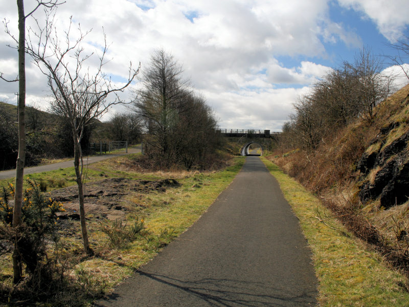
caption = The intended site of the station in 2008
manager = Glasgow and South Western Railway
locale = Near Howwood
borough = Renfrewshire
latitude = 55.8138
longitude = -4.5740
gridref = NS388608
years = N/A
events = Never opened|
Castle Semple railway station was intended to be a railway station that would have served the village of Howwood, Renfrewshire, Scotland as part of the Dalry and North Johnstone Line on the Glasgow and South Western Railway.
History
This station never opened.[Wham, p. 23] The proposed location of the station was a short distance north east of Castle Semple Loch, where a widening on the former railway line is still visible. A platform did exist here, used by the workers of the nearby Castle Semple Estate.] References
Notes
ources
rail line
previous = Lochwinnoch
"Line and station closed
next = Kilbarchan
"Line and station closed
route = Glasgow and South Western Railway
"'Dalry and North Johnstone Line
col = G&SW colour
###@@@KEYEND@@@###
Wikimedia Foundation.
2010.
Look at other dictionaries:
Castle Semple — may refer to:* Castle Semple Loch, a castle in Renfrewshire * Castle Semple railway station, a disused railway station in Renfrewshire … Wikipedia
Castle Semple Loch — Infobox lake lake name = Castle Semple Loch image lake = Lochwinnoch loch.jpg caption lake = Watersports on Castle Semple Loch image bathymetry = caption bathymetry = location = Renfrewshire, Scotland coords = coord|55|47|N|4|36|W|region:GB… … Wikipedia
Lochwinnoch (loop) railway station — Infobox UK disused station name = Lochwinnoch caption = The approach to Lochwinnoch looking west in 2008 manager = Glasgow and South Western Railway locale = Lochwinnoch borough = Renfrewshire latitude = 55.7949 longitude = 4.6248 gridref =… … Wikipedia
Kilbarchan railway station — Infobox UK disused station name = Kilbarchan caption = The remains of Kilbarchan in 2008 manager = Glasgow and South Western Railway locale = Kilbarchan borough = Renfrewshire latitude = 55.8322 longitude = 4.5446 gridref = NS407628 years = 1… … Wikipedia
Clyde Muirshiel Regional Park — is the collective name for areas of countryside set aside for conservation and recreation on the South Clyde estuary in Scotland. The Park covers an area of 108 square miles (280 km2) of Inverclyde, North Ayrshire and Renfrewshire,… … Wikipedia
Kilkenny — For other uses, see Kilkenny (disambiguation). Kilkenny Cill Chainnigh City … Wikipedia
Johnstone — infobox UK place country = Scotland official name= Johnstone gaelic name=Baile Eòin scots name= os grid reference= NS434628 map type= Scotland latitude=55.83333 longitude= 4.51667 population= 16,847 [… … Wikipedia
Medway — This article is about the Medway towns in England. For others, see Medway (disambiguation). Medway (Unitary Authority) Geography Status: Unitary, Borough Region … Wikipedia
Paisley — PAISLEY, a burgh, market town, and ancient parish, in the Upper ward of the county of Renfrew, of which it is the principal place, and the seat of a wide manufacturing district, 7½ miles (W. by S.) from Glasgow, and 50 (W. by S.) from… … A Topographical dictionary of Scotland
County Kilkenny — For other uses, see Kilkenny (disambiguation). County Kilkenny Contae Chill Chainnigh Coat of a … Wikipedia