- Montlake Bridge
-
Montlake Bridge 
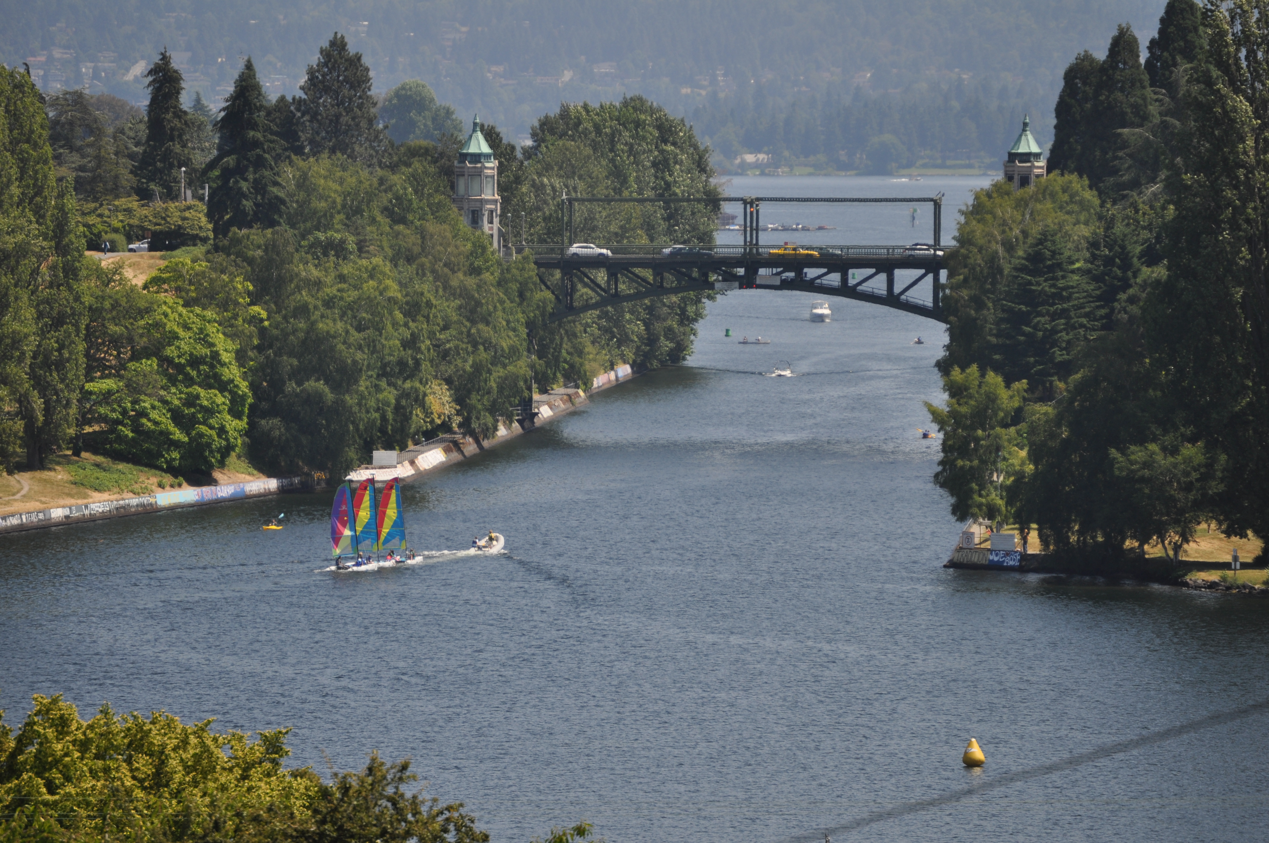
Montlake Bridge from the westCarries Montlake Boulevard (SR 513) Crosses Montlake Cut Locale Seattle, Washington Designer Carl F. Gould Design Bascule bridge Total length 344 ft (105 m) Clearance below 46 ft (14 m) Opened June 1925 Coordinates 47°38′50″N 122°18′17″W / 47.64731°N 122.30468°WCoordinates: 47°38′50″N 122°18′17″W / 47.64731°N 122.30468°W The Montlake Bridge is a double-leaf bascule bridge that carries Montlake Boulevard (State Route 513) over Seattle's Montlake Cut--part of the Lake Washington Ship Canal--connecting Montlake and the University District.
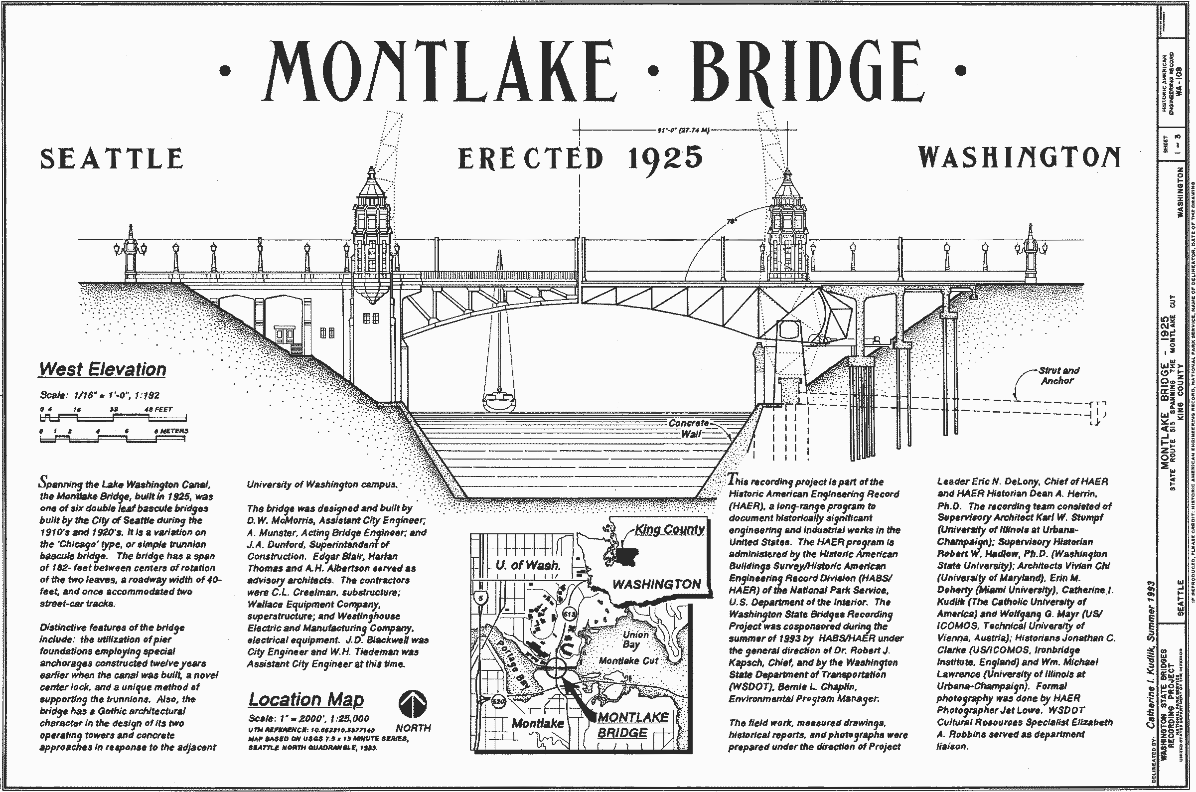
It is the easternmost bridge spanning the canal. The bridge is 104.9 m (344 ft) long, and was designed by Carl F. Gould, one of the original architects of the University of Washington. The bridge and its control towers were designed in conjunction with the university's Collegiate Gothic style. It provides a clearance of 14 m (46 ft)[1] and is reported as providing 14.6 m (48 ft) of vertical clearance above the mean regulated level of Lake Washington for the central 30.5 m (100 ft) of the bascule span.[2] It is one of four original bascule-type drawbridges over the Ship Canal, the others being the Ballard, Fremont, and University Bridges. It was the last one to be completed, has the highest clearance of the four, and is the only one that is part of the state highway system. It is also one of six bascule bridges based on a design derived from the Chicago bascule bridge, but is unique because of its trunnion supports, employed to avoid a patent infringement lawsuit by the Strauss Bascule Bridge Company.
Piers and abutments for a permanent bridge were built in 1914 as part of construction for the Ship Canal, but a serious proposal for a bridge at Montlake didn't come until 1916.[3] The first bridge in its place was a makeshift walkway made from a series of barges, set up by graduate manager Dar Meisnest to allow football fans to cross for the Washington/Dartmouth game in 1920. The temporary bridge was so heavily traveled, it demonstrated the need for a permanent structure,[4] which was finished in June 1925.
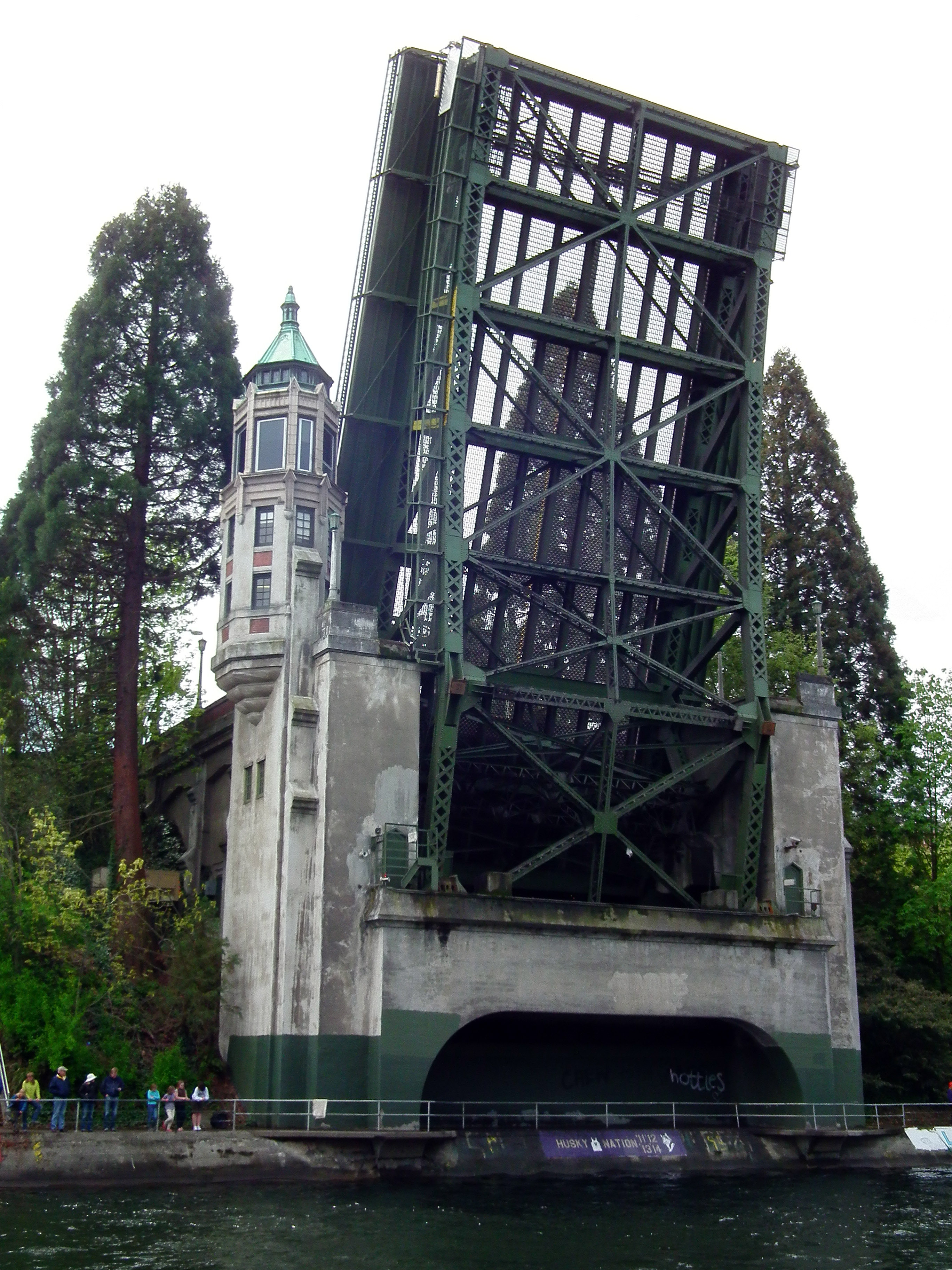
 The south side of the Montlake Bridge fully open
A report from 1993 states that the Montlake Bridge averaged a volume of 60,900 vehicles each weekday,[5] while another report from 2001 puts normal weekend traffic across the bridge at about 40,000 vehicles each day.[2] In addition to the vehicular traffic, the bridge conveys pedestrians and bicyclists across the canal by way of sidewalks on each side of the roadway. The bridge does not open during morning and evening rush hours. It opens at designated times (usually on the hour and half-hour) during the hours just prior to and after rush periods, and on demand at other times. Most of the openings are for sailboats, as most of the tugs that operate this far east are able to pass under the bridge in its closed position. The bridge creates a bottleneck for traffic heading to and from State Route 520, and the creation of alternate routes has been proposed multiple times over the years. Traffic can become backed up for more than a mile when the bridge is open, as can be seen in aerial photographs.[6] Plans to replace SR-520 include adding a second bascule bridge across the Montlake Cut next to the current Montlake Bridge.[7]
Contents
Historical significance
The Montlake Bridge is celebrated as the site of boating season's "opening day" festivities the first Saturday in May.
The bridge and the Montlake Cut together are a City of Seattle Designated Landmark (ID #107995),[8] and the bridge was added to the National Register of Historic Places in 1982, as well as the Washington Heritage Register. It is owned and operated by the Washington State Department of Transportation.
Gallery
-

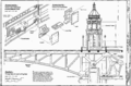
HAER description
-

Gears and Machinery
-
Center lock mechanism
References
- ^ lwsc - Bridge
- ^ a b Drawbridge Operations Regulations; Lake Washington Ship Canal, WA | Federal Register Environmental Documents | USEPA
- ^ Montlake History by Jim Gould
- ^ News: Historic Gearheads Tour (Seattle Weekly)
- ^ 110 Wn. App. 731, MONTLAKE CMTY. CLUB v. HEARINGS BD
- ^ Aerial image from USGS via Microsoft Research Maps
- ^ SR-520 Bridge Program: I-5 to Medina Project Design
- ^ Landmarks Alphabetical Listing for M, Individual Landmarks, Department of Neighborhoods, City of Seattle. Accessed 28 December 2007.
External links
Bridges and tunnels in and around Seattle Road bridges: Alaskan Way Viaduct | Ballard Bridge | Cowen Park Bridge | East Channel Bridge | Evergreen Point Floating Bridge | First Avenue South Bridge | Fremont Bridge | George Washington Memorial Bridge (Aurora Bridge) | Homer M. Hadley Memorial Bridge (Third Lake Washington Floating Bridge) | Jose Rizal Bridge | Lacey V. Murrow Memorial Bridge (I-90 Floating Bridge) | Magnolia Bridge | Montlake Bridge | North Queen Anne Drive Bridge | Schmitz Park Bridge | Ship Canal Bridge | South Park Bridge | Spokane Street Bridge | 20th Avenue NE Bridge | University Bridge | West Seattle BridgeRail bridges/trestles: Tunnels: Battery Street Tunnel | Great Northern Tunnel | Mercer Island Lid | Downtown Seattle Transit Tunnel | Mount Baker Tunnel | Convention Center-Freeway Park Lid | Beacon Hill TunnelCrossings of the Lake Washington Ship Canal Upstream
Lake WashingtonMontlake Bridge Downstream
University BridgeCategories:- Bascule bridges
- Bridges in Seattle, Washington
- Bridges completed in 1925
- Bridges on the National Register of Historic Places in Washington (state)
- National Register of Historic Places in Seattle, Washington
- Road bridges in Washington (state)
-


Wikimedia Foundation. 2010.