- Dawei
-
For other uses, see Dawei (disambiguation).
Dawei
ထားဝယ်မြို့
TavoyLocation in Burma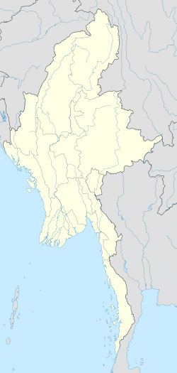
 Dawei
DaweiCoordinates: 14°05′0″N 98°12′0″E / 14.083333°N 98.2°E Country  Burma
BurmaDivision Tanintharyi Region District Dawei District Township Dawei Township Government - Mayor Population (2005) - Religions Buddhism Time zone MST (UTC+6.30) Area code(s) 59[1] Dawei (Burmese: ထားဝယ်မြို့; MLCTS: hta: wai mrui., pronounced [dəwɛ̀ mjo̰]; Mon: ဓဝဲါ, [həwài]; formerly known as Tavoy), is a city in southeastern Myanmar and is capital of Tanintharyi Region, formerly Tanintharyi Division, situated about 614.3 km (381.7 mi) south of Yangon on the northern bank of the Dawei River. Population (2004 estimate) 139 900. It is situated at 14.09°N 98.20°E. Dawei is a port at the head of the Dawei River estuary, 30 km (18.6 mi). from the Andaman Sea. As a result the city is prone to flooding during the monsoon season.
Contents
History
The area around the Dawei River estuary has been inhabited for centuries by Mon, Kayin and Thai mariners. From the 11th to 13th centuries, Dawei was part of the Pagan Kingdom. From 1287 to 1564, Dawei became part of the Sukhothai Kingdom and its successor Ayutthaya Kingdom (Siam). From 1564 to 1599, Dawei was part of the Toungoo Kingdom of Burma. Siam temporarily regained the city between 1599 and 1614. From 1614 to the 1740s, Dawei was the southernmost city of Burmese authority, and was backed by a Burmese garrison. In the late 1740s during the Burmese civil war of 1740–1757, Dawei along with the northern Tenasserim coast was taken over by the Siamese. Burma regained the city and extended its control over the entire Tenasserim coast in 1765. The Tenasserim coast was ceded to the British after the First Anglo-Burmese War (1824–1826).
After independence in 1948, the city became part of the Tenasserim Division, which also included today's Mon State. In 1974, Mon State was carved out of Tenasserim, and Dawei became the capital of the truncated Division. In 1989, the city's English name was changed from Tavoy to Dawei, and Tenasserim became Tanintharyi.
Climate
Climate data for Dawei Month Jan Feb Mar Apr May Jun Jul Aug Sep Oct Nov Dec Year Average high °C (°F) 32.4
(90.3)33.1
(91.6)34.0
(93.2)34.5
(94.1)31.7
(89.1)28.6
(83.5)27.7
(81.9)27.8
(82.0)29.0
(84.2)31.1
(88.0)32.1
(89.8)32.1
(89.8)31.18
(88.12)Average low °C (°F) 18.2
(64.8)19.9
(67.8)21.7
(71.1)23.7
(74.7)24.0
(75.2)23.6
(74.5)23.6
(74.5)23.3
(73.9)23.1
(73.6)23.1
(73.6)21.5
(70.7)18.7
(65.7)22.03
(71.66)Precipitation mm (inches) 4.6
(0.181)11.3
(0.445)19.3
(0.76)47.5
(1.87)554.2
(21.819)1087.5
(42.815)1360.7
(53.571)1289.2
(50.756)954.0
(37.559)257.2
(10.126)26.4
(1.039)9.0
(0.354)5,620.9
(221.295)Source no. 1: HKO Source no. 2: World Climate Transport
Only recently Dawei was connected to the rest of Myanmar by road and rail. There are plans to construct a deepwater port in Dawei.[2] In November 2010, the Myanmar Port Authority signed a USD $8.6 billion deal with Italian-Thai Development to develop a deep sea port at Dawei.[3] This development would become Myanmar's first Special Economic Zone, which includes plans to develop a 250 square kilometres (97 sq mi) industrial estate, with sea, land (railway and road) infrastructure links to Thailand, Cambodia, and Vietnam, as well as a gas pipeline to Thailand’s Kanchanaburi Province and commercial and residential developments.[4]
Local products
Dawei longyi (sarong) is a famous local product.[5] The area produces rubber, dried fish and teakwood. It also produces cashew nuts and betel nuts and exports them through local traders to China, India and Thailand. Dawei is also well known for its variety of tropical fruits such as pineapples, a variety of mangoes, mangosteens, and durian (also known as the "King of Fruits"). There is one fruit called "zin thi" (in Dawei language), which can only be found in Dawei and surrounding areas; this fruit is sweet with a touch of sour.
Attractions
- Maungmagan Beach is a popular beach in Myanmar and served as a beach retreat for the British during colonial days.
There are also a number of hot water springs around the outskirts, about one to a few hours drive from Dawei. There is one quite close to Maungmagan (on the way to Maungmagan from Dawei).
The largest reclining Buddha in Myanmar is in Dawei (about 30 minutes drive from Dawei). The closest city from Dawei is Yeiphyu. Dawei Hope at a long sleeved peninsula has a lighthouse guiding to Dawei port and Mali Naval Base.
- Dawei Education College
- Dawei University
See also
- Dawei Airport
- Railway stations in Burma
- Railway stations in Thailand
References
- ^ "Myanmar Area Codes". http://en.18dao.net/Area_Code/Myanmar. Retrieved 2009-04-10.
- ^ "Railway Gazette: China's horizons extend southwards". 2011-01-06. http://www.railwaygazette.com/nc/news/single-view/view/chinas-horizons-extend-southwards.html. Retrieved 2011-01-06.
- ^ Aye Thidar Kyaw; Stuart Deed (7 February 2011). "SPDC signs Special Economic Zone law into effect on Jan 27". Myanmar Times. http://www.mmtimes.com/2011/business/561/biz56102.html. Retrieved 23 August 2011.
- ^ Thein Linn (4 November 2010). "Dawei deep-sea port, SEZ gets green light". Myanmar Times. http://www.mmtimes.com/2010/business/549/biz54901.html. Retrieved 23 August 2011.
- ^ "Dawei Traditional Longyi Weaving Art inc. video". http://www.mrtv3.net.mm/pages/daweiwea.html.
External links
Coordinates: 14°05′N 98°12′E / 14.083°N 98.2°E
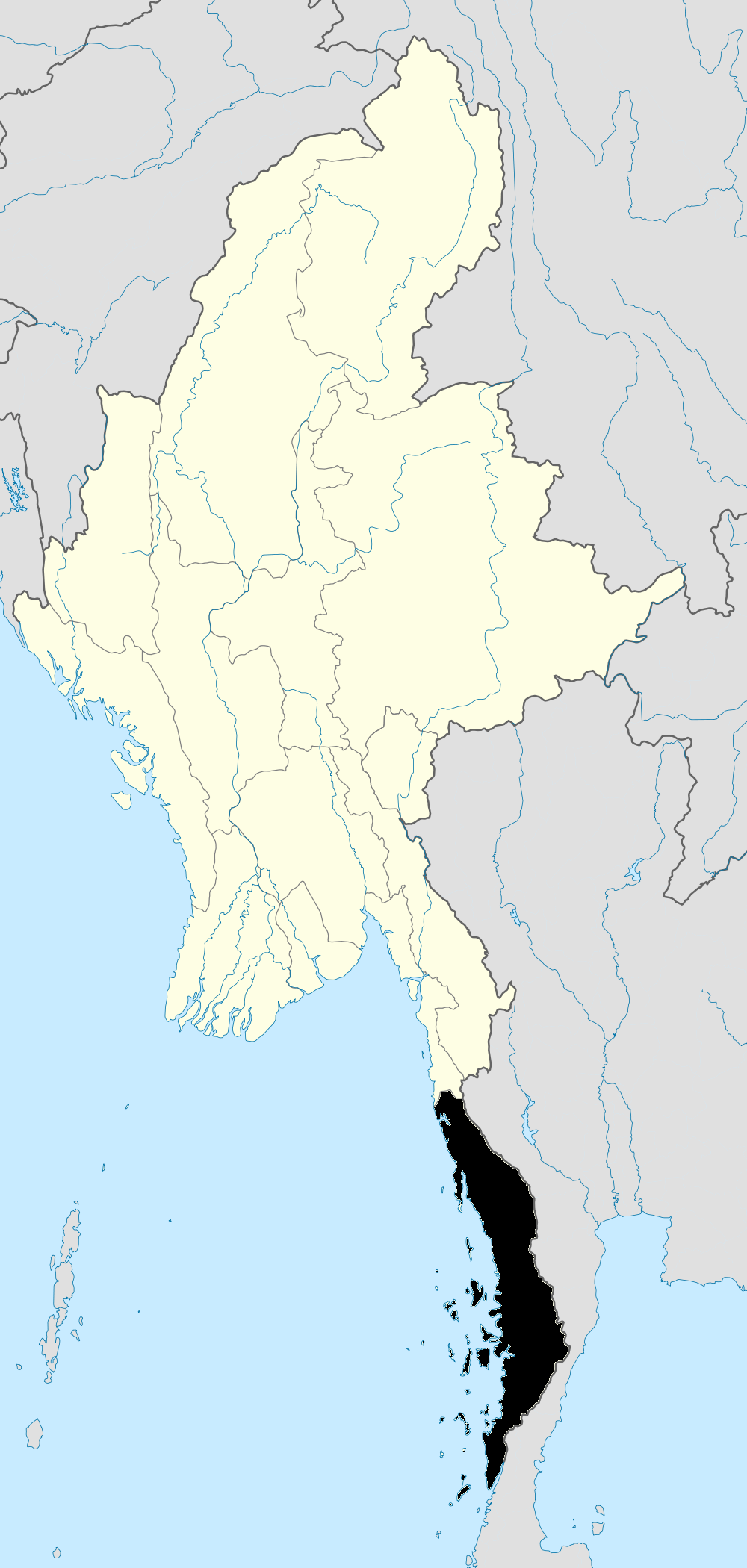
Tanintharyi Region Capital: Dawei Dawei District 

Myeik District Kawthaung District Bokpyin Township · Kawthaung TownshipMain cities and towns Categories:- Township capitals of Burma
- Populated places in Taninthayi Region


Wikimedia Foundation. 2010.