- Naganohara, Gunma
-
Naganohara
長野原町— Town — 
FlagLocation of Naganohara in Gunma Prefecture
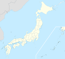
 Naganohara
Coordinates: 36°33′N 138°38′E / 36.55°N 138.633°ECoordinates: 36°33′N 138°38′E / 36.55°N 138.633°E Country Japan Region Kantō Prefecture Gunma Prefecture Area – Total 133.93 km2 (51.7 sq mi) Population (September 1, 2007) – Total 6,361 – Density 47.50/km2 (123/sq mi) Time zone Japan Standard Time (UTC+9) City symbols - Tree Larch - Flower Azalea - Bird Copper Pheasant Phone number 0279-82-2244 Address Naganohara-machi, 66-3 Ōaza Naganohara
377-1392Website Town of Naganohara  JR Naganohara-Kusatsuguchi Station
Naganohara (長野原町 Naganohara-machi) is a town located in Agatsuma District, Gunma, Japan.
As of September 1, 2007, the town has an estimated population of 6,361 and a density of 47.50 persons per km². The total area is 133.93 km².
Contents
Geography
Located in the northwestern portion of Gunma Prefecture, almost all of the town has an elevation higher than 500m. The town has Mount Shirane to the north and Mount Asama to the south.
- Rivers: Agatsuma River, Shirasuna River, Kuma River
Surrounding municipalities
Education
- Naganohara High School
Visitor attractions
- Asama Volcano Museum
External links
 Media related to Naganohara, Gunma at Wikimedia Commons
- Naganohara Official English Website
- Naganohara Official Website (Japanese)
- Dam cancellation leaves local residents high and dry

This Gunma Prefecture location article is a stub. You can help Wikipedia by expanding it.


