- Oklahoma State Highway 87
-
State Highway 87

Route information Maintained by ODOT Length: 14.58 mi[1] (23.46 km) Major junctions West end:  US-259 near Harris
East end:  AR-108 at the Arkansas state line
Highway system Oklahoma State Highways
Oklahoma turnpike system←  SH-86
SH-86SH-88  →
→State Highway 87 is a highway in southeastern Oklahoma, running for 14.58 miles (23.46 km)[1]. It passes through the extreme southeastern corner of the state, running entirely through McCurtain Co.. It has no lettered spur routes.
Contents
Route description
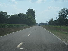 Eastbound on SH-87 just west of the Arkansas state line
SH-87 begins at an intersection with US-259 near the unincorporated community of Harris, about 1 mile (1.6 km) from the Red River. SH-87 heads east from here, proceeding along many curves. The highway is two-lane for its entire length, and much of it is very narrow with no shoulders (though a short stretch of highway that was realigned to approach a new girder bridge that replaced an old through truss bridge was built with shoulders). The highway crosses no major rivers, but does bridge Walnut Bayou. SH-87 ends at the Arkansas state line, where it becomes Arkansas Highway 108.
SH-87 is shown on the Oklahoma state highway map as concurrent with US-259 to at least Idabel.[2] However, this is an error, as the highway is only signed from US-259 to the Arkansas state line, and is shown on ODOT's internal control section maps as ending at US-259.[1]
History
State Highway 87 first appeared on the June 1944 state highway map. When it was originally commissioned, the highway was a spur route; its western end was in Idabel, and its eastern end was approximately the location of the present-day US-259–SH-87 intersection. Towards the end of its route, SH-87 served Harris.[3]
By 1948, SH-87 was extended, setting its eastern terminus at its present location at the Arkansas state line.[4] However, this terminus proved to be temporary at first, as the highway was rerouted to turn north to end at SH-21 (now SH-3) in Tom in 1952.[5] However, by 1957, the state line terminus had been reestablished, and SH-87 has ended there to the present day.[6]
In the early 1960s, SH-87's length was at its zenith, as the highway stretched from Idabel to the Arkansas state line. However, on 1963-01-07, US-259 was established.[7][8] The section of SH-87 from Idabel through Harris was turned over to the new U.S. route, setting the western terminus of the highway to its present-day location.
Junction list
County Location Mile[1] Destinations Notes McCurtain 0.00 US-259Western terminus 14.58 Hwy. 108Arkansas state line; eastern terminus 1.000 mi = 1.609 km; 1.000 km = 0.621 mi References
- ^ a b c d Oklahoma Department of Transportation. 2008 Control Section Maps (Map). p. McCurtain 45. http://www.odot.org/hqdiv/p-r-div/maps/control-maps/mccurtain.pdf. Retrieved 2008-06-06.
- ^ Oklahoma Department of Transportation. Oklahoma Official State Map (Map) (2008 ed.).
- ^ Oklahoma Department of Highways. Map Showing Condition of Improvement of the State Highway System (Map) (June 1944 ed.). http://www.odot.org/hqdiv/p-r-div/maps/state-maps/pdfs/1944.pdf. Retrieved 2008-06-09.
- ^ Oklahoma Department of Highways. Map of Oklahoma's State Highway System (Map) (1948 ed.). http://www.odot.org/hqdiv/p-r-div/maps/state-maps/pdfs/1948.pdf. Retrieved 2008-06-09.
- ^ Oklahoma Department of Highways (1953). Highways of Oklahoma (Map). http://www.odot.org/hqdiv/p-r-div/maps/state-maps/pdfs/1953.pdf. Retrieved 2008-06-09.
- ^ Oklahoma Department of Highways. Oklahoma's Highways 1957 (Map). http://www.odot.org/hqdiv/p-r-div/maps/state-maps/pdfs/1957.pdf. Retrieved 2008-06-09.
- ^ Oklahoma Department of Transportation, Planning & Research Division. "Memorial Dedication & Revision History - US-259". http://www.okladot.state.ok.us/memorial/legal/us259.htm. Retrieved 2008-06-09.
- ^ Oklahoma Department of Highways. Oklahoma 1963 (Map). http://www.odot.org/hqdiv/p-r-div/maps/state-maps/pdfs/1963.pdf. Retrieved 2008-06-09.
External links
Categories:- State highways in Oklahoma
- McCurtain County, Oklahoma


Wikimedia Foundation. 2010.