Scarborough Beach Road, Perth
- Scarborough Beach Road, Perth
Infobox Australian Road
road_name = Scarborough Beach Road
route_
route_
route_
photo =
caption =
length = 11
direction = Northwest-Southeast
start = West Coast Highway, Scarborough
finish = Charles Street, North Perth
est = 1910s
through = Doubleview, Innaloo, Woodlands, Osborne Park, Mount Hawthorn
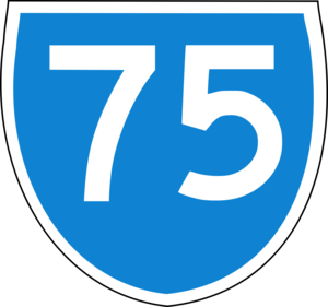
route = State Route 75
exits = Huntriss Road, Odin Road, Main Street, Green Street, Oxford Street, Loftus Street
Scarborough Beach Road is an arterial northwest-southeast road located in the inner northern suburbs of Perth, Western Australia. It is mostly a single carriageway road, with two or three lanes in each direction.
It was built to offer access to the Osborne Park agricultural and market gardening area and Scarborough Beach in the early 20th century. It was originally a plank road. In the 1950s, prior to the development of shopping centres at Karrinyup and Innaloo, the Mount Hawthorn section of the road was a popular shopping area.
Since the development of the Osborne Park industrial area and the Innaloo commercial area in the 1960s, Scarborough Beach Road has become one of the major arterial roads in the northern suburbs. The Westfield Innaloo shopping centre, a large cinema and a tavern are located around the Odin Street/Liege Street/Ellen Stirling Boulevard triple-intersection, which also carries State Route 64 traffic between the Mitchell Freeway and the western suburbs.
The Stirling railway station is a short distance away while the Glendalough railway station, built in 1992, picks up passengers on the road underneath the Mitchell Freeway bridge. It is one of only two arterial roads between Perth and Joondalup (along with Beach Road) not to provide ramp access to the Mitchell Freeway to general traffic.
Major Intersections
*
* Duke Street - Scarborough (to Wembley Downs)
* Huntriss Road - Doubleview (to Karrinyup)
* Westfield Innaloo precinct:
**
** Liege Street - Woodlands
** Ellen Stirling Boulevard - Innaloo
*
* King Edward Road/Selby Street North - Osborne Park
* Hutton Street - Osborne Park (to )
* Harborne Street/Frobisher Street - Osborne Park
* Glendalough railway station
* Main Street/Brady Street - Osborne Park, Glendalough and Mount Hawthorn
*
* Oxford Street - Mount Hawthorn
*
Wikimedia Foundation.
2010.
Look at other dictionaries:
Beach Road, Perth — Infobox Australian Road road name = Beach Road type = road route route route photo = caption = length = 14 direction = West East start = Marmion finish = Malaga est = 1900 through = Duncraig, Carine, Warwick, Hamersley, Balga, Mirrabooka, Malaga… … Wikipedia
Scarborough (Western Australia) — Scarborough Staat … Deutsch Wikipedia
List of major roads in Perth, Western Australia — This page details the major roads in the greater Perth conurbation, in Western Australia.A list of the routes (most involving multiple roads) is available at List of road routes in Perth, Western Australia.Freeways in Perth (by road route… … Wikipedia
List of road routes in Perth, Western Australia — This is a list of the road routes in Perth, Western Australia. A list of road routes in Rural Western Australia is available at List of road routes in rural and remote Western Australia.For a list of freeways, highways and roads, see List of… … Wikipedia
Stirling railway station, Perth — Stirling Train Station is a Transperth train station 9km from Perth Train Station, in Western Australia. It is on the Joondalup Line.HistoryConstructed from 1990 to 1992, it was built as part of the Northern Suburbs Transit System and the… … Wikipedia
Glendalough railway station, Perth — Glendalough Station is a Transperth railway station 5km from Perth railway station in Western Australia. It is on the Joondalup Line.HistoryThe station was built over the period 1990 1992, for the opening of the original Joondalup Line. As the… … Wikipedia
List of Perth bus routes — For detailed travel information, do not rely solely on this page; please refer to the [http://www.transperth.wa.gov.au Transperth] website. This is a list of the numerous bus routes in Perth, Western Australia. They are organized by route number … Wikipedia
West Coast Drive, Perth — Infobox Australian Road road name = West Coast Drive route route route photo = caption = length = 7 direction = South North start = Trigg Beach finish = Hepburn Avenue, Hillarys est = 1930s through = North Beach, Watermans Bay, Marmion, Sorrento… … Wikipedia
North Beach, Western Australia — North Beach Perth, Western Australia View from Mt Flora … Wikipedia
Marmion Avenue, Perth — Infobox Australian Road road name = Marmion Avenue route route route photo = caption = length = 27 direction = South North start = Karrinyup Road, Trigg finish = Butler est = 1960s through = Hillarys, Ocean Reef, Quinns Rocks Jindalee route =… … Wikipedia
