- North Eleuthera Airport
-
North Eleuthera Airport IATA: ELH – ICAO: MYEH Summary Airport type Public Location North Eleuthera Elevation AMSL 13 ft / 4 m Coordinates 25°28′30″N 076°41′01″W / 25.475°N 76.68361°WCoordinates: 25°28′30″N 076°41′01″W / 25.475°N 76.68361°W Map Location in The Bahamas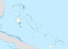
 MYEH
MYEHRunways Direction Length Surface m ft 07/25 1,835 6,020 Asphalt Source: DAFIF[1] North Eleuthera Airport is an airport in North Eleuthera on Eleuthera in the Bahamas (IATA: ELH, ICAO: MYEH). It serves the outlying islands of Harbour Island and Spanish Wells as well as the northernmost third of Eleuthera Island.
Airlines and destinations
Airlines Destinations American Eagle Miami Bahamasair Governor's Harbour, Nassau, Rock Sound Continental Connection operated by Gulfstream International Airlines Fort Lauderdale, Miami Southern Air Charter Nassau References
- ^ Airport information for MYEH at World Aero Data. Data current as of October 2006.Source: DAFIF.
Categories:- Airports in the Bahamas
- North American airport stubs
- Bahamas geography stubs

Wikimedia Foundation. 2010.