Shire of Koorda

Shire of Koorda

Infobox Australian Place | type = lga
name =Shire of Koorda
state =wa
region =Wheatbelt
area =2835.7
est =1927
seat =Koorda
pop =430 (2006 census)


imagesize= 180
caption = Location in Western Australia
logo =
logosize =
url =http://www.koorda.wa.gov.au
mayor =Janet Brooks
fedgov =O'Connor
stategov =Central Wheatbelt
near-nw = Dalwallinu
near-n = Dalwallinu
near-ne = Mt Marshall
near-w = Wongan Ballidu
near-e = Mt Marshall
near-sw = Dowerin
near-s = Wyalkatchem
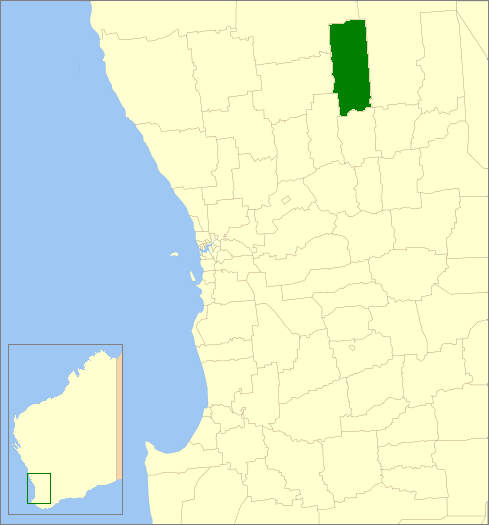
near-se = Trayning

The Shire of Koorda is a Local Government Area in the Wheatbelt region of Western Australia, about convert|240|km|mi|-1 northeast of Perth, the state capital. The Shire covers an area of convert|2836|km2|sqmi|0 and its seat of government is the town of Koorda.

History

In 1927, the Koorda Road Board was gazetted out of land previously administered by the Wyalkatchem and Mount Marshall Road Boards. On 1 July 1961, it became the Shire of Koorda following changes to the Local Government Act. [WA Electoral Commission, "Municipality Boundary Amendments Register" (release 2.0), 31 May 2003.]

Wards

The shire has been divided into 4 wards, each with two councillors.

* Town Ward
* Central Ward
* North Ward
* South Ward

Towns/Localities

* Koorda
* Badgerin Rock
* Mollerin
* Newcarlbeon

References

External links

* [http://www.koorda.wa.gov.au Shire of Koorda website]


Wikimedia Foundation. 2010.

Игры ⚽ Поможем написать реферат

Look at other dictionaries:

  • Koorda Shire — Shire of Koorda Lage des Koorda Shire in Westaustralien Gliederung …   Deutsch Wikipedia

  • Koorda, Western Australia — Infobox Australian Place | type = town name = Koorda state = wa caption = lga = Shire of Koorda postcode = 6475 est = 1910s pop = 259 elevation= 307 maxtemp = mintemp = rainfall = stategov = Central Wheatbelt fedgov = O Connor dist1 = 236 | dir1 …   Wikipedia

  • Shire of Murchison — Western Australia Location in Western Australia Population …   Wikipedia

  • Shire of Derby-West Kimberley — Western Australia Population: 7,9 …   Wikipedia

  • Shire of Christmas Island — Population: 1,440(2009)[1] …   Wikipedia

  • Shire of Ngaanyatjarraku — Western Australia Location in Western Australia Population …   Wikipedia

  • Shire of Mount Marshall — Mount Marshall redirects here. For other uses, see Mount Marshall (New York) and Mount Marshall (Antarctica). Shire of Mount Marshall Western Australia …   Wikipedia

  • Shire of Wongan-Ballidu — Infobox Australian Place | type = lga name = Shire of Wongan Ballidu state = wa imagesize= 180 caption = Location in Western Australia pop = 1,385 (2006 census) area = 3368.7 est = seat = Wongan Hills mayor = Peter Macnamara region = Wheatbelt… …   Wikipedia

  • Shire of Murray — This article is about the Western Australian Shire of Murray. For the New South Wales shire, see Murray Shire. Shire of Murray Western Australia Location in …   Wikipedia

  • Shire of Donnybrook-Balingup — This article is about a local government area. For the town, see Donnybrook, Western Australia. Shire of Donnybrook Balingup Western Australia …   Wikipedia

Share the article and excerpts

Direct link
Do a right-click on the link above
and select “Copy Link”