- Lander County, Nevada
Infobox U.S. County
county = Lander County
state = Nevada
map size =
founded = 1861
seat = Battle Mountain | area_total_sq_mi =5519
area_water_sq_mi =26
area percentage = 0.47%
census yr = 2000
pop = 5794
density_sq_mi =
web= www.landercounty.org|Lander County is a county located in the
U.S. state ofNevada . As of the 2000 census, the population is 5,794. Itscounty seat is Battle MountainGR|6.History
Lander County was one of the original nine counties created in 1861. Named for
Frederick W. Lander ; chief engineer of a federal wagon route through the area in 1857. He later served as Special Indian Agent in the area, and died during the Civil War inVirginia in 1862 at the rank of brigadier general. Created in 1862, Lander County sprang forth as the result of a mining boom on theReese River , along the old pony express line; taking a considerable portion of Churchill and Humboldt counties with it. Eventually, Lander would be known as the "mother of counties" because so many were carved out of it. Its first county seat was Jacobsville in 1862 which was soon after moved to Austin in 1863 and finallyBattle Mountain in 1979.Geography
According to the U.S. Census Bureau, the county has a total area of 5,519
square mile s (14,295km² ), of which, 5,494 square miles (14,228 km²) of it is land and 26 square miles (67 km²) of it (0.47%) is water.Adjacent counties
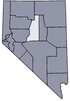
*
Elko County, Nevada - north
*Eureka County, Nevada - east
*Nye County, Nevada - south
*Churchill County, Nevada - west
*Pershing County, Nevada - west
*Humboldt County, Nevada - northwestDemographics
As of the
census GR|2 of 2000, there were 5,794 people, 2,093 households, and 1,523 families residing in the county. Thepopulation density was 1 people per square mile (0/km²). There were 2,780 housing units at an average density of 0 per square mile (0/km²). The racial makeup of the county was 84.41% White, 0.21% Black or African American, 3.99% Native American, 0.35% Asian, 0.03% Pacific Islander, 8.66% from other races, and 2.35% from two or more races. 18.52% of the population were Hispanic or Latino of any race.There were 2,093 households out of which 39.70% had children under the age of 18 living with them, 59.70% were married couples living together, 8.10% had a female householder with no husband present, and 27.20% were non-families. 22.30% of all households were made up of individuals and 5.00% had someone living alone who was 65 years of age or older. The average household size was 2.73 and the average family size was 3.23.
In the county the population was spread out with 32.20% under the age of 18, 6.80% from 18 to 24, 29.00% from 25 to 44, 25.00% from 45 to 64, and 7.00% who were 65 years of age or older. The median age was 34 years. For every 100 females there were 105.50 males. For every 100 females age 18 and over, there were 105.50 males.
The median income for a household in the county was $46,067, and the median income for a family was $51,538. Males had a median income of $45,375 versus $22,197 for females. The
per capita income for the county was $16,998. About 8.60% of families and 12.50% of the population were below thepoverty line , including 13.50% of those under age 18 and 12.90% of those age 65 or over.Unincorporated communities
*Austin 2004 population 340.
*Battle Mountain 2006 population 3,779.
*Galena Population 10.
*Kingston 2005 population 288.
*Pittsburg
*RixieReferences
Further reading
*Theodore, T.G. and G.M. Jones. (1992). "Geochemistry and geology of gold in jasperoid, Elephant Head area, Lander County, Nevada" [U.S. Geological Survey Bulletin 2009] . Washington, D.C.: U.S. Department of the Interior, U.S. Geological Survey.
External links
* [http://www.landercounty.org Lander County website]
* [http://www.shopbattlemountain.com Battle Mountain Chamber of Commerce]
* [http://www.austinnevada.com Greater Austin Chamber of Commerce]
* [http://www.elkocountylibrary.org/austin.htm Austin Branch Library]
* [http://www.elkocountylibrary.org/battle.htm Battle Mountain Branch Library]
Wikimedia Foundation. 2010.