- New Eltham
-
Coordinates: 51°26′16″N 0°04′13″E / 51.43770°N 0.07037°E
New Eltham 
 New Eltham
New Eltham shown within Greater LondonOS grid reference TQ440730 London borough Greenwich Ceremonial county Greater London Region London Country England Sovereign state United Kingdom Post town LONDON Postcode district SE9 Dialling code 020 Police Metropolitan Fire London Ambulance London EU Parliament London UK Parliament Eltham London Assembly Greenwich and Lewisham List of places: UK • England • London New Eltham is a commuter suburb in the London Borough of Greenwich, England, although the Dulverton catchment area to the North side of Footscray Road falls within the London Borough of Bexley.
The crossroads around the railway station are the hub of the area, with the library, post office and other shops along Footscray and Avery Hill Roads providing the area's amenities.
Neighbouring the area south west at the end of Green Lane is Chislehurst, with Eltham and Sidcup at either ends of Footscray Road.
Contents
History
New Eltham grew up as a suburb of farmland to the south of Eltham in and around the small hamlet and crossroads of Pope's Street.
The railway station was opened in 1878 as "Pope Street", and acted as a catalyst for growth. Less than a decade later in 1886, the station officially became known as "New Eltham". The redevelopment of land into housing had spread southwards from Eltham, the Pope Street area being rechristened as a new extension. On the main building of Wyborne School (Footscray Road) there is a sign, clearly identifying it as "Pope Street" School, built in 1904.
As part of the Cold War Civil defence, a rectangular windowless blockhouse was built in 1954 behind New Eltham library. It served as the Woolwich Borough Control and when Woolwich merged with Greenwich in 1965 it took over the role as the Greenwich Borough Control. The control was part of the South East London Group reporting to the Regional Group War HQ at Chislehurst and later to Pear Tree House. Further information about the bunker can be found in the Subterranea Britannica, see the External Links section below.
Until the mid 1970's New Eltham had 3 butchers, 2 greengrocers, 3 grocers, 2 toy shops, a shoe repairer, 2 barbers, a radio and television repair shop, a clothing and material store, timber yard, cycle sales and repairs, 2 motor spares, hardware store, 2 dairys and a fishmongers. What is now The Co-operative supermarket was actually composed of smaller separate purpose shops (all CO-OP). From the station end, was a greengrocers, a chemist, butchers then the co-op grocery store. There was a fishmongers that later became a fish and chip shop (and still is as of 2008). Behind this, in what is now the car park was the CO-OP dairy, the other (Unigate) was in Green Lane near Fiveways in what is now a small business park.
In 1974 the bridge (crossing the railway line) at Avery Hill Road was widened to allow buses to cross it. This replaced a narrow iron bridge which only had a separate path on one side for pedestrians.
There has not been any major developments or sprawl in the area. Extra housing has been built where factories were closed and demolished, notably in Hainault Street and more recently on the site of the Stanley factory at the junction of Avery Hill and Lannoy Road.
Sport and recreation
New Eltham Joggers is a running club based in the area. They claim to be the friendliest group of runners in the South East, and take part in many events wearing their distinctive green shirts. They have a website where full details of upcoming events and training are available. See external links below.
New Eltham Operatic Society is a member of the National Operatic and Dramatic Association. As well as organising regular social events, they present one major production each year in April and one Autumn Concert, generally in September. See external links section below for a link to the society website for further details.
Footscray RUFC is located on Footscray Road - a rugby club that proudly follows rugby traditions. The club is better known for its reputation off the pitch rather than its playing prowess. The Footscray 7s is a highly competitive annual Rugby 7s tournament held at the club on the first Saturday in May. The tournament attracts entries from across the country.
Newpark FC play in the South London Alliance Division 3 and are currently holders of the Beckenham Hospital Cup. Several other local football clubs and the League One side Charlton Athletic have their training ground in New Eltham, down Sparrows Lane.
RACS Cricket Club are based in the area.
New Eltham also consists of two football teams of the same name in different competitive leagues, one of those play in the London & Kent Borders League and are based at the STC Ground on Ivor Grove on Sunday mornings. The team has two published authors, Andrew Muckle and Daniel Harrison, who both live in New Eltham, wrote Don't Drink the Water a travel diary charting their exploits whilst Inter-railing around Western Europe. The other New Eltham play in the Woolwich & Eltham League, based at the London girls football club on Southwood Road who play on a Sunday morning.
Amenities
Near the Railway station is the Library, the Co-operative Food Store, a cluster of small shops and restaurants and the Post Office. Larger chain stores may be found in nearby Eltham High Street and the larger shopping areas of Bromley and Bluewater are a short drive away. Dance classes are held above the Co-op store and a public house opposite was refurbished during 2009. It offers a limited range of food and drinks.
Education
- For education in the portion of New Eltham in Greenwich, see the main London Borough of Greenwich article
Neighbouring areas
- Chislehurst
- Eltham
- Mottingham
- Sidcup
Railway stations
Frequent services from New Eltham railway station operate to London Bridge, Waterloo East, Charing Cross & Cannon Street terminals in Central London. Journey times average around 20 minutes. Connections are also made with Lewisham Station (10 minutes) where Docklands Light Railway services operate to the Docklands commercial district.
The following stations are adjacent stops on the line to Charing Cross and Cannon Street stations in London known locally as the Dartford Loop.
- Mottingham railway station distance: 1 mile
- Sidcup railway station distance: 1.5 miles
The following stations are adjacent stops on the line to Charing Cross and Cannon Street stations in London known locally as the Bexleyheath Line.
- Eltham railway station distance: 1.5 miles
- Falconwood railway station distance: 1.5 miles
External links
- Community Association of New Eltham
- New Eltham Residents Association
- New Eltham Operatic Society
- Dominic Drive Residents Association
- New Eltham Joggers
- The Green Chain
- Suburbia in Focus
- Kent Rail - New Eltham
- This is New Eltham
- Subterranea Britannica - New Eltham
- As featured in Hidden London book
- Let's move to Eltham - article in the Guardian
London Borough of Greenwich Districts Abbey Wood · Blackheath · Charlton · Deptford · Eltham · Greenwich · Kidbrooke · Mottingham · New Eltham · Plumstead · Shooter's Hill · Thamesmead · Westcombe Park · Woolwich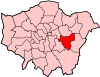
Attractions The O2 arena (formerly the Millennium Dome) · The Royal Artillery Museum · Cutty Sark · National Maritime Museum · Eltham Palace · Greenwich Hospital · Royal ObservatoryStreet markets Parks and open spaces Bostall Heath and WoodsConstituencies Other topics People · Public art · SchoolsLondon Borough of Bexley Districts Abbey Wood · Albany Park · Barnehurst · Barnes Cray · Belvedere · Bexley · Bexleyheath · Blackfen · Crayford · Crook Log · Crossness · East Wickham · Erith · Falconwood · Foots Cray · Lamorbey · Lessness Heath · Longlands · North Cray · Northumberland Heath · Sidcup · Slade Green · Thamesmead · Upton · Welling · West Heath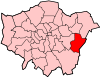
Attractions Parks and open spaces Lesnes Abbey WoodsConstituencies Other topics People · Public art · SchoolsCategories:- Districts of London
- Districts of Greenwich
- Districts of Bexley


Wikimedia Foundation. 2010.