- Oregon Coast Trail
-
Oregon Coast Trail 
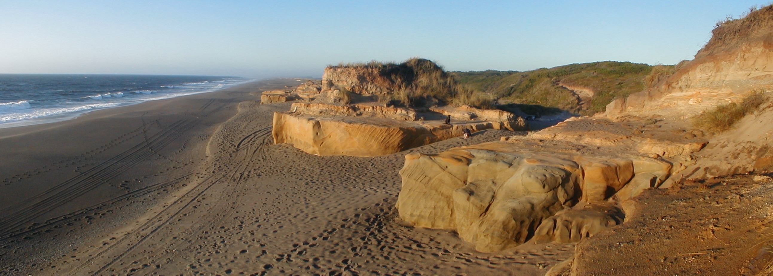
The Oregon Coast Trail at Floras Lake, looking north to the BLM's New River Area of Critical Environmental Concern (ACEC) Length 425 mi (684 km) Location Pacific Ocean coast of Oregon, USA Trailheads Mouth of the Columbia River/California border Use Hiking Trail difficulty Easy to moderate The Oregon Coast Trail is a long-distance hiking route along the Pacific coast of Oregon in the United States. It follows the coast of Oregon from the mouth of the Columbia River to the California border south of Brookings.[1]
The trail was created by Oregon Recreation Trails Advisory Council and managed by the Oregon Parks and Recreation Department as part of the state park system of Oregon.[1] The walking length of the trail varies depending on choice of passage across or around estuaries and rivers along the route. If a ferry is not arranged or available, an alternate route around the estuary must be taken; if traveling on foot, this means road walking. The length of the trail, using the Gmaps Pedometer tool to measure route mileage, is approximately 425 miles (680 km) if no ferries are used, though the official coastal guide gives a length of 382 miles (615 km). If no ferries are used, about 39% of the route is on the beach, 41% is on paved road, and 20% is on trail and dirt roads.
A chief feature of the trail are the public beaches created by 1967's Oregon Beach Bill which formalized the public nature of the coastal beaches since the first such law was passed in 1913.[2] Many of the locations, particularly on the southern portion, are remote and isolated. The Oregon coast is bordered by a temperate rainforest,[3]much of which is now second or third growth.
The difficulty of the trail ranges from easy to moderate, with elevation changes of up to a few hundred feet.[4]
Contents
Route
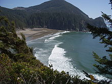
 Oregon Coast Trail crossing over a headland in Samuel H. Boardman State Park
The northern trailhead is at the base of the south jetty of the Columbia River, approximately 4 miles (6 km) north of the campground of Fort Stevens State Park and about 13 miles (21 km) from the city of Astoria. The trail runs north-south along the entire Oregon Coast, following the shore as closely as practical. For many portions of the route, it is beach walking, mostly on sand. In populated areas it often follows the nearest street to the shore. Many parts of the trail leave the beach and take an inland path, usually where land formations make the shoreline impassable, such as at Cape Kiwanda. Some of the rocky headlands are passable on foot at beach level only at low tide. Other headlands are traversed by state park or forest service trails well above the sea. In many other places, the road is the only feasible route, mostly U.S. Route 101. The southern terminus of the trail is the unmarked Oregon/California border on a stretch of beach about 5 miles (8.0 km) south of Brookings, and about half a mile south of the Winchuck River.
Besides headlands, there are numerous rivers and creeks which must be crossed. Most creeks are forded by wading, although sometimes the water can be waist deep even at low tide. At high tide, some are hazardous or impossible to cross and require a boat or a detour to a bridge. Rainfall during winter and early spring decreases the number of streams which are safely fordable.
Trail Walking Information
A dedicated guidebook for the OCT has not has been published. In 2009, the State of Oregon posted a set of downloadable maps with brief route descriptions. Local Oregon hiking guidebooks have good descriptions of portions of the route, particularly for the trail segments. Updated route guides are published on a discussion group.[5] A recently published descriptive trail guide can be accessed in the Links at the bottom of the page. The Oregon Coast Trail is a described route and not a continuous trail. More than 150 miles (240 km) of the route is on pavement. The OCT is very poorly signed throughout its length, however it is difficult to become lost since the route is never more than a few miles from a paved road.
The trail is open to hikers, and in some places, to bicycles, and equestrians. As portions of the route lead around headlands or cross river mouths that are only passable at low tide, carrying a current tide table and relevant topographic information can be extremely helpful. Sometimes a hiker must choose between waiting for a lower tide or walking inland to avoid high water.
Many state campgrounds have areas dedicated for hikers and bicyclists at reduced prices. Beach camping is free but only where out of sight of residences and not adjacent to state parks. This limits camping on some areas of the trail to developed campgrounds. The State of Oregon has stated its intention to create more primitive and free camping areas.
The State of Oregon allows the public to use vehicles on some beaches. Dune buggies are used extensively in the Oregon Dunes National Recreation Area, a 40-mile (64 km) stretch of beach from Florence to Coos Bay.
Several portions of the trail are pristine and secluded, such as the segment from Bandon to Port Orford, where several days of relative solitude and free camping exist.
Prevailing winds are from the northwest which makes the trail easier to hike from north to south. Route descriptions are also written assuming a north to south direction of travel.
Cities and towns of various sizes are located along Highway 101 every twenty to twenty-five miles permitting reprovisioning on a regular basis. Public transportation is extremely limited along the coast.
Points of interest
 The sand beach at Oswald West State Park's Smuggler Cove seen from the Oregon Coast Trail
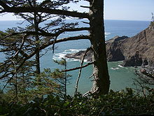 Headlands visible from Oregon Coast Trail north of Cape Falcon within Oswald West State Park
Places found along the OCT from north to south.
- Fort Stevens State Park
- Gearhart, at the mouth of the Necanicum River
- Seaside
- Tillamook Head
- Ecola State Park
- Cannon Beach
- Oswald West State Park
- Manzanita
- Nehalem and Nehalem Bay State Park
- Garibaldi
- Tillamook Bay
- Tillamook
- Cape Meares State Park
- Oceanside
- Netarts
- Cape Lookout and Cape Lookout State Park
- Neskowin
- Lincoln City
- Depoe Bay
- Devils Punch Bowl State Natural Area
- Beverly Beach State Park
- Newport
- South Beach State Park
- Ona Beach State Park
- Seal Rock State Recreation Site
- Waldport
- Yachats
- Neptune State Scenic Viewpoint
- Carl G. Washburne Memorial State Park
- Heceta Head Light
- Jessie M. Honeyman Memorial State Park
- Oregon Dunes National Recreation Area
- Reedsport
- Umpqua Lighthouse State Park
- Coos Bay
- Bullards Beach State Park
- BLM primitive campground, at the New River ACEC
- Boice Cope Park, a Curry County campground at Floras Lake
- Cape Blanco and Cape Blanco State Park
- Humbug Mountain State Park
- Gold Beach
- Samuel Boardman State Park
- Harris Beach State Park
- Brookings
See also
References
- ^ a b "Oregon Coast Trail Maps". Oregon Parks and Recreation Department. http://www.oregon.gov/OPRD/PARKS/OCT_main.shtml. Retrieved 2009-05-14.
- ^ Greg Johnston (June 19, 2003). "The Oregon shore is blessed with beauty". Seattle Post-Intelligencer. http://www.seattlepi.com/getaways/127182_oregoncoast19.html. Retrieved 2009-03-02.
- ^ "The Oregon Coast". Oregon Travel Regions. Go Northwest. http://www.gonorthwest.com/Oregon/coast/Oregon_Coast.htm. Retrieved 2009-03-02.
- ^ Nancy Prichard (May 9, 2001). "Oregon Coast Trail". Great Outdoors. http://www.greatoutdoors.com/published/oregon-coast-trail. Retrieved 2009-03-02.
- ^ The route guide is published in the Yahoo! Groups moderated subscription group OregonCoastTrail; look under files for OCT.xlss, a spreadsheet describing segments of the route.
External links
- OCT Trail logs and other information
- Oregon tide tables for current year published by Oregon State Parks
- Henderson OCT page Descriptive trail guide.
Categories:- Transportation in Clatsop County, Oregon
- Transportation in Coos County, Oregon
- Transportation in Curry County, Oregon
- Transportation in Douglas County, Oregon
- Transportation in Lane County, Oregon
- Transportation in Lincoln County, Oregon
- Transportation in Tillamook County, Oregon
- Parks in Clatsop County, Oregon
- Parks in Coos County, Oregon
- Parks in Curry County, Oregon
- Parks in Douglas County, Oregon
- Parks in Lane County, Oregon
- Parks in Lincoln County, Oregon
- Parks in Tillamook County, Oregon
- Oregon state parks
- Oregon Coast
- Hiking trails in Oregon
- Long-distance trails in the United States


Wikimedia Foundation. 2010.