- Dixonville, Pennsylvania
-
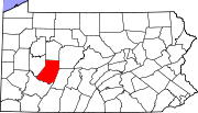
Dixonville is a census-designated place (CDP) in Indiana County, Pennsylvania, United States. The population was 450 at the 2000 census. The CDP lies mostly on the western edge of Green Township, though a small portion extends into Rayne Township.
Geography
Dixonville is located at 40°43′03″N 79°00′25″W / 40.717399°N 79.006883°WCoordinates: 40°43′03″N 79°00′25″W / 40.717399°N 79.006883°W (40.717399, -79.006883).[1]
According to the United States Census Bureau, the CDP has a total area of 0.9 square miles (2.3 km2), all of it land.
Demographics
As of the census[2] of 2000, there were 450 people, 176 households, and 124 families residing in the CDP. The population density was 509.4 people per square mile (197.4/km2). There were 195 housing units at an average density of 220.7/sq mi (85.6/km2). The racial makeup of the CDP was 99.11% White, and 0.89% from two or more races. Hispanic or Latino of any race were 1.33% of the population.
There were 176 households out of which 35.2% had children under the age of 18 living with them, 53.4% were married couples living together, 11.4% had a female householder with no husband present, and 29.5% were non-families. 25.0% of all households were made up of individuals and 13.6% had someone living alone who was 65 years of age or older. The average household size was 2.56 and the average family size was 3.09.
In the CDP the population was spread out with 25.6% under the age of 18, 7.3% from 18 to 24, 32.0% from 25 to 44, 19.6% from 45 to 64, and 15.6% who were 65 years of age or older. The median age was 37 years. For every 100 females there were 92.3 males. For every 100 females age 18 and over, there were 95.9 males.
The median income for a household in the town was $32,961, and the median income for a family was $36,827. Males had a median income of $27,969 versus $17,632 for females. The per capita income for the CDP was $14,785. None of the families and 3.1% of the population were living below the poverty line, including no under eighteens and 6.7% of those over 64.
References
- ^ "US Gazetteer files: 2010, 2000, and 1990". United States Census Bureau. 2011-02-12. http://www.census.gov/geo/www/gazetteer/gazette.html. Retrieved 2011-04-23.
- ^ "American FactFinder". United States Census Bureau. http://factfinder.census.gov. Retrieved 2008-01-31.
Municipalities and communities of Indiana County, Pennsylvania Boroughs Armagh | Blairsville | Cherry Tree | Clymer | Creekside | Ernest | Glen Campbell | Homer City | Indiana | Marion Center | Plumville | Saltsburg | Shelocta | Smicksburg
Townships Armstrong | Banks | Black Lick | Brush Valley | Buffington | Burrell | Canoe | Center | Cherryhill | Conemaugh | East Mahoning | East Wheatfield | Grant | Green | Montgomery | North Mahoning | Pine | Rayne | South Mahoning | Washington | West Mahoning | West Wheatfield | White | Young
CDPs Black Lick | Chevy Chase Heights | Commodore | Dixonville | Heilwood | Jacksonville | Lucerne Mines | Rossiter
Unincorporated
communitiesClarksburg | Home | Sesha Loop | Wehrum | West Lebanon
Categories:- Census-designated places in Indiana County, Pennsylvania

Wikimedia Foundation. 2010.