Beba Veche

Beba Veche
Beba Veche
—  Commune  —
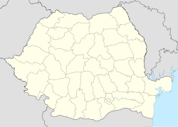
Beba Veche is located in Romania
Beba Veche
Coordinates: 46°8′N 20°19′E / 46.133°N 20.317°E / 46.133; 20.317
Country  Romania
County Timiş County
Population (2002)[1] 1,600
Time zone EET (UTC+2)
 – Summer (DST) EEST (UTC+3)

Beba Veche is a commune in Timiş County, Romania. It is composed of three villages: Beba Veche, Cherestur and Pordeanu.

It is located in the west of the county, at Romanian border with Serbia and Hungary.

Demography

Census[2] Ethnicity
Year Population Romanians Hungarians Germans Gypsies Others
1880 4,576 1,838 2,212 507  ? 19
1910 4,182 1,854 1,819 417  ? 92
1941 3,655 1,452 1,721 351  ? 131
1977 2,142 988 985 90 41 38
1992 1,625 898 640 19 47 21
2002 1,603 976 573 19 30 4

References

Coordinates: 46°08′N 20°19′E / 46.133°N 20.317°E / 46.133; 20.317


Wikimedia Foundation. 2010.

Игры ⚽ Поможем сделать НИР

Look at other dictionaries:

  • Beba Veche — Altbeba Óbéba Hilfe zu Wappen …   Deutsch Wikipedia

  • Beba Veche — Original name in latin Beba Veche Name in other language Alt Beba, Beba, Beba Veche, Mala Beba, Obeb, Stara Beba, bb State code RO Continent/City Europe/Bucharest longitude 46.13333 latitude 20.31667 altitude 75 Population 1586 Date 2012 06 12 …   Cities with a population over 1000 database

  • Comuna Beba Veche — Admin ASC 2 Code Orig. name Comuna Beba Veche Country and Admin Code RO.36.155724 RO …   World countries Adminstrative division ASC I-II

  • Besenova Veche — Dudeştii Vechi Altbeschenowa Óbesenyő Stár Bišnov …   Deutsch Wikipedia

  • Geography of Romania — With an area of 238,391 square kilometers, Romania is the twelfth largest country in Europe. Situated in the northeastern portion of the Balkan Peninsula, the country is halfway between the equator and the North Pole and equidistant from the… …   Wikipedia

  • Extreme points of Romania — This is a list of the extreme points of Romania, the points that are farther north, south, east or west than any other location.Latitude and longitude*Northernmost point: Horodiştea, a village in Botoşani County, on the border with Ukraine,… …   Wikipedia

  • Geographie Rumäniens — Lage Rumäniens in der Europäischen Union Rumänien ist ein Land im Südosten Europas. Es nimmt unter anderem Teile der Karpaten und der ausgedehnten Tiefebenen am Unterlauf der Donau ein. Inhaltsverzeichnis …   Deutsch Wikipedia

  • Dudeştii Vechi — Stár Bišnov   Commune   Coat of arms …   Wikipedia

  • Sânandrei —   Commune   …   Wikipedia

  • Moşniţa Nouă —   Commune   …   Wikipedia

Share the article and excerpts

Direct link
Do a right-click on the link above
and select “Copy Link”