- Lanett, Alabama
Infobox Settlement
official_name = Lanett, Alabama
settlement_type =City
imagesize =
image_caption =
image_
imagesize =
image_caption =
image_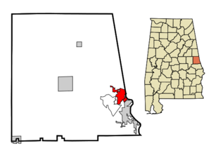
mapsize = 250px
map_caption = Location in Chambers County and the state ofAlabama
mapsize1 =
map_caption1 =
subdivision_type = Country
subdivision_type1 = State
subdivision_type2 = County
subdivision_name =United States
subdivision_name1 =Alabama
subdivision_name2 = Chambers
government_type =
leader_title = Mayor
leader_name = Oscar Crawley
established_date =
area_magnitude =
area_total_km2 = 14
area_total_sq_mi = 5.4
area_land_km2 = 14
area_land_sq_mi = 5.4
area_water_km2 = 0
area_water_sq_mi = 0
elevation_ft = 591
elevation_m = 180
population_as_of = 2000
population_footnotes =
population_total = 7897
population_metro =
population_density_km2 = 564.1
population_density_sq_mi = 1462.4
timezone = Eastern (EST)
utc_offset = -6
latd = 32 |latm = 51 |lats = 48 |latNS = N
longd = 85 |longm = 11 |longs = 59 |longEW = W
timezone_DST = CDT
utc_offset_DST = -5
postal_code_type =ZIP code
postal_code = 36863
area_code = 334
blank_name = FIPS code
blank_info = 01-41296
blank1_name = GNIS feature ID
blank1_info = 0151988
footnotes =
website =Lanett is a city in Chambers County,
Alabama ,United States . At the 2000 census the population was 7,897. Lanett is located in eastern Alabama, on theChattahoochee River , northeast of Montgomery. One of the major industries iscotton mill ing. The city's name is derived from Lanier and Bennett, founders of the West Point Pepperell Co.Geography
Lanett is located at 32°51'48.326" North, 85°11'58.862" West (32.863424, -85.199684)GR|1.
According to the
U.S. Census Bureau , the city has a total area of 5.4square mile s (14.0km² ), all of it land.Demographics
As of the
census GR|2 of 2000, there were 7,897 people, 3,186 households, and 2,125 families residing in the city. Thepopulation density was 1,463.6 people per square mile (564.6/km²). There were 3,589 housing units at an average density of 665.2/sq mi (256.6/km²). The racial makeup of the city was 53.58% Black or African American, 45.36% White, 0.11% Native American, 0.22% Asian, 0.10% from other races, and 0.63% from two or more races. 0.80% of the population were Hispanic or Latino of any race.There were 3,186 households out of which 28.2% had children under the age of 18 living with them, 40.1% were married couples living together, 22.1% had a female householder with no husband present, and 33.3% were non-families. 30.4% of all households were made up of individuals and 14.8% had someone living alone who was 65 years of age or older. The average household size was 2.46 and the average family size was 3.06.
In the city the population was spread out with 25.9% under the age of 18, 8.7% from 18 to 24, 25.0% from 25 to 44, 22.2% from 45 to 64, and 18.1% who were 65 years of age or older. The median age was 37 years. For every 100 females there were 83.8 males. For every 100 females age 18 and over, there were 77.5 males.
The median income for a household in the city was $26,197, and the median income for a family was $36,481. Males had a median income of $28,066 versus $22,101 for females. The
per capita income for the city was $15,614. About 17.8% of families and 20.7% of the population were below thepoverty line , including 25.9% of those under age 18 and 19.3% of those age 65 or over.References
External links
* [http://www.cityoflanett.com City website]
Wikimedia Foundation. 2010.