- Pinson, Alabama
Infobox Settlement
official_name = Pinson, Alabama
settlement_type = CDP
imagesize =
image_caption =
image_
imagesize =
image_caption =
image_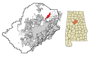
mapsize = 250px
map_caption = Location in Jefferson County and the state ofAlabama
mapsize1 =
map_caption1 =
subdivision_type = Country
subdivision_type1 = State
subdivision_type2 = County
subdivision_name =United States
subdivision_name1 =Alabama
subdivision_name2 = Jefferson
government_type =
leader_title =
leader_name =
established_date =
area_magnitude =
area_total_km2 = 18.2
area_total_sq_mi = 7
area_land_km2 = 18.1
area_land_sq_mi = 7
area_water_km2 = 0.1
area_water_sq_mi = 0
elevation_ft = 620
elevation_m = 189
population_as_of = 2000
population_footnotes =
population_total = 5033
population_metro =
population_density_km2 = 276.5
population_density_sq_mi = 719
timezone = Central (CST)
utc_offset = -6
latd = 33 |latm = 41 |lats = 10 |latNS = N
longd = 86 |longm = 40 |longs = 54 |longEW = W
timezone_DST = CDT
utc_offset_DST = -5
postal_code_type =ZIP code
postal_code = 35126
area_code = 205
blank_name = FIPS code
blank_info = 01-60648
blank1_name = GNIS feature ID
blank1_info = 0152950
footnotes =
website =Pinson is a
city and a northeast suburb of Birmingham in Jefferson County,Alabama ,United States . At the 2000 census, the population was 5,033.Geography
Pinson is located at coor dms|33|41|11|N|86|40|55|W|city (33.686301, -86.681913)GR|1.
According to the
U.S. Census Bureau , the community has a total area of 7.0square mile s (18.2km² ), of which, 7.0 square miles (18.1 km²) of it is land and 0.04 square miles (0.1 km²) of it (0.43%) is water.Its also home to Turkey Creek.Demographics
As of the
census GR|2 of 2000, there were 5,033 people, 1,853 households, and 1,450 families residing in the community. Thepopulation density was 721.2 people per square mile (278.4/km²). There were 1,953 housing units at an average density of 279.8/sq mi (108.0/km²). The racial makeup of the community was 89.85% White, 8.33% Black or African American, 0.32% Native American, 0.40% Asian, 0.02% Pacific Islander, 0.34% from other races, and 0.76% from two or more races. 2.27% of the population were Hispanic or Latino of any race.There were 1,853 households out of which 41.4% had children under the age of 18 living with them, 59.8% were married couples living together, 15.3% had a female householder with no husband present, and 21.7% were non-families. 19.0% of all households were made up of individuals and 6.3% had someone living alone who was 65 years of age or older. The average household size was 2.71 and the average family size was 3.08.
In the community the population was spread out with 28.3% under the age of 18, 9.7% from 18 to 24, 31.7% from 25 to 44, 20.6% from 45 to 64, and 9.8% who were 65 years of age or older. The median age was 33 years. For every 100 females there were 93.5 males. For every 100 females age 18 and over, there were 88.8 males.
The median income for a household in the community was $39,583, and the median income for a family was $48,707. Males had a median income of $33,843 versus $25,112 for females. The
per capita income for the community was $17,704. About 8.6% of families and 10.3% of the population were below thepoverty line , including 12.2% of those under age 18 and 10.9% of those age 65 or over.chools
Pinson Valley High School- Located on Highway 75 in Pinson. Grades 9-12.
Rudd Middle School- Grades 6-8.
Kermit Johnson Elementary- Grades 3-5.
Pinson Elementary School- Grades k-2.Notable residents/former residents
Melinda Gunter (Toole)-Former
Miss Alabama
Adam Pinson-contestant and finalist onJeopardy College Tournmant (UAB )
Samantha Francis-contestant onAmerica's Next Top Model
Terry Jones-Former outfielder for theMontreal Expos andColorado Rockies References
External links
* [http://www.thecityofpinson.com/ City of Pinson Official website]
* [http://www.thepinsonnews.com/ The Pinson News]
*Mapit-US-cityscale|33.686301|-86.681913
Wikimedia Foundation. 2010.