- Springerville, Arizona
Infobox Settlement
official_name = Springerville, Arizona
settlement_type =Town
imagesize =
image_caption =
image_
imagesize =
image_caption =
image_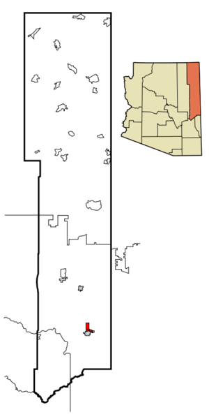
mapsize = 250x250px
map_caption = Location inApache County and the state ofArizona
mapsize1 =
map_caption1 =
subdivision_type = Country
subdivision_type1 = State
subdivision_type2 = County
subdivision_name =United States
subdivision_name1 =Arizona
subdivision_name2 = Apache
government_type =
leader_title = Mayor
leader_name = Kay Dyson
established_date =
area_magnitude =
area_total_km2 = 30.3
area_total_sq_mi = 11.7
area_land_km2 = 29.9
area_land_sq_mi = 11.5
area_water_km2 = 0.4
area_water_sq_mi = 0.1
elevation_ft = 6967
elevation_m = 2124
population_as_of = 2007
population_footnotes =cite web|url=http://www.census.gov/popest/cities/tables/SUB-EST2007-04-04.csv|title=Annual Estimates of the Population for Incorporated Places in Arizona|publisher=United States Census Bureau |date=2008-07-10|accessdate=2008-07-14]
population_total = 1980
population_metro =
population_density_km2 = 65.9
population_density_sq_mi = 170.8
timezone = MST
utc_offset = -7
latd = 34 |latm = 8 |lats = 11 |latNS = N
longd = 109 |longm = 16 |longs = 45 |longEW = W
timezone_DST =
utc_offset_DST =
postal_code_type =ZIP code
postal_code = 85938
area_code = 928
GNIS_id = 34747
blank_name = FIPS code
blank_info = 04-68990
blank1_name =
blank1_info =
footnotes =
website = http://www.springerville.com/Springerville is a town in Apache County,
Arizona ,United States within the White Mountains. Its postalZIP Code is 85938. According to 2006 Census Bureau estimates, the population of the town is 1,956.cite web | date =June 21 2006 | url = http://www.census.gov/popest/cities/tables/SUB-EST2005-04-04.csv | title = Annual Estimates of the Population for All Incorporated Places in Arizona | format = CSV | work = 2005 Population Estimates | publisher = U.S. Census Bureau, Population Division | accessmonthday = November 15 | accessyear = 2006]The town growing around Henry Springer's trading post was officially given its name
May 10 ,1876 [http://www.roundvalleyaz.com/page1.html] . Before that time it had gone by names such as Colorado Chiquito, Milligan Settlement, and Valle Redondo (Round Valley). It was incorporated in1948 . Springerville sits at an elevation of 6,974 feet. Along with its neighbor Eagar, both communities make up the place known as Round Valley which is in the northeastern part of Arizona close to theNew Mexico border.Geography
Springerville is located at coor dms|34|8|11|N|109|16|45|W|city (34.136342, -109.279227)GR|1.
According to the
United States Census Bureau , the town has a total area of 11.7square mile s (30.3km² ), of which, 11.6 square miles (29.9 km²) of it is land and 0.1 square miles (0.4 km²) of it (1.20%) is water.Demographics
As of the
census GR|2 of 2000, there were 1,972 people, 753 households, and 499 families residing in the town. Thepopulation density was 170.8 people per square mile (65.9/km²). There were 896 housing units at an average density of 77.6/sq mi (30.0/km²). The racial makeup of the town was 79.46% White, 0.20% Black or African American, 6.54% Native American, 0.41% Asian, 0.10% Pacific Islander, 10.24% from other races, and 3.04% from two or more races. 25.20% of the population were Hispanic or Latino of any race.There were 753 households out of which 34.3% had children under the age of 18 living with them, 50.6% were married couples living together, 11.2% had a female householder with no husband present, and 33.7% were non-families. 30.1% of all households were made up of individuals and 14.7% had someone living alone who was 65 years of age or older. The average household size was 2.55 and the average family size was 3.18.
In the town the population was spread out with 29.2% under the age of 18, 7.6% from 18 to 24, 25.2% from 25 to 44, 23.4% from 45 to 64, and 14.6% who were 65 years of age or older. The median age was 37 years. For every 100 females there were 94.9 males. For every 100 females age 18 and over, there were 88.4 males.
The median income for a household in the town was $30,769, and the median income for a family was $36,331. Males had a median income of $32,313 versus $19,519 for females. The
per capita income for the town was $13,830. About 14.7% of families and 21.0% of the population were below thepoverty line , including 25.4% of those under age 18 and 26.1% of those age 65 or over.Education
The town is served by the
Round Valley Unified School District . The school's mascot is theelk and its school colors areBlack andGold . The St. JohnsRedskin s are the school's biggest rival.Round Valley Primary School is located in the town and serves the town.
Round Valley Intermediate School, Round Valley Middle School, and
Round Valley High School serve the town are in nearby Eagar. In addition, White Mountain Academy, a K-12 charter school, is located in Eagar.The high school's football stadium, The Round Valley Ensphere located in Eagar, is the eighth biggest
geodesic dome in theworld with a diameter of 440 feet / 134 m. The school board voted to give the Dome a pinkish looking color, and it was completed in1992 . It was used as a shelter for evacuees from theRodeo-Chediski fire in2002 . Round Valley is the only high school in the world to have a domed stadium.The first Springerville School House was dedicated
September 3 ,1884 .In
1969 -- the Springerville, Eagar, Vernon, Nutrioso, Greer, and Colter Schools consolidated with each other to form the Round Valley Unified School District.Attractions
Casa Malpais is located near Springerville. It is a nationally recognized archeological site. [http://www.delange.org/CasaMalpais1/CasaMalpais.htm]The name Casa Malpais means House of the Badlands, which was given to the site by early Basque sheepherders who referred to the surrounding volcanic lava field as "badlands." The
Springerville volcanic field contains over 400volcanoes within a fifty mile radius of Springerville, making it the third largest volcanic field in the continentalUnited States .The first visit to Casa Malpais by a professional
anthropologist was in1883 , whenFrank Cushing , an anthropologist living at Zuni, visited a site at "El Valle Redondo on the Colorado Chiquito", and was impressed by what he termed "the fissure typepueblo " he found there. In his journal he sketched dry masonry, bridging fissures, upon which the pueblo is constructed.Unique and unusual features characterize the site. The Great
Kiva , painstakingly constructed of volcanic rock, is the centerpiece. A steepbasalt staircase set into a crevice of the high red cliff wall leads to the top of the mesa.Both the
Hopi andZuni Indian tribes still consider Casa Malpais a sacred ancestral place.The town contains one of the twelve "
Madonna of the Trail " monuments created by sculptorAugust Leimbach . [http://www.route40.net/history/madonnas/az.shtml]The town is close to the
Apache-Sitgreaves National Forest , which runs along theMogollon Rim . It is also close to the Sunrise Ski Resort.Famous residents
*
Mark Gastineau : A former professional football player for theNew York Jets .Trivia
*
Ike Clanton , a major player in the events that led to theGunfight at the O.K. Corral , was shot dead in Springerville by a detective named Jonas V. Brighton for resisting arrest on charges of cattle-rustling onJune 1 1887 . [http://www.roundvalleyaz.com/acc1.html] [http://clantongang.com/oldwest/gangike.html]Quotes
:"I was the one who had Apache county separated from Yavapai. Everything was very high at that time, and I used to haul my goods from Albuquerque to live on. I was hauling goods one time from Henry Springer's store in Albuquerque, and I told Henry Springer he had better come into Round Valley, as it was called then, and put in a store; that the people were coming in and we would name the postoffice and little village after him, Springerville, and that was old Henry Springer. ":——James G. H. Colter from [http://southwest.library.arizona.edu/hav6/body.1_div.14.html History of Arizona, Volume VI]
References
External links
* [http://www.springerville.com/ The Springerville Homepage]
* [http://www.roundvalleyaz.com/ Round Valley History]
* [http://www.topix.net/city/springerville-az Springerville News]
* [http://www.city-data.com/city/Springerville-Arizona.html Springerville Stats]
* [http://www.wmonline.com/cities/rvscenic.htm Springerville Attractions]
Wikimedia Foundation. 2010.