- Tusayan, Arizona
Infobox Settlement
official_name = Tusayan, Arizona
settlement_type = CDP
imagesize =
image_caption =
image_
imagesize =
image_caption =
image_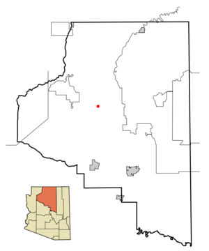
mapsize = 250px
map_caption = Location inCoconino County and the state ofArizona
mapsize1 =
map_caption1 =
subdivision_type = Country
subdivision_type1 = State
subdivision_type2 = County
subdivision_name =United States
subdivision_name1 =Arizona
subdivision_name2 = Coconino
government_type =
leader_title =
leader_name =
established_date =
area_magnitude =
area_total_km2 = 74.1
area_total_sq_mi = 28.6
area_land_km2 = 74.0
area_land_sq_mi = 28.6
area_water_km2 = 0.0
area_water_sq_mi = 0.0
elevation_ft = 6612
elevation_m = 2015
population_as_of = 2000
population_footnotes =
population_total = 562
population_metro =
population_density_km2 = 7.6
population_density_sq_mi = 19.7
timezone = MST
utc_offset = -7
latd = 35 |latm = 58 |lats = 32 |latNS = N
longd = 112 |longm = 7 |longs = 45 |longEW = W
timezone_DST =
utc_offset_DST =
postal_code_type =ZIP code
postal_code = 86023
area_code = 928
blank_name = FIPS code
blank_info = 04-77490
blank1_name = GNIS feature ID
blank1_info = 0042842
footnotes =
website =Tusayan is a
census-designated place (CDP) in Coconino County,Arizona ,United States . Aresort town near the south entrance toGrand Canyon National Park , Tusayan is served byGrand Canyon National Park Airport . The population was 562 at the 2000 census.Geography
Tusayan is located at coor dms|35|58|32|N|112|7|45|W|city (35.975674, -112.129046).GR|1
According to the
United States Census Bureau , the CDP has a total area of 28.6square mile s (74.0km² ), of which, 28.6 square miles (74.0 km²) of it is land and 0.04% is water.Demographics
As of the
census GR|2 of 2000, there were 562 people, 222 households, and 101 families residing in the CDP. Thepopulation density was 19.7 people per square mile (7.6/km²). There were 313 housing units at an average density of 11.0/sq mi (4.2/km²). The racial makeup of the CDP was 69.22% White, 15.84% Native American, 1.07% Black or African American, 11.57% from other races, and 2.31% from two or more races. 30.25% of the population were Hispanic or Latino of any race.There were 222 households out of which 27.0% had children under the age of 18 living with them, 30.2% were married couples living together, 9.0% had a female householder with no husband present, and 54.1% were non-families. 32.9% of all households were made up of individuals and 1.8% had someone living alone who was 65 years of age or older. The average household size was 2.37 and the average family size was 3.38.
In the CDP the population was spread out with 25.4% under the age of 18, 15.5% from 18 to 24, 36.5% from 25 to 44, 20.1% from 45 to 64, and 2.5% who were 65 years of age or older. The median age was 31 years. For every 100 females there were 128.5 males. For every 100 females age 18 and over, there were 125.3 males.
The median income for a household in the CDP was $34,917, and the median income for a family was $45,625. Males had a median income of $28,125 versus $21,250 for females. The
per capita income for the CDP was $16,637. About 14.9% of families and 18.2% of the population were below thepoverty line , including 18.0% of those under age 18 and none of those age 65 or over.Economy
Tusayan is approximately two miles from the south entrance to
Grand Canyon National Park . The town's businesses mainly serve tourists visiting the park. Nearby Grand Canyon National Park Airport mainly supports sightseeing flights, by fixed-wing aircraft as well as helicopters, to the Grand Canyon. The National Geographic Society maintains a visitor center with anImax theater exclusively showingGrand Canyon Movie in Tusayan.Incorporation
The community first explored incorporation in the early 1990s. Legislation passed to allow it, but was challenged and defeated as unconstitutional because it applied only to Tusayan. In 2003, new legislation was passed allowing any community of 500 or more to incorporate if located in proximity to a national park or monument. The Tusayan-Grand Canyon Chamber of Commerce appointed a task force of community leaders who studied the issue for four years. In June 2007, they made a neutral presentation to the community, offering revenue projections and an overview of pros and cons.In April 2008, about 30 voters signed a petition to put the question of incorporation on the Sept. 2, 2008, ballot. Backing the move is a political action committee, Citizens for Tusayan Incorporation Choice, which was formed with backing from Elling Halvorson, who owns numerous businesses in Tusayan including Papillon Helicopters and the Best Western Grand Canyon Squire Inn. Opposing it is "The Price is NOT Right: Say NO to Tusayan Incorporation," backed by Red Feather Lodge.
Source: [http://grandcanyonnews.com/main.asp?SectionID=7&SubSectionID=7&ArticleID=6626] "Grand Canyon News" report of Tusayan Incorporation Study presentation by the Incorporation Task Force, June 18, 2007Source: [http://grandcanyonnews.1upprelaunch.com/main.asp?SectionID=1&SubSectionID=1&ArticleID=7489&TM=68287.1] "Grand Canyon News" report "Incorporation Group Holds Public Meetings," June 25, 2008
References
External links
* [http://www.tusayanhotels.com/grand_canyon_hotel_map_3.htm Map from tusayanhotels.com]
Wikimedia Foundation. 2010.