- Rector, Arkansas
Infobox Settlement
official_name = Rector, Arkansas
settlement_type =City
imagesize =
image_caption =
image_
imagesize =
image_caption =
image_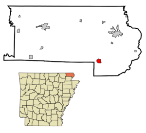
mapsize = 250px
map_caption = Location in Clay County and the state ofArkansas
mapsize1 =
map_caption1 =
subdivision_type = Country
subdivision_type1 = State
subdivision_type2 = County
subdivision_name =United States
subdivision_name1 =Arkansas
subdivision_name2 = Clay
government_type =
leader_title =
leader_name =
established_date =
area_magnitude =
area_total_km2 = 3.4
area_total_sq_mi = 1.3
area_land_km2 = 3.4
area_land_sq_mi = 1.3
area_water_km2 = 0
area_water_sq_mi = 0
elevation_ft = 285
elevation_m = 87
population_as_of = 2000
population_footnotes =
population_total = 2017
population_metro =
population_density_km2 = 593.2
population_density_sq_mi = 1551.5
timezone = Central (CST)
utc_offset = -6
latd = 36 |latm = 15 |lats = 48 |latNS = N
longd = 90 |longm = 17 |longs = 36 |longEW = W
timezone_DST = CDT
utc_offset_DST = -5
postal_code_type =ZIP code
postal_code = 72461
area_code = 870
blank_name = FIPS code
blank_info = 05-58490
blank1_name = GNIS feature ID
blank1_info = 0058468
footnotes =
website =Rector is a city in Clay County,
Arkansas ,United States . The population was 2,017 at the 2000 census.Geography
Rector is located at coor dms|36|15|48|N|90|17|36|W|city (36.263320, -90.293464)GR|1.
According to the
United States Census Bureau , the city has a total area of 1.3square mile s (3.4km² ), all of it land.History
Rector is named after former
Governor Henry Massey Rector .In 1881 the St. Louis and Texas Railroad laid out the town of Rector about two miles to the south of an existing settlement named Scatterville, and the population of Scatterville gradually migrated to the new and booming town.
Demographics
As of the
census GR|2 of 2000, there were 2,017 people, 915 households, and 570 families residing in the city. Thepopulation density was 1,556.9 people per square mile (599.1/km²). There were 1,045 housing units at an average density of 806.6/sq mi (310.4/km²). The racial makeup of the city was 98.26% White, 0.55% Native American, 0.20% Asian, and 0.99% from two or more races. 0.89% of the population were Hispanic or Latino of any race.There were 915 households out of which 25.4% had children under the age of 18 living with them, 48.6% were married couples living together, 10.8% had a female householder with no husband present, and 37.6% were non-families. 35.7% of all households were made up of individuals and 24.8% had someone living alone who was 65 years of age or older. The average household size was 2.20 and the average family size was 2.83.
In the city the population was spread out with 21.7% under the age of 18, 7.3% from 18 to 24, 22.7% from 25 to 44, 23.8% from 45 to 64, and 24.5% who were 65 years of age or older. The median age was 44 years. For every 100 females there were 83.4 males. For every 100 females age 18 and over, there were 76.8 males.
The median income for a household in the city was $21,051, and the median income for a family was $29,330. Males had a median income of $27,650 versus $19,293 for females. The
per capita income for the city was $14,931. About 17.9% of families and 23.9% of the population were below thepoverty line , including 33.3% of those under age 18 and 31.6% of those age 65 or over.Facts
*The Rector School District was known as Clay County Central from 1985 until 2000.
*The Rector Labor Day Picnic is held duringLabor Day weekend each year, serving as a Homecoming for former and current residents. The weekend features a rodeo, a parade, beauty pagents, and is a popular political campaign stop.Notable natives
*Thomas Dale Alford - U.S. Representative (
1959 -1961 )
*Maurice Copeland - actor
*Denver "Bull" Randleman — sergeant in the famed Easy Company,101st Airborne Division .
*Mike Randleman [http://www.imdb.com/name/nm0709835/] - Actor--over 180 appearances on "The Tonight Show with Jay Leno"
*Kenneth Camp - Arkansas House of Representatives (1971-1978)
*W.J. (Jack) Hurst - Arkansas State Senate (1951-1956)
*Cencil M. McNeil - Arkansas State Senate (1961-1968)References
External links
* [http://www.rectorarkansas.com Official City Website]
* [http://www.claycountydemocrat.com Clay County Democrat Newspaper]
Wikimedia Foundation. 2010.