- Lafe, Arkansas
Infobox Settlement
official_name = Lafe, Arkansas
settlement_type =Town
imagesize =
image_caption =
image_
imagesize =
image_caption =
image_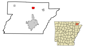
mapsize = 250px
map_caption = Location in Greene County and the state ofArkansas
mapsize1 =
map_caption1 =
subdivision_type = Country
subdivision_type1 = State
subdivision_type2 = County
subdivision_name =United States
subdivision_name1 =Arkansas
subdivision_name2 = Greene
government_type =
leader_title =
leader_name =
established_date =
area_magnitude =
area_total_km2 = 5.4
area_total_sq_mi = 2.1
area_land_km2 = 5.4
area_land_sq_mi = 2.1
area_water_km2 = 0
area_water_sq_mi = 0
elevation_ft = 318
elevation_m = 97
population_as_of = 2000
population_footnotes =
population_total = 385
population_metro =
population_density_km2 = 71.3
population_density_sq_mi = 183.3
timezone = Central (CST)
utc_offset = -6
latd = 36 |latm = 12 |lats = 18 |latNS = N
longd = 90 |longm = 30 |longs = 25 |longEW = W
timezone_DST = CDT
utc_offset_DST = -5
postal_code_type =ZIP code
postal_code = 72436
area_code = 870
blank_name = FIPS code
blank_info = 05-37660
blank1_name = GNIS feature ID
blank1_info = 0077427
footnotes =
website =Lafe is a town in Greene County,
Arkansas onCrowley's Ridge . The population was 385 at the 2000 census.History
The first settler of Lafe was Mr. Herman Toelken, a German immigrant who had been living in
New Haven, Missouri and was seeking new opportunities in an unsettled area. Toelken began cutting railroad ties for the railroad in order to save enough money to purchase land and send for his familyWhen Mr. Toelken was settled he began advertising in a
Minneapolis, Minnesota German newspaper seeking other GermanLutherans to come to the area. Several families responded to this advertisement and an assortment of German immigrant families followed him fromFranklin County, Missouri .On
9 December 1889 an application was made to theUS Postal Service for the establishment of a post office for "Newberry, Arkansas", so named due to a sawmill operator of the same name who had set up in the area. The name "Newberry" was denied by the Postal Service so the postmaster combined the names of his daughters and reapplied with the name "Loulyma" which was accepted. Mail arrived addressed to "Loulyma" and freight arrived addressed to "Newberry". In 1901 a new postmaster named Lafayette Mueller took over and sought to settle the name permanently by resubmitting a new name. Townspeople elected to name the town "Lafe" in honor of the new postmaster and the name was officially changed on21 May 1902 .Geography
Lafe is located at coor dms|36|12|18|N|90|30|25|W|city (36.204987, -90.507041)GR|1.
According to the
United States Census Bureau , the town has a total area of 5.4km² (2.1 mi²), all land.Demographics
As of the
census GR|2 of 2000, there were 385 people, 137 households, and 110 families residing in the town. Thepopulation density was 71.1/km² (184.1/mi²). There were 153 housing units at an average density of 28.3/km² (73.2/mi²). The racial makeup of the town was 89.09% White, 2.34% Native American, and 8.57% from two or more races. 0.78% of the population were Hispanic or Latino of any race.There were 137 households out of which 36.5% had children under the age of 18 living with them, 65.0% were married couples living together, 10.9% had a female householder with no husband present, and 19.0% were non-families. 16.1% of all households were made up of individuals and 7.3% had someone living alone who was 65 years of age or older. The average household size was 2.81 and the average family size was 3.14.
In the town the population was spread out with 27.5% under the age of 18, 9.4% from 18 to 24, 30.9% from 25 to 44, 23.4% from 45 to 64, and 8.8% who were 65 years of age or older. The median age was 34 years. For every 100 females there were 87.8 males. For every 100 females age 18 and over, there were 89.8 males.
The median income for a household in the town was $30,938, and the median income for a family was $32,125. Males had a median income of $25,313 versus $16,667 for females. The
per capita income for the town was $12,234. About 15.0% of families and 17.7% of the population were below thepoverty line , including 22.7% of those under age 18 and 8.6% of those age 65 or over.Facts
Joshua Logan Dantzler currently holds both the Lafe Drinking title and the Lafe Wrestling Title
References
External links
Wikimedia Foundation. 2010.