- West Fork, Arkansas
Infobox Settlement
official_name = West Fork, Arkansas
settlement_type =City
imagesize =
image_caption =
image_
imagesize =
image_caption =
image_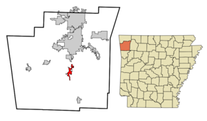
mapsize = 250px
map_caption = Location in Washington County and the state ofArkansas
mapsize1 =
map_caption1 =
subdivision_type = Country
subdivision_type1 = State
subdivision_type2 = County
subdivision_name =United States
subdivision_name1 =Arkansas
subdivision_name2 = Washington
government_type =
leader_title =
leader_name =
established_date =
area_magnitude =
area_total_km2 = 8.6
area_total_sq_mi = 3.3
area_land_km2 = 8.6
area_land_sq_mi = 3.3
area_water_km2 = 0
area_water_sq_mi = 0
elevation_ft = 1342
elevation_m = 409
population_as_of = 2000
population_footnotes =
population_total = 2042
population_metro =
population_density_km2 = 237.4
population_density_sq_mi = 618.8
timezone = Central (CST)
utc_offset = -6
latd = 35 |latm = 55 |lats = 57 |latNS = N
longd = 94 |longm = 10 |longs = 57 |longEW = W
timezone_DST = CDT
utc_offset_DST = -5
postal_code_type =ZIP code
postal_code = 72774
area_code = 479
blank_name = FIPS code
blank_info = 05-74360
blank1_name = GNIS feature ID
blank1_info = 0081903
footnotes =
website =West Fork is a city in Washington County,
Arkansas ,United States . The population is 2,042 at the 2000 census.Geography
West Fork is located at coor dms|35|55|57|N|94|10|57|W|city (35.932618, -94.182539)GR|1.
According to the
United States Census Bureau , the city has a total area of 3.3square mile s (8.6km² ), all of it land.Demographics
As of the
census GR|2 of 2000, there were 2,042 people, 750 households, and 600 families residing in the city. Thepopulation density was 612.8 people per square mile (236.8/km²). There were 800 housing units at an average density of 240.1/sq mi (92.8/km²). The racial makeup of the city was 94.56% White, 0.44% Black or African American, 0.93% Native American, 0.54% Asian, 1.71% from other races, and 1.81% from two or more races. 3.13% of the population were Hispanic or Latino of any race.There were 750 households out of which 41.2% had children under the age of 18 living with them, 63.3% were married couples living together, 12.1% had a female householder with no husband present, and 19.9% were non-families. 16.4% of all households were made up of individuals and 7.6% had someone living alone who was 65 years of age or older. The average household size was 2.72 and the average family size was 3.04.
In the city the population was spread out with 30.0% under the age of 18, 8.1% from 18 to 24, 30.2% from 25 to 44, 21.8% from 45 to 64, and 9.8% who were 65 years of age or older. The median age was 33 years. For every 100 females there were 96.9 males. For every 100 females age 18 and over, there were 92.1 males.
The median income for a household in the city was $37,356, and the median income for a family was $41,818. Males had a median income of $30,037 versus $24,091 for females. The
per capita income for the city was $14,976. About 11.6% of families and 13.8% of the population were below thepoverty line , including 18.3% of those under age 18 and 14.7% of those age 65 or over.chools
West Fork Public Schools [http://www.westforkschools.org/] serves the city.West Fork Elementary, West Fork Middle School, and West Fork High School are all located on School Avenue, west of the White River. West Fork's school mascot is a tiger.
Landmarks
The White River cuts the town of West Fork in half. The town sits on the west fork of the White River, hence the name. Alongside the river is Riverside Park, a common spot for recreational activities such as parties and reunions. The park features playground equipment, several pavilions, many benches, and a walking path. The town is flanked by mountains on both the east and west with Bloyd Mountain on the east being over 2,000 ft. in elevation
References
External links
* Encyclopedia of Arkansas History & Culture entry: [http://www.encyclopediaofarkansas.net/encyclopedia/entry-detail.aspx?entryID=1011 West Fork (Washington County)]
Wikimedia Foundation. 2010.