- Pagosa Springs, Colorado
Infobox Settlement
official_name = Town of Pagosa Springs, Colorado
other_name =
native_name =
nickname =
settlement_type =Town
motto =
imagesize =
image_caption =
flag_size =
image_
seal_size =
image_shield =
shield_size =
image_blank_emblem =
blank_emblem_type =
blank_emblem_size =
imagesize =
image_caption =
flag_size =
image_
seal_size =
image_shield =
shield_size =
image_blank_emblem =
blank_emblem_type =
blank_emblem_size =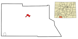
mapsize = 250px
map_caption = Location in Archuleta County and the state ofColorado
mapsize1 =
map_caption1 =
image_dot_
dot_mapsize =
dot_map_caption =
dot_x =
dot_y =
pushpin_
pushpin_label_position =
pushpin_map_caption =
pushpin_mapsize =
subdivision_type = Country
subdivision_name = USA
subdivision_type1 = State
subdivision_name1 = flag|Colorado|name=State of Colorado
subdivision_type2 = Countycite web | url = http://www.dola.state.co.us/dlg/local_governments/municipalities.html | title = Active Colorado Municipalities | format =HTML | publisher = State of Colorado, Department of Local Affairs | accessdate = 2007-09-01]
subdivision_name2 = Archuleta County Seat
subdivision_type3 =
subdivision_name3 =
subdivision_type4 =
subdivision_name4 =
government_footnotes =
government_type = Home Rule Municipality
leader_title =Mayor
leader_name = Ross Aragon
leader_title1 =
leader_name1 =
leader_title2 =
leader_name2 =
leader_title3 =
leader_name3 =
leader_title4 =
leader_name4 =
established_title =
established_date =
established_title2 = Incorporated (town)
established_date2 =March 18 ,1891 cite web | url = http://www.colorado.gov/dpa/doit/archives/muninc.html | title = Colorado Municipal Incorporations | format =HTML | publisher = State of Colorado, Department of Personnel & Administration, Colorado State Archives | date =2004-12-01 | accessdate = 2007-09-02]
established_title3 =
established_date3 =
area_magnitude =
unit_pref = Imperial
area_footnotes =
area_total_km2 = 11.4
area_land_km2 = 11.4
area_water_km2 = 0.1
area_total_sq_mi = 4.4
area_land_sq_mi = 4.4
area_water_sq_mi = 0.0
area_water_percent =
area_urban_km2 =
area_urban_sq_mi =
area_metro_km2 =
area_metro_sq_mi =
area_blank1_title =
area_blank1_km2 =
area_blank1_sq_mi =
population_as_of = 2000
population_footnotes =
population_note =
population_total = 1,591
population_density_km2 = 140.2
population_density_sq_mi = 363.1
population_metro =
population_density_metro_km2 =
population_density_metro_sq_mi =
population_urban =
population_density_urban_km2 =
population_density_urban_sq_mi =
population_blank1_title =
population_blank1 =
population_density_blank1_km2 =
population_density_blank1_sq_mi =
timezone = Mountain (MST)
utc_offset = -7
timezone_DST = MDT
utc_offset_DST = -6
latd = 37 |latm = 16 |lats = 5 |latNS = N
longd = 107 |longm = 1 |longs = 28 |longEW = W
elevation_footnotes = GR|3
elevation_m = 2172
elevation_ft = 7126
postal_code_type =ZIP code scite web | url = http://zip4.usps.com/zip4/citytown.jsp | title = ZIP Code Lookup| format =JavaScript /HTML | publisher =United States Postal Service | accessdate = December 1 | accessyear = 2007]
postal_code = 81147, 81157 (PO Box )
area_code = 970
blank_name = FIPS code
blank_info = 08-56860
blank1_name = GNIS feature ID
blank1_info = [http://geonames.usgs.gov/pls/gnispublic/f?p=gnispq:3:::NO::P3_FID:0184338 0184338]
website = [http://www.townofpagosasprings.com/ Town of Pagosa Springs]
footnotes =The Town of Pagosa Springs is a Home Rule Municipality that is the
county seat of, and the only incorporated municipality in, Archuleta County,Colorado ,United States .GR|6 The population was 1,591 at the 2000 census. Approximately 65 percent of county land is eitherSan Juan National Forest or Southern Ute Indian land.Pagosa Springs and the surrounding county are both experiencing a substantial influx of second home owners; a 2006 property assessment indicates that 60% of area private properties are owned by non-residents.
Pagosa Springs is located approximately convert|35|mi|km|0 north of the
New Mexico border, nestled at convert|7000|ft|m on the Western Slope of theContinental Divide . This combination of high desert plateau and dramatic Rocky Mountains to the north and east creates an unusually mild climate, especially in the summer months, when compared with much of the surrounding Southwest. Pagosa is favored with around 300 days of sun each year, as well as four distinct seasons.The town is located in the upper
San Juan Basin , surrounded by the 3 million acre (12,000 km²) San Juan National Forest, and adjacent to the largest contiguous wilderness area in the nation, theWeminuche Wilderness .Folks still gather at the Hot Springs, one of the largest and hottest natural springs in the world, and one which continues to be celebrated for its therapeutic powers. The Utes called the sulfur-rich mineral springs "Pah gosah" meaning "healing waters" and visitors from all over the world come to enjoy its hot baths. Some come to cure ailments, others to simply relax in the mineral-rich waters. The Hot Springs are a natural complement to the Pagosa Springs area's year round recreational activities, which include downhill and cross country skiing at nearby
Wolf Creek ski area . Snowmobiling in the forest service land is also quite popular. Summertime activities include fishing, hiking, and rafting. Come autumn, the area is a popular destination for hunters, who harvest elk, deer, and other game animals."Downtown Pagosa Springs" was the final destination for a duo of truckers in the 1975 country song "Wolf Creek Pass" by
C.W. McCall .U.S. Highway 160 from the pass to town goes through a vertical drop of around convert|5000|ft|m|-2, and is described in the song as "hairpin county and switchback city".Geography
Pagosa Springs is located at coor dms|37|16|5|N|107|1|28|W|city (37.268032, -107.024554)GR|1.
According to the
United States Census Bureau , the town has a total area of 4.4 square miles (11.4 km²), of which, 4.4 square miles (11.3 km²) of it is land and 0.04 square miles (0.1 km²) of it (0.68%) is water.Demographics
As of the
census GR|2 of 2000, there were 1,591 people, 633 households, and 415 families residing in the town. Thepopulation density was 363.1 people per square mile (140.2/km²). There were 746 housing units at an average density of 170.2/sq mi (65.8/km²). The racial makeup of the town was 74.61% White, 0.50% African American, 2.20% Native American, 0.25% Asian, 18.73% from other races, and 3.71% from two or more races. Hispanic or Latino of any race were 43.18% of the population.There were 633 households out of which 32.4% had children under the age of 18 living with them, 46.1% were married couples living together, 13.6% had a female householder with no husband present, and 34.4% were non-families. 27.8% of all households were made up of individuals and 10.3% had someone living alone who was 65 years of age or older. The average household size was 2.48 and the average family size was 3.07.
In the town the population was spread out with 27.6% under the age of 18, 9.4% from 18 to 24, 26.9% from 25 to 44, 24.8% from 45 to 64, and 11.3% who were 65 years of age or older. The median age was 37 years. For every 100 females there were 96.4 males. For every 100 females age 18 and over, there were 94.3 males.
The median income for a household in the town was $29,469, and the median income for a family was $33,831. Males had a median income of $24,125 versus $21,406 for females. The
per capita income for the town was $15,355. About 11.9% of families and 14.1% of the population were below thepoverty line , including 14.6% of those under age 18 and 21.1% of those age 65 or over.ee also
*
State of Colorado
**Colorado cities and towns
***Colorado municipalities
**Colorado counties
***Archuleta County, Colorado References
External links
* [http://www.pagosa.com/ Pagosa Springs most comprehensive Area Information]
* [http://pagosa.com/artman/publish/index.shtml Pagosa Springs Area Daily News]
* [http://www.townofpagosasprings.com/ Town of Pagosa Springs website]
** [http://www.dot.state.co.us/App_DTD_DataAccess/Downloads/CityMaps/Pagosa%20Springs.pdf CDOT map of the Town of Pagosa Springs]
* [http://www.visitpagosasprings.com/ Pagosa Springs Official Visitor Site]
* [http://www.archuletaeconomicdevelopment.org Pagosa Springs Economic Development Organization]
** [http://www.YourPagosa.com/schools Pagosa Springs Schools]
Wikimedia Foundation. 2010.