- Silverthorne, Colorado
Infobox Settlement
official_name = Town of Silverthorne, Colorado
other_name =
native_name =
nickname =
settlement_type =Town
motto =
imagesize =
image_caption =
flag_size =
image_
seal_size =
image_shield =
shield_size =
image_blank_emblem =
blank_emblem_type =
blank_emblem_size =
imagesize =
image_caption =
flag_size =
image_
seal_size =
image_shield =
shield_size =
image_blank_emblem =
blank_emblem_type =
blank_emblem_size =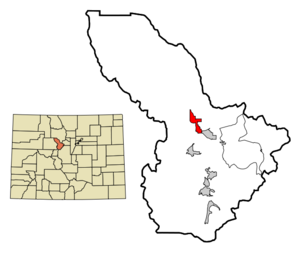
mapsize = 250x200px
map_caption = Location in Summit County and the state ofColorado
mapsize1 =
map_caption1 =
image_dot_
dot_mapsize =
dot_map_caption =
dot_x =
dot_y =
pushpin_
pushpin_label_position =
pushpin_map_caption =
pushpin_mapsize =
subdivision_type = Country
subdivision_name = USA
subdivision_type1 = State
subdivision_name1 = flag|Colorado
subdivision_type2 = Countycite web | url = http://www.dola.state.co.us/dlg/local_governments/municipalities.html | title = Active Colorado Municipalities | format =HTML | publisher = State of Colorado, Department of Local Affairs | accessdate = 2007-09-01]
subdivision_name2 = Summit County
subdivision_type3 =
subdivision_name3 =
subdivision_type4 =
subdivision_name4 =
government_footnotes =
government_type = Home Rule Municipality
leader_title =
leader_name =
leader_title1 =
leader_name1 =
leader_title2 =
leader_name2 =
leader_title3 =
leader_name3 =
leader_title4 =
leader_name4 =
established_title =
established_date =
established_title2 = Incorporated
established_date2 =September 5 ,1967 cite web | url = http://www.colorado.gov/dpa/doit/archives/muninc.html | title = Colorado Municipal Incorporations | format =HTML | publisher = State of Colorado, Department of Personnel & Administration, Colorado State Archives | date =2004-12-01 | accessdate = 2007-09-02]
established_title3 =
established_date3 =
area_magnitude =
unit_pref = Imperial
area_footnotes =
area_total_km2 = 8.3
area_land_km2 = 8.2
area_water_km2 = 0.1
area_total_sq_mi = 3.2
area_land_sq_mi = 3.2
area_water_sq_mi = 0
area_water_percent =
area_urban_km2 =
area_urban_sq_mi =
area_metro_km2 =
area_metro_sq_mi =
area_blank1_title =
area_blank1_km2 =
area_blank1_sq_mi =
population_as_of = 2000
population_footnotes =
population_note =
population_total = 3196
population_density_km2 = 385.1
population_density_sq_mi = 998.8
population_metro =
population_density_metro_km2 =
population_density_metro_sq_mi =
population_urban =
population_density_urban_km2 =
population_density_urban_sq_mi =
population_blank1_title =
population_blank1 =
population_density_blank1_km2 =
population_density_blank1_sq_mi =
timezone = Mountain (MST)
utc_offset = -7
timezone_DST = MDT
utc_offset_DST = -6
latd = 39 |latm = 38 |lats = 18 |latNS = N
longd = 106 |longm = 4 |longs = 35 |longEW = W
elevation_footnotes = GR|3
elevation_m = 2754
elevation_ft = 9035
postal_code_type =ZIP code scite web | url = http://zip4.usps.com/zip4/citytown.jsp | title = ZIP Code Lookup| format =JavaScript /HTML | publisher =United States Postal Service | accessdate = 2008-01-02]
postal_code = 80497 (PO Box ), 80498
area_code = 970
blank_name = FIPS code
blank_info = 08-70525
blank1_name = GNIS feature ID
blank1_info = [http://geonames.usgs.gov/pls/gnispublic/f?p=gnispq:3:::NO::P3_FID:0204668 0204668]
website = [http://www.silverthorne.org/ Town of Silverthorne]
footnotes =The Town of Silverthorne is a Home Rule Municipality that is the most populous town in Summit County,
Colorado ,United States . According to 2006 Census Bureau estimates, the population of the city is 3,610.cite web | date =June 21 2006 | url = http://www.census.gov/popest/cities/tables/SUB-EST2005-04-08.csv | title = Annual Estimates of the Population for All Incorporated Places in Colorado|format = CSV | work = 2005 Population Estimates | publisher = U.S. Census Bureau, Population Division | accessmonthday = November 17 | accessyear = 2006]History
Silverthorne Colorado is named after Judge Silverthorn, Summit County pioneer and judge from the late 1800s, known as "Hangin' Judge Silverthorn" for his strict demeanor.Fact|date=January 2008 The town of Silverthorne was incorporated
1967-09-05 .Silverthorne began as a convenient place to move buildings from the site of old Dillon, a town which was relocated prior to being flooded with the waters behind the Dillon Dam. The first post office and general store were both buildings moved from old Dillon.
The Old Dillon Inn, famous for its neon "BA" sign, (The R never having been illuminated,) is another transplant from Old Dillon. Recently when the sign was refurbished, the "R", which was painted on behind the dead neon letter, was simply left out. For many years, unknown to the owners, original works of art by famous western artists Frederick Remington and Charles Russell adorned the walls of the Old Dillon Inn. In the early '70's, the Old DI, as it is known locally, was sold to a man who recognized the paintings, whereupon the paintings were promptly removed and the mortgage defaulted. The Old Dillon Inn closed down in 2007.
At least one building in Silverthorne was moved from the town of Kokomo, which was bought by the Climax mine in order to construct a slag pond for their molybdenum mining operation. That building, a former hotel, was placed on the site of the current Eddie Bears store at the approximate center of the town of Silverthorne. Frank and Nellie Flynt converted the old building into Silverthorne's general store, where they did a good amount of business until Frank died in the early '70's.
Silverthorne's identity was originally envisioned as a four season sports destination when the Dillon Dam, a key source of water for Denver, Colorado, began construction in 1960. Silverthorne later became a bedroom community for seasonal workers, who supported Summit County's ski industry after the
Eisenhower Tunnel was finished in 1973. Silverthorne experienced a boom in recreational skiing during the late 60's.Colorado's Eisenhower Tunnel goes through the
Continental Divide near Loveland Pass. The new tunnel linked Silverthorne with Denver via Interstate 70 and served as the thoroughfare, to the west, for many major Colorado ski resorts. These ski areas include Keystone, Breckenridge, Copper Mountain,Arapahoe Basin , Vail and Beaver Creek. The new interstate also literally paved the way for many commercial businesses in Silverthorne, including City Market, Silverthorne Factory Outlet Stores, Target and many others. Silverthorne enjoys a high quality of life due to its unique alpine environment, restricted growth, and ample outdoor activities.Geography
Silverthorne is located at coor dms|39|38|18|N|106|4|35|W|city (39.638391, -106.076505)GR|1 at 8,730 feet above sea level (over about 3000 meters). The town is situated between the Gore Range to the west and the
Continental Divide to the east. The two most visible mountains are Buffalo and Red Mountains. Also surrounding the valley are Ptarmigan, Tenderfoot, and Ten Mile Peaks.According to the
United States Census Bureau , the town has a total area of 3.2square mile s (8.3km² ), of which, 3.2 square miles (8.2 km²) of it is land and 0.04 square miles (0.1 km²) of it (0.94%) is water.Demographics
As of the
census GR|2 of 2000, there were 3,196 people, 1,103 households, and 736 families residing in the town. Thepopulation density was 1,009.1 people per square mile (389.3/km²). There were 1,582 housing units at an average density of 499.5/sq mi (192.7/km²). The racial makeup of the town was 82.17% White, 1.00% African American, 0.66% Native American, 0.75% Asian, 0.28% Pacific Islander, 11.17% from other races, and 3.97% from two or more races. Hispanic or Latino of any race were 23.50% of the population.There were 1,103 households out of which 36.2% had children under the age of 18 living with them, 53.0% were married couples living together, 6.7% had a female householder with no husband present, and 33.2% were non-families. 13.8% of all households were made up of individuals and 0.5% had someone living alone who was 65 years of age or older. The average household size was 2.90 and the average family size was 3.14.
In the town the population was spread out with 23.1% under the age of 18, 14.8% from 18 to 24, 42.3% from 25 to 44, 17.8% from 45 to 64, and 2.0% who were 65 years of age or older. The median age was 30 years. For every 100 females there were 130.4 males. For every 100 females age 18 and over, there were 140.7 males.
The median income for a household in the town was $58,839, and the median income for a family was $61,715. Males had a median income of $31,983 versus $27,172 for females. The
per capita income for the town was $24,271. About 2.9% of families and 7.2% of the population were below thepoverty line , including 6.1% of those under age 18 and none of those age 65 or over.ee also
*
State of Colorado
**Colorado cities and towns
***Colorado municipalities
**Colorado counties
***Summit County, Colorado
**Colorado geography
***Blue River (Colorado)
***Lake Dillon
**Colorado metropolitan areas
***Silverthorne Micropolitan Statistical Area
*United States Forest Service
**Arapaho National Forest References
External links
* [http://www.silverthorne.org/ Town of Silverthorne website]
** [http://www.dot.state.co.us/App_DTD_DataAccess/Downloads/CityMaps/Silverthorne.pdf CDOT map of the Town of Silverthorne]
* [http://ldfr.org/ Lake Dillon Fire Protection District]
* [http://www.co.summit.co.us Summit County]
* [http://www.townofbreckenridge.com City of Breckenridge]
* [http://www.townofdillon.com City of Dillon]
* [http://www.townoffrisco.com City of Frisco]
* [http://www.cotrip.org Colorado Department of Transportation]
Wikimedia Foundation. 2010.